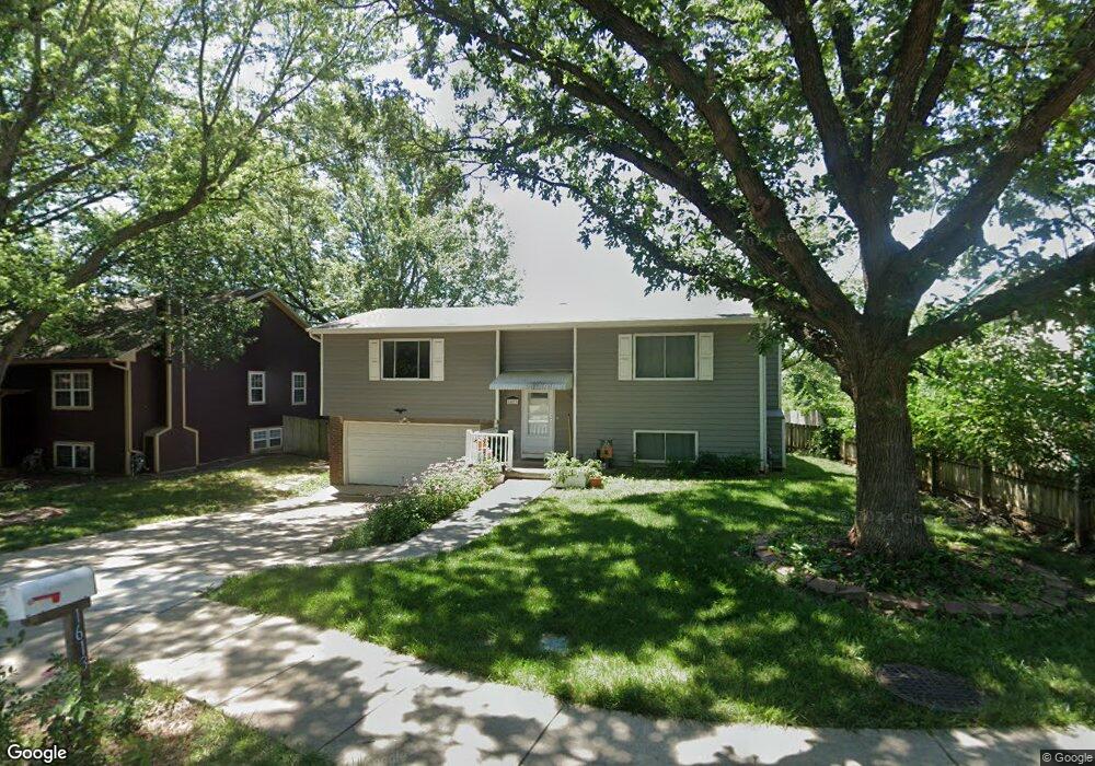
1613 W 26th St Lawrence, KS 66046
Estimated Value: $268,000 - $282,000
3
Beds
2
Baths
1,590
Sq Ft
$171/Sq Ft
Est. Value
About This Home
This home is located at 1613 W 26th St, Lawrence, KS 66046 and is currently estimated at $272,485, approximately $171 per square foot. 1613 W 26th St is a home located in Douglas County with nearby schools including Billy Mills Middle School, Lawrence High School, and Bishop Seabury Academy.
Ownership History
Date
Name
Owned For
Owner Type
Purchase Details
Closed on
Dec 16, 2022
Sold by
Wendt Winifred F
Bought by
Kaup Molly G and Carpenter David M
Current Estimated Value
Home Financials for this Owner
Home Financials are based on the most recent Mortgage that was taken out on this home.
Original Mortgage
$215,340
Outstanding Balance
$209,031
Interest Rate
7.08%
Mortgage Type
New Conventional
Estimated Equity
$63,454
Purchase Details
Closed on
Mar 3, 2007
Sold by
Perry Griffith Darlene and Griffith Christopher W
Bought by
Wendt Winifred F
Create a Home Valuation Report for This Property
The Home Valuation Report is an in-depth analysis detailing your home's value as well as a comparison with similar homes in the area
Home Values in the Area
Average Home Value in this Area
Purchase History
| Date | Buyer | Sale Price | Title Company |
|---|---|---|---|
| Kaup Molly G | -- | -- | |
| Wendt Winifred F | -- | Kansas Secured Title |
Source: Public Records
Mortgage History
| Date | Status | Borrower | Loan Amount |
|---|---|---|---|
| Open | Kaup Molly G | $215,340 |
Source: Public Records
Tax History Compared to Growth
Tax History
| Year | Tax Paid | Tax Assessment Tax Assessment Total Assessment is a certain percentage of the fair market value that is determined by local assessors to be the total taxable value of land and additions on the property. | Land | Improvement |
|---|---|---|---|---|
| 2025 | $3,218 | $28,279 | $5,750 | $22,529 |
| 2024 | $3,218 | $26,424 | $5,405 | $21,019 |
| 2023 | $3,251 | $25,530 | $5,175 | $20,355 |
| 2022 | $3,037 | $23,702 | $4,830 | $18,872 |
| 2021 | $2,742 | $20,648 | $3,795 | $16,853 |
| 2020 | $2,547 | $19,297 | $3,795 | $15,502 |
| 2019 | $2,321 | $17,630 | $3,449 | $14,181 |
| 2018 | $2,308 | $17,411 | $3,449 | $13,962 |
| 2017 | $2,264 | $16,894 | $3,449 | $13,445 |
| 2016 | $1,999 | $15,617 | $2,760 | $12,857 |
| 2015 | -- | $15,755 | $2,760 | $12,995 |
| 2014 | -- | $16,526 | $2,760 | $13,766 |
Source: Public Records
Map
Nearby Homes
- 1834 W 27th Terrace
- 1214 W 29th Ct
- 2439 Jasu Dr
- 1114 W 25th St
- 2726 Chipperfield Rd
- 2728 Chipperfield Rd
- 731 W 25th St
- 2912 Harrison Ave
- 1620 W 20th Terrace
- 1738 W 20th St
- 3013 W 23rd Terrace
- 314 Oklahoma St
- 3003 W 29th Terrace
- 3024 W 23rd Terrace
- 2421 Atchison Ave
- 2223 Breckenridge Dr
- 2234 Tennessee St
- 2218 Vail Way
- 2407 Yosemite Dr
- 2301 Massachusetts St
- 1609 W 26th St
- 1617 W 26th St
- 2612 Knollbrook Ct
- 2616 Knollbrook Ct
- 1605 W 26th St
- 1621 W 26th St
- 2608 Knollbrook Ct
- 1604 W 26th St
- 1714 W 26th St
- 1727 W 26th St
- 1601 W 26th St
- 2604 Knollbrook Ct
- 2576 Cedarwood Ave
- 2624 Knollbrook Ct
- 2575 Ousdahl Rd
- 2613 Knollbrook Ct
- 1733 W 26th St
- 2617 Knollbrook Ct
- 2572 Ousdahl Rd
- 2583 Cedarwood Ave