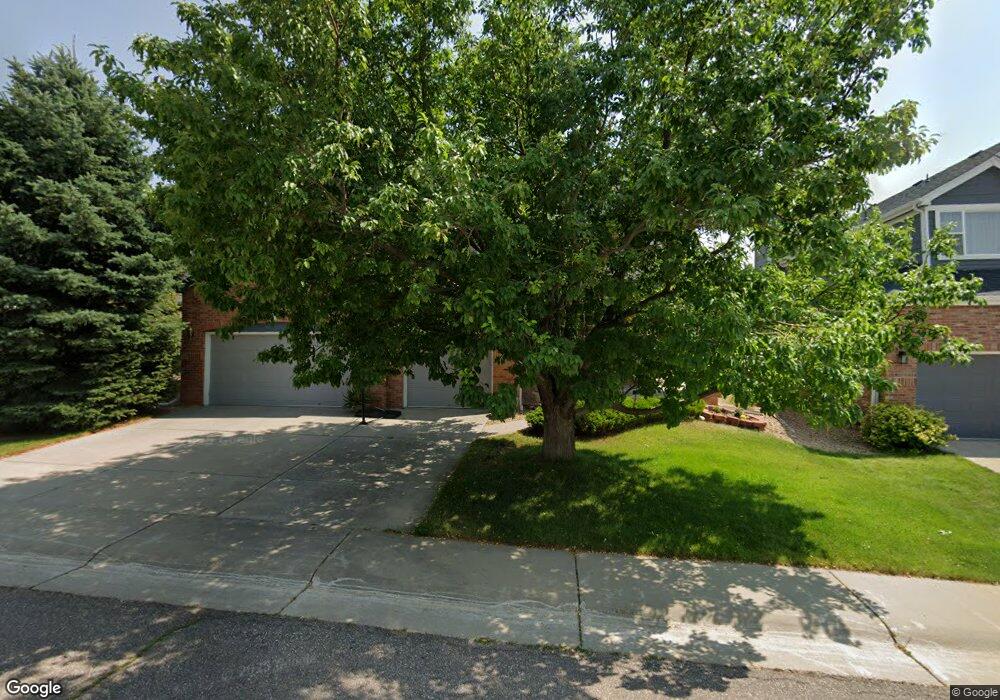
16138 Crestrock Ct Parker, CO 80134
Stonegate NeighborhoodEstimated Value: $728,000 - $759,000
4
Beds
4
Baths
2,580
Sq Ft
$286/Sq Ft
Est. Value
About This Home
This home is located at 16138 Crestrock Ct, Parker, CO 80134 and is currently estimated at $738,866, approximately $286 per square foot. 16138 Crestrock Ct is a home located in Douglas County with nearby schools including Pine Grove Elementary School, Sierra Middle School, and Chaparral High School.
Ownership History
Date
Name
Owned For
Owner Type
Purchase Details
Closed on
Jun 9, 2016
Sold by
Lowe David F and Lowe Terese V
Bought by
Lowe David F and Lowe Teresa V
Current Estimated Value
Home Financials for this Owner
Home Financials are based on the most recent Mortgage that was taken out on this home.
Original Mortgage
$350,000
Outstanding Balance
$278,924
Interest Rate
3.61%
Mortgage Type
New Conventional
Estimated Equity
$459,942
Purchase Details
Closed on
Aug 7, 2002
Sold by
Shafer Ernst W and Shafer Jill A
Bought by
Lowe David F and Lowe Terese V
Home Financials for this Owner
Home Financials are based on the most recent Mortgage that was taken out on this home.
Original Mortgage
$272,250
Interest Rate
5.12%
Purchase Details
Closed on
Aug 26, 1999
Sold by
Kieffer James M and Kieffer Sharice M
Bought by
Shafer Ernst W and Shafer Jill A
Home Financials for this Owner
Home Financials are based on the most recent Mortgage that was taken out on this home.
Original Mortgage
$231,650
Interest Rate
7.65%
Purchase Details
Closed on
May 24, 1996
Sold by
Finn Steven and Lapierre Nathalie
Bought by
Kieffer James M and Kieffer Sharice M
Home Financials for this Owner
Home Financials are based on the most recent Mortgage that was taken out on this home.
Original Mortgage
$172,760
Interest Rate
6.75%
Purchase Details
Closed on
May 21, 1996
Sold by
Finn Steven Et Al Lapierre Nathalie
Bought by
Kieffer James M Et Al Kieffer James M
Home Financials for this Owner
Home Financials are based on the most recent Mortgage that was taken out on this home.
Original Mortgage
$172,760
Interest Rate
6.75%
Purchase Details
Closed on
Aug 17, 1995
Sold by
Falcon Partnership Ltd
Bought by
Finn Steven and Lapierre Nathalie
Home Financials for this Owner
Home Financials are based on the most recent Mortgage that was taken out on this home.
Original Mortgage
$164,450
Interest Rate
7.59%
Purchase Details
Closed on
May 13, 1994
Sold by
Stonegate Dev Inc
Bought by
Falcon Partnership Ltd
Create a Home Valuation Report for This Property
The Home Valuation Report is an in-depth analysis detailing your home's value as well as a comparison with similar homes in the area
Home Values in the Area
Average Home Value in this Area
Purchase History
| Date | Buyer | Sale Price | Title Company |
|---|---|---|---|
| Lowe David F | -- | First Integrity Title | |
| Lowe David F | $302,500 | Land Title | |
| Shafer Ernst W | $257,400 | Land Title | |
| Kieffer James M | $215,950 | -- | |
| Kieffer James M Et Al Kieffer James M | $216,000 | -- | |
| Finn Steven | $205,590 | Land Title | |
| Falcon Partnership Ltd | $314,900 | -- |
Source: Public Records
Mortgage History
| Date | Status | Borrower | Loan Amount |
|---|---|---|---|
| Open | Lowe David F | $350,000 | |
| Closed | Lowe David F | $272,250 | |
| Previous Owner | Shafer Ernst W | $231,650 | |
| Previous Owner | Kieffer James M | $172,760 | |
| Previous Owner | Finn Steven | $164,450 |
Source: Public Records
Tax History Compared to Growth
Tax History
| Year | Tax Paid | Tax Assessment Tax Assessment Total Assessment is a certain percentage of the fair market value that is determined by local assessors to be the total taxable value of land and additions on the property. | Land | Improvement |
|---|---|---|---|---|
| 2024 | $5,244 | $52,660 | $9,320 | $43,340 |
| 2023 | $5,289 | $52,660 | $9,320 | $43,340 |
| 2022 | $3,968 | $35,950 | $6,340 | $29,610 |
| 2021 | $4,081 | $35,950 | $6,340 | $29,610 |
| 2020 | $4,114 | $37,160 | $7,780 | $29,380 |
| 2019 | $4,015 | $37,160 | $7,780 | $29,380 |
| 2018 | $3,631 | $33,150 | $7,010 | $26,140 |
| 2017 | $3,424 | $33,150 | $7,010 | $26,140 |
| 2016 | $3,417 | $32,560 | $6,410 | $26,150 |
| 2015 | $3,482 | $32,560 | $6,410 | $26,150 |
| 2014 | $3,309 | $27,890 | $6,220 | $21,670 |
Source: Public Records
Map
Nearby Homes
- 16116 Martingale Dr
- 10818 Mcclellan Rd
- 10828 Snowdon St
- 10834 Snowdon St
- 16641 Martingale Dr
- 10832 Tundra Top Dr
- 16135 Peregrine Dr
- 10896 Snowdon St
- 10849 Tundra Top Dr
- 10873 Tundra Top Dr
- 11029 Grouse Ct
- 15733 Mccauley Dr
- 10553 Stonemeadow Dr
- 15902 Stringhalt Way
- 10968 Snowdon St
- 10730 Tomboy Dr
- Pinnacle Plan at Newlin Crossing - The Pioneer Collection
- Graham Plan at Newlin Crossing - The Monarch Collection
- Ashbrook Plan at Newlin Crossing - The Monarch Collection
- Evans Plan at Newlin Crossing - The Pioneer Collection
- 16122 Crestrock Ct
- 16154 Crestrock Ct
- 16106 Crestrock Ct
- 16170 Crestrock Ct
- 10763 Appaloosa Ct
- 10759 Appaloosa Ct
- 16052 Crestrock Cir
- 16121 Crestrock Ct
- 10765 Appaloosa Ct
- 16153 Crestrock Ct
- 16186 Crestrock Ct
- 10755 Appaloosa Ct
- 16169 Crestrock Ct
- 10749 Appaloosa Ct
- 16042 Crestrock Cir
- 16185 Crestrock Ct
- 10745 Appaloosa Ct
- 16061 Crestrock Cir
- 16051 Crestrock Cir
- 16032 Crestrock Cir