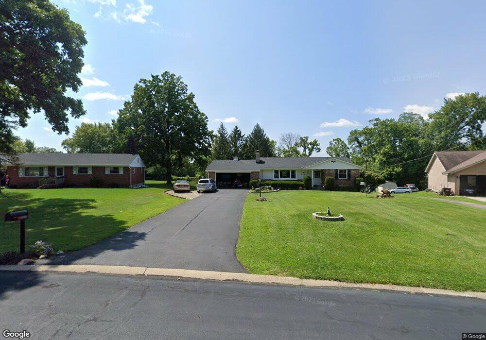
1615 Acreview Dr Cincinnati, OH 45240
New Burlington NeighborhoodEstimated Value: $212,000 - $254,000
3
Beds
1
Bath
1,200
Sq Ft
$193/Sq Ft
Est. Value
About This Home
This home is located at 1615 Acreview Dr, Cincinnati, OH 45240 and is currently estimated at $231,842, approximately $193 per square foot. 1615 Acreview Dr is a home located in Hamilton County with nearby schools including Mt Healthy High School, Hamilton County Mathematics and Science Academy, and Central Montessori Academy.
Ownership History
Date
Name
Owned For
Owner Type
Purchase Details
Closed on
Jan 29, 2021
Sold by
Spohr Fritz R and Holland Jean S
Bought by
Holland Jean S
Current Estimated Value
Home Financials for this Owner
Home Financials are based on the most recent Mortgage that was taken out on this home.
Original Mortgage
$124,000
Outstanding Balance
$109,682
Interest Rate
2.6%
Mortgage Type
New Conventional
Estimated Equity
$122,160
Purchase Details
Closed on
Oct 8, 1997
Sold by
Stone Darrell E
Bought by
Spohr Fritz R and Spohr Jean S
Home Financials for this Owner
Home Financials are based on the most recent Mortgage that was taken out on this home.
Original Mortgage
$82,170
Interest Rate
7.26%
Purchase Details
Closed on
Feb 22, 1996
Sold by
Summe Betty Lee
Bought by
Stone Darrell E
Create a Home Valuation Report for This Property
The Home Valuation Report is an in-depth analysis detailing your home's value as well as a comparison with similar homes in the area
Home Values in the Area
Average Home Value in this Area
Purchase History
| Date | Buyer | Sale Price | Title Company |
|---|---|---|---|
| Holland Jean S | -- | American Homeland Title | |
| Spohr Fritz R | $82,200 | -- | |
| Stone Darrell E | -- | -- |
Source: Public Records
Mortgage History
| Date | Status | Borrower | Loan Amount |
|---|---|---|---|
| Open | Holland Jean S | $124,000 | |
| Previous Owner | Spohr Fritz R | $82,170 |
Source: Public Records
Tax History
| Year | Tax Paid | Tax Assessment Tax Assessment Total Assessment is a certain percentage of the fair market value that is determined by local assessors to be the total taxable value of land and additions on the property. | Land | Improvement |
|---|---|---|---|---|
| 2025 | $3,875 | $65,580 | $16,384 | $49,196 |
| 2024 | $3,840 | $65,580 | $16,384 | $49,196 |
| 2023 | $3,651 | $65,580 | $16,384 | $49,196 |
| 2022 | $4,105 | $53,225 | $16,006 | $37,219 |
| 2021 | $3,997 | $53,225 | $16,006 | $37,219 |
| 2020 | $4,056 | $53,225 | $16,006 | $37,219 |
| 2019 | $3,426 | $41,910 | $12,604 | $29,306 |
| 2018 | $3,445 | $41,910 | $12,604 | $29,306 |
| 2017 | $3,212 | $41,910 | $12,604 | $29,306 |
| 2016 | $2,904 | $37,324 | $11,928 | $25,396 |
| 2015 | $2,927 | $37,324 | $11,928 | $25,396 |
| 2014 | $2,913 | $37,324 | $11,928 | $25,396 |
| 2013 | $3,132 | $41,017 | $13,108 | $27,909 |
Source: Public Records
Map
Nearby Homes
- 1854 Windmill Way
- 1858 Aspenhill Dr
- 1887 Lotushill Dr
- 1931 Lotushill Dr
- 10493 Mill Rd
- 10908 Tangleberry Ct
- 10945 Crystalhill Ct
- 1958 Bluehill Dr
- 10453 Mill Rd
- 2071 Roosevelt Ave
- 10897 Sprucehill Dr
- 10877 Birchridge Dr
- 23 Briarwood Ln
- 11440 Mill Rd
- 1413 Waycross Rd
- 2192 Pinney Ln
- 2342 Washington Ave
- 48 Damon Rd
- 6 Belknap Place 1
- 10228 Springbeauty Ln
- 1613 Acreview Dr
- 1658 Aspenhill Dr
- 1617 Acreview Dr
- 1609 Acreview Dr
- 10712 Baronwood Ct
- 1642 Aspenhill Dr
- 10718 Baronwood Ct
- 10706 Baronwood Ct
- 1626 Aspenhill Dr
- 10724 Baronwood Ct
- 10749 Mill Rd
- 10739 Mill Rd
- 10699 Stonewood Ct
- 1614 Acreview Dr
- 1603 Acreview Dr
- 1665 Acreview Dr
- 1686 Aspenhill Dr
- 10698 Stonewood Ct
- 10723 Baronwood Ct
- 1681 Acreview Dr
Your Personal Tour Guide
Ask me questions while you tour the home.