Estimated Value: $298,000 - $344,205
4
Beds
2
Baths
1,632
Sq Ft
$195/Sq Ft
Est. Value
About This Home
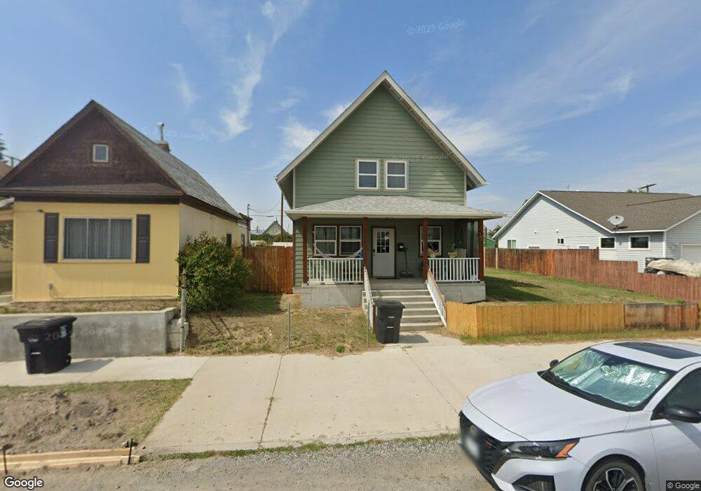
This home is located at 1615 Lowell Ave, Butte, MT 59701 and is currently estimated at $318,551, approximately $195 per square foot. 1615 Lowell Ave is a home with nearby schools including Emerson School, East Middle School, and Butte High School.
Ownership History
Date
Name
Owned For
Owner Type
Purchase Details
Closed on
Jul 7, 2017
Sold by
Mcmillan Brent W
Bought by
Burrow Katrinna
Current Estimated Value
Purchase Details
Closed on
Nov 16, 2012
Sold by
National Affordable Housing Network
Bought by
Mcmillan Brent W
Home Financials for this Owner
Home Financials are based on the most recent Mortgage that was taken out on this home.
Original Mortgage
$133,640
Interest Rate
3.33%
Purchase Details
Closed on
Aug 20, 2012
Sold by
Mcclincy Michael D
Bought by
National Affordable Housing Network Inc
Create a Home Valuation Report for This Property
The Home Valuation Report is an in-depth analysis detailing your home's value as well as a comparison with similar homes in the area
Purchase History
| Date | Buyer | Sale Price | Title Company |
|---|---|---|---|
| Burrow Katrinna | -- | None Available | |
| Mcmillan Brent W | -- | -- | |
| National Affordable Housing Network Inc | -- | -- |
Source: Public Records
Mortgage History
| Date | Status | Borrower | Loan Amount |
|---|---|---|---|
| Previous Owner | Mcmillan Brent W | $133,640 |
Source: Public Records
Tax History
| Year | Tax Paid | Tax Assessment Tax Assessment Total Assessment is a certain percentage of the fair market value that is determined by local assessors to be the total taxable value of land and additions on the property. | Land | Improvement |
|---|---|---|---|---|
| 2025 | $2,556 | $347,700 | $0 | $0 |
| 2024 | $2,996 | $283,700 | $0 | $0 |
| 2023 | $2,996 | $283,700 | $0 | $0 |
| 2022 | $2,892 | $215,200 | $0 | $0 |
| 2021 | $2,385 | $215,200 | $0 | $0 |
| 2020 | $2,836 | $197,400 | $0 | $0 |
| 2019 | $2,836 | $197,400 | $0 | $0 |
| 2018 | $2,332 | $157,700 | $0 | $0 |
| 2017 | $1,600 | $157,700 | $0 | $0 |
| 2016 | $2,158 | $157,400 | $0 | $0 |
| 2015 | $1,660 | $157,400 | $0 | $0 |
| 2014 | $597 | $6,540 | $0 | $0 |
Source: Public Records
Map
Nearby Homes
- 1630 Phillips Ave
- 1639 Lowell Ave
- 1636 Harrison Ave
- 1809 Phillips Ave
- 1734 Whitman Ave
- 1832 Phillips Ave
- 1404 S Warren Ave
- 1409 S Warren Ave
- 1705 Wall St
- 1651 Grand Ave
- 1699 Grand Ave
- 1875 Harrison Ave
- 1920 Aberdeen St
- 1953 George St
- 1514 Majors St
- 2007 Florida Ave
- 1924 Carolina Ave
- 1231 1st St
- 1727 A St
- 2124 Roberts Ave
- 1617 Lowell Ave
- 1601 Lowell Ave
- 1623 Lowell Ave
- 1600 Whitman Ave
- 1608 Whitman Ave
- 1603 Phillips Ave
- 1610 Whitman Ave
- 1635 Lowell Ave
- 1626 Lowell Ave
- 1616 Whitman Ave
- 1632 Phillips Ave
- 1628 Whitman Ave
- 1634 Phillips Ave
- 1541 Dundee St
- 1638 Phillips Ave
- 1630 Lowell Ave
- 1644 Phillips Ave
- 1632 Whitman Ave
- 1543 Dundee St
- 1547 Dundee St
Your Personal Tour Guide
Ask me questions while you tour the home.