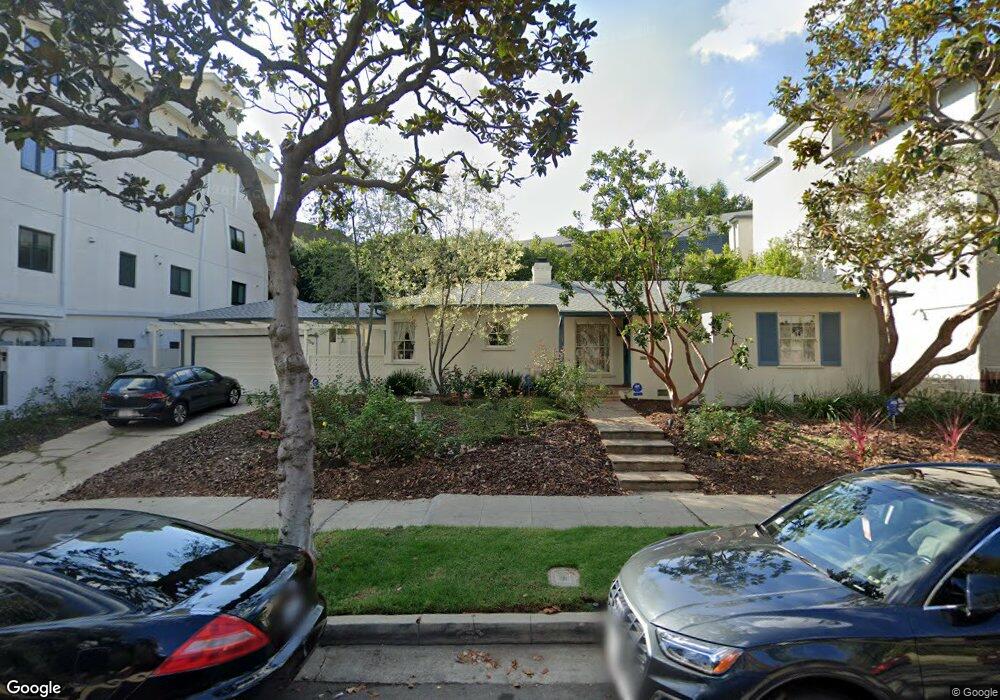
1615 Malcolm Ave Los Angeles, CA 90024
Westwood NeighborhoodEstimated Value: $1,771,631 - $2,201,000
3
Beds
2
Baths
1,435
Sq Ft
$1,335/Sq Ft
Est. Value
About This Home
This home is located at 1615 Malcolm Ave, Los Angeles, CA 90024 and is currently estimated at $1,915,658, approximately $1,334 per square foot. 1615 Malcolm Ave is a home located in Los Angeles County with nearby schools including Fairburn Avenue Elementary, Westwood Charter School, and Ralph Waldo Emerson Community Charter Middle School.
Ownership History
Date
Name
Owned For
Owner Type
Purchase Details
Closed on
Mar 9, 1999
Sold by
Meadows David W and Meadows David
Bought by
Meadows David W and Meadows Linda Sarah
Current Estimated Value
Purchase Details
Closed on
Mar 14, 1996
Sold by
Hooks Robert J and Hooks Barbara J
Bought by
Meadows David and Meadows Linda
Home Financials for this Owner
Home Financials are based on the most recent Mortgage that was taken out on this home.
Original Mortgage
$304,000
Outstanding Balance
$12,777
Interest Rate
7.75%
Estimated Equity
$1,902,881
Purchase Details
Closed on
Oct 24, 1995
Sold by
Graves Gloria V and Hooks Robert J
Bought by
Hooks Robert J and Hooks Barbara J
Create a Home Valuation Report for This Property
The Home Valuation Report is an in-depth analysis detailing your home's value as well as a comparison with similar homes in the area
Home Values in the Area
Average Home Value in this Area
Purchase History
| Date | Buyer | Sale Price | Title Company |
|---|---|---|---|
| Meadows David W | -- | -- | |
| Meadows David | $329,090 | First American Title Co | |
| Hooks Robert J | $231,529 | American Title Ins Co |
Source: Public Records
Mortgage History
| Date | Status | Borrower | Loan Amount |
|---|---|---|---|
| Open | Meadows David | $304,000 |
Source: Public Records
Tax History Compared to Growth
Tax History
| Year | Tax Paid | Tax Assessment Tax Assessment Total Assessment is a certain percentage of the fair market value that is determined by local assessors to be the total taxable value of land and additions on the property. | Land | Improvement |
|---|---|---|---|---|
| 2025 | $6,482 | $531,576 | $398,690 | $132,886 |
| 2024 | $6,482 | $521,154 | $390,873 | $130,281 |
| 2023 | $6,361 | $510,936 | $383,209 | $127,727 |
| 2022 | $6,073 | $500,919 | $375,696 | $125,223 |
| 2021 | $5,991 | $491,098 | $368,330 | $122,768 |
| 2019 | $5,814 | $476,534 | $357,406 | $119,128 |
| 2018 | $5,743 | $467,192 | $350,399 | $116,793 |
| 2016 | $5,486 | $449,052 | $336,794 | $112,258 |
| 2015 | $5,406 | $442,308 | $331,736 | $110,572 |
| 2014 | $5,430 | $433,645 | $325,238 | $108,407 |
Source: Public Records
Map
Nearby Homes
- 1645 Malcolm Ave Unit 302
- 1512 Glendon Ave
- 10745 Ohio Ave
- 1733 Malcolm Ave Unit 2
- 1551 Manning Ave Unit 101
- 1621 Manning Ave
- 10725 Ohio Ave Unit PH2
- 10725 Ohio Ave Unit 301
- 10721 Ohio Ave
- 1768 Kelton Ave
- 10687 Wilkins Ave Unit 1
- 10735 Rochester Ave
- 10671 Wilkins Ave Unit 5
- 1650 Veteran Ave Unit 107
- 1440 Veteran Ave Unit 209
- 1440 Veteran Ave Unit 544
- 1601 Hilts Ave Unit 3
- 10633 Kinnard Ave Unit 1
- 1663 Veteran Ave Unit 206
- 1825 Midvale Ave Unit 101
- 1621 Malcolm Ave Unit 101
- 1621 Malcolm Ave Unit 4
- 1621 Malcolm Ave Unit 201
- 1621 Malcolm Ave Unit 1
- 1621 Malcolm Ave Unit 2
- 1621 Malcolm Ave
- 10800 Holman Ave Unit 2
- 10800 Holman Ave Unit 3
- 10800 Holman Ave Unit 6
- 10800 Holman Ave Unit PH
- 10800 Holman Ave Unit 5
- 10800 Holman Ave Unit 1
- 10800 Holman Ave Unit 306
- 10800 Holman Ave Unit P1
- 10800 Holman Ave Unit PH3
- 10800 Holman Ave Unit PH6
- 10800 Holman Ave Unit PH5
- 10800 Holman Ave Unit PH2
- 10800 Holman Ave Unit PH1
- 10800 Holman Ave Unit PH4