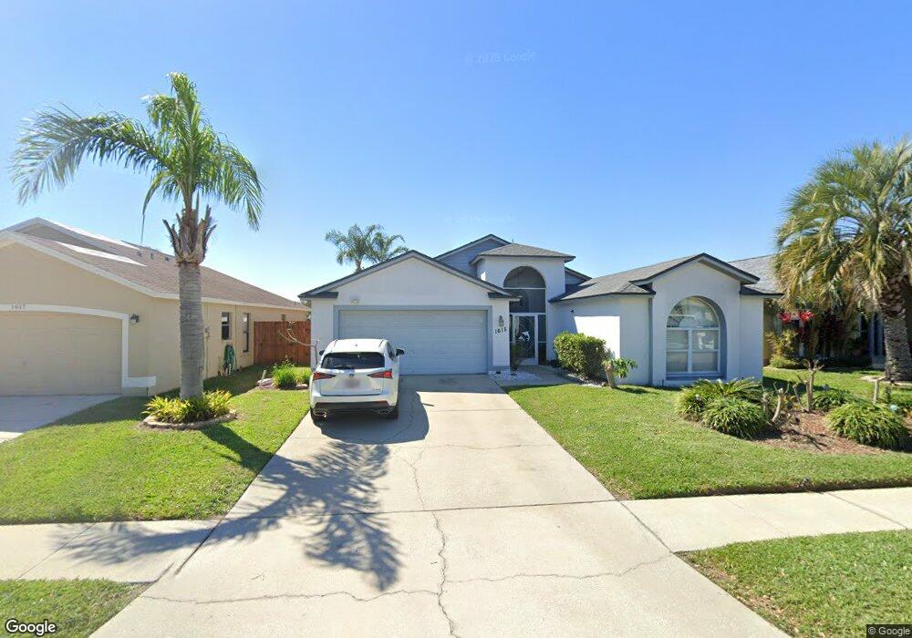
1615 Westerly Dr Brandon, FL 33511
Estimated Value: $392,107 - $425,000
4
Beds
2
Baths
2,468
Sq Ft
$165/Sq Ft
Est. Value
About This Home
This home is located at 1615 Westerly Dr, Brandon, FL 33511 and is currently estimated at $406,527, approximately $164 per square foot. 1615 Westerly Dr is a home located in Hillsborough County with nearby schools including Mintz Elementary School, Giunta Middle School, and Riverview High School.
Ownership History
Date
Name
Owned For
Owner Type
Purchase Details
Closed on
Apr 10, 2013
Sold by
Good Kenneth A and Good Wanda L
Bought by
Ruiz Israel
Current Estimated Value
Home Financials for this Owner
Home Financials are based on the most recent Mortgage that was taken out on this home.
Original Mortgage
$174,775
Outstanding Balance
$121,091
Interest Rate
3.37%
Mortgage Type
FHA
Estimated Equity
$285,436
Create a Home Valuation Report for This Property
The Home Valuation Report is an in-depth analysis detailing your home's value as well as a comparison with similar homes in the area
Home Values in the Area
Average Home Value in this Area
Purchase History
| Date | Buyer | Sale Price | Title Company |
|---|---|---|---|
| Ruiz Israel | $178,000 | All American Title |
Source: Public Records
Mortgage History
| Date | Status | Borrower | Loan Amount |
|---|---|---|---|
| Open | Ruiz Israel | $174,775 |
Source: Public Records
Tax History
| Year | Tax Paid | Tax Assessment Tax Assessment Total Assessment is a certain percentage of the fair market value that is determined by local assessors to be the total taxable value of land and additions on the property. | Land | Improvement |
|---|---|---|---|---|
| 2025 | $2,857 | $174,618 | -- | -- |
| 2024 | $2,857 | $169,697 | -- | -- |
| 2023 | $2,737 | $164,754 | $0 | $0 |
| 2022 | $2,566 | $159,955 | $0 | $0 |
| 2021 | $2,519 | $155,296 | $0 | $0 |
| 2020 | $2,434 | $153,152 | $0 | $0 |
| 2019 | $2,339 | $149,709 | $0 | $0 |
| 2018 | $2,285 | $146,918 | $0 | $0 |
| 2017 | $2,248 | $181,098 | $0 | $0 |
| 2016 | $2,211 | $140,936 | $0 | $0 |
| 2015 | $2,234 | $139,956 | $0 | $0 |
| 2014 | $2,209 | $138,845 | $0 | $0 |
| 2013 | -- | $134,923 | $0 | $0 |
Source: Public Records
Map
Nearby Homes
- 1510 Attleboro Ln
- 1504 Attleboro Ln
- 1532 Chepacket St
- 1504 Storington Ave
- 1515 Lions Club Dr
- 1717 Compton St
- 1653 Portsmouth Lake Dr Unit IV
- 2023 Fluorshire Dr
- 1922 Blue Sage Ct
- 2140 Fluorshire Dr
- 2030 Fluorshire Dr
- 2234 Fluorshire Dr
- 1907 Fluorshire Dr
- 1641 Ledgestone Dr
- 1805 Fluorshire Dr
- 1751 Fluorshire Dr
- 1330 Mohrlake Dr
- 2074 Shadow Pine Dr
- 1313 Coolmont Dr
- 1408 Woodstork Dr
- 1613 Westerly Dr
- 1617 Westerly Dr
- 1611 Westerly Dr
- 1701 Westerly Dr
- 1521 Sakonnet Ct
- 1609 Westerly Dr
- 1614 Westerly Dr
- 1703 Westerly Dr
- 1612 Westerly Dr
- 1519 Sakonnet Ct
- 1607 Westerly Dr
- 1705 Westerly Dr
- 1522 Sakonnet Ct
- 1610 Westerly Dr
- 1517 Sakonnet Ct
- 1605 Westerly Dr
- 1608 Westerly Dr
- 1520 Sakonnet Ct
- 1707 Westerly Dr
- 1516 Dawley Ct
