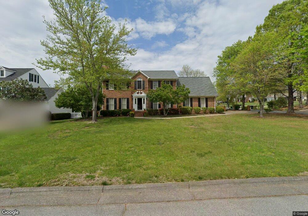
1617 Lakeland Point High Point, NC 27265
Deep River NeighborhoodEstimated Value: $350,000 - $372,000
4
Beds
3
Baths
2,348
Sq Ft
$155/Sq Ft
Est. Value
About This Home
This home is located at 1617 Lakeland Point, High Point, NC 27265 and is currently estimated at $363,833, approximately $154 per square foot. 1617 Lakeland Point is a home located in Guilford County with nearby schools including Southwest Elementary School, Welborn Academy of Science & Technology, and T.W. Andrews High School.
Ownership History
Date
Name
Owned For
Owner Type
Purchase Details
Closed on
Jun 12, 2007
Sold by
Tate Stephen W
Bought by
Chandler Dee D Samet
Current Estimated Value
Purchase Details
Closed on
Jun 18, 2003
Sold by
Sutton Jeffrey S and Sutton Joann C
Bought by
Tate Stephen Wesley and Tate Lisa Marie
Home Financials for this Owner
Home Financials are based on the most recent Mortgage that was taken out on this home.
Original Mortgage
$192,850
Interest Rate
5.56%
Mortgage Type
Purchase Money Mortgage
Create a Home Valuation Report for This Property
The Home Valuation Report is an in-depth analysis detailing your home's value as well as a comparison with similar homes in the area
Home Values in the Area
Average Home Value in this Area
Purchase History
| Date | Buyer | Sale Price | Title Company |
|---|---|---|---|
| Chandler Dee D Samet | $75,000 | None Available | |
| Tate Stephen Wesley | $203,000 | -- |
Source: Public Records
Mortgage History
| Date | Status | Borrower | Loan Amount |
|---|---|---|---|
| Previous Owner | Tate Stephen Wesley | $192,850 |
Source: Public Records
Tax History Compared to Growth
Tax History
| Year | Tax Paid | Tax Assessment Tax Assessment Total Assessment is a certain percentage of the fair market value that is determined by local assessors to be the total taxable value of land and additions on the property. | Land | Improvement |
|---|---|---|---|---|
| 2025 | $3,555 | $258,000 | $65,000 | $193,000 |
| 2024 | $3,555 | $258,000 | $65,000 | $193,000 |
| 2023 | $3,555 | $258,000 | $65,000 | $193,000 |
| 2022 | $3,478 | $258,000 | $65,000 | $193,000 |
| 2021 | $2,785 | $202,100 | $37,000 | $165,100 |
| 2020 | $2,785 | $202,100 | $37,000 | $165,100 |
| 2019 | $2,785 | $202,100 | $0 | $0 |
| 2018 | $2,771 | $202,100 | $0 | $0 |
| 2017 | $2,771 | $202,100 | $0 | $0 |
| 2016 | $2,813 | $200,600 | $0 | $0 |
| 2015 | $2,828 | $200,600 | $0 | $0 |
| 2014 | $2,877 | $200,600 | $0 | $0 |
Source: Public Records
Map
Nearby Homes
- 4126 Birchgarden Dr
- 4404 Essex Ct
- 3905 Wynne Brook Ct
- 1515 Skeet Club Rd
- 3924 Braddock Rd
- 3650 Single Leaf Ct
- 4218 Pelican St
- 3753 Carvette Ct
- 2115 Mirus Ct
- 4307 Oak Hollow Dr
- 4407 Oak Hollow Dr
- 2116 Penny Rd
- 4004 Baywater Point
- 3710 Spanish Peak Dr Unit 2D
- 2200 Delaine Point
- 3724 Spanish Peak Dr Unit 2B
- 3838 Galloway Ct
- 4323 Holstein Dr
- 3855 Thistleberry Rd
- 4103 Quarterstaff Ct
- 1615 Lakeland Point
- 4018 Banoak St
- 4010 Banoak St
- 1618 Lakeland Point
- 4000 Red Oak Ct
- 1614 Lakeland Point
- 1700 Lakeland Point
- 4002 Red Oak Ct
- 4022 Banoak St
- 1610 Lakeland Point
- 4026 Ban Oak St
- 4004 Red Oak Ct
- 4033 Banoak St
- 1702 Lakeland Point
- 4026 Banoak St
- 4003 Banoak St
- 4030 Banoak St
- 4030 Ban Oak St
- 4006 Red Oak Ct
- 4037 Banoak St