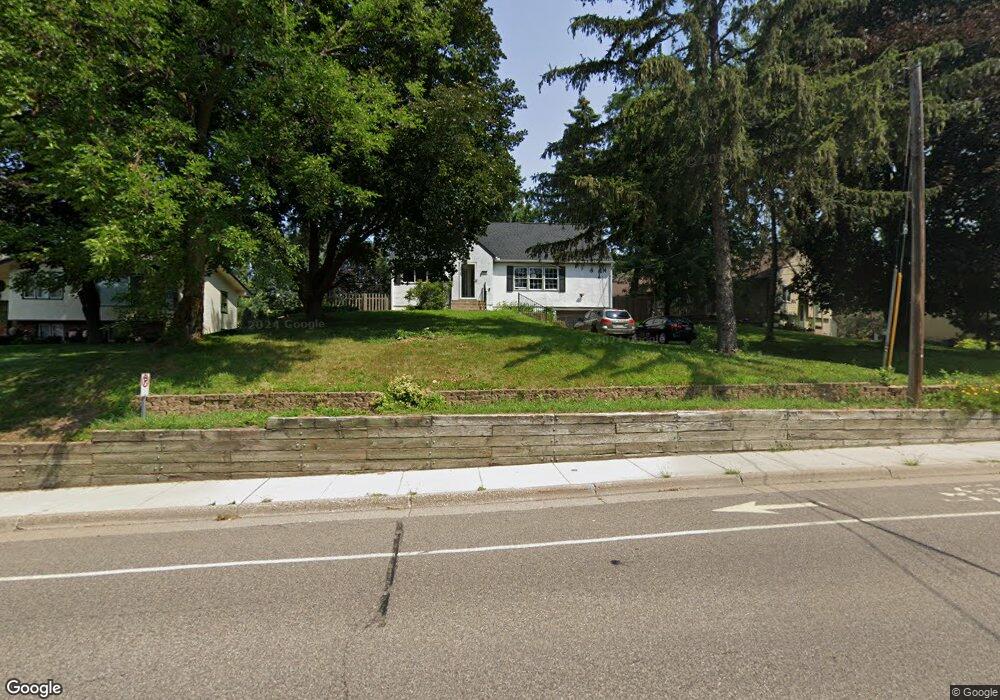
1617 Upper Afton Rd Saint Paul, MN 55106
Battle Creek NeighborhoodEstimated Value: $314,862 - $337,000
3
Beds
3
Baths
2,075
Sq Ft
$155/Sq Ft
Est. Value
About This Home
This home is located at 1617 Upper Afton Rd, Saint Paul, MN 55106 and is currently estimated at $321,466, approximately $154 per square foot. 1617 Upper Afton Rd is a home located in Ramsey County with nearby schools including Highwood Hills Elementary School, Battle Creek Middle School, and Harding Senior High School.
Ownership History
Date
Name
Owned For
Owner Type
Purchase Details
Closed on
Sep 6, 2022
Sold by
Kurysh Michael J and Kurysh Victoria
Bought by
Benatar Leon and Benatar Anna
Current Estimated Value
Home Financials for this Owner
Home Financials are based on the most recent Mortgage that was taken out on this home.
Original Mortgage
$251,100
Outstanding Balance
$239,992
Interest Rate
5.3%
Mortgage Type
New Conventional
Estimated Equity
$81,474
Purchase Details
Closed on
Jun 2, 2014
Bought by
Benson Robin Robin
Purchase Details
Closed on
May 23, 2014
Sold by
The Bank Of New York Mellon
Bought by
Benson Robin
Purchase Details
Closed on
Aug 16, 2013
Sold by
Debowski Jozef F and Debowska Teresa B
Bought by
The Bank Of New York Mellon
Create a Home Valuation Report for This Property
The Home Valuation Report is an in-depth analysis detailing your home's value as well as a comparison with similar homes in the area
Home Values in the Area
Average Home Value in this Area
Purchase History
| Date | Buyer | Sale Price | Title Company |
|---|---|---|---|
| Benatar Leon | $310,000 | -- | |
| Benson Robin Robin | $101,300 | -- | |
| Benson Robin | $101,250 | Servicelink Llc | |
| The Bank Of New York Mellon | $167,611 | None Available |
Source: Public Records
Mortgage History
| Date | Status | Borrower | Loan Amount |
|---|---|---|---|
| Open | Benatar Leon | $251,100 |
Source: Public Records
Tax History Compared to Growth
Tax History
| Year | Tax Paid | Tax Assessment Tax Assessment Total Assessment is a certain percentage of the fair market value that is determined by local assessors to be the total taxable value of land and additions on the property. | Land | Improvement |
|---|---|---|---|---|
| 2025 | $4,404 | $273,200 | $44,000 | $229,200 |
| 2024 | $4,404 | $284,400 | $44,000 | $240,400 |
| 2023 | $4,404 | $273,400 | $44,000 | $229,400 |
| 2022 | $4,180 | $278,200 | $44,000 | $234,200 |
| 2021 | $3,586 | $249,400 | $44,000 | $205,400 |
| 2020 | $3,802 | $221,400 | $44,000 | $177,400 |
| 2019 | $3,756 | $219,900 | $44,000 | $175,900 |
| 2018 | $3,356 | $215,900 | $44,000 | $171,900 |
| 2017 | $3,010 | $194,400 | $38,700 | $155,700 |
| 2016 | $3,074 | $0 | $0 | $0 |
| 2015 | $2,376 | $173,300 | $38,700 | $134,600 |
| 2014 | $2,524 | $0 | $0 | $0 |
Source: Public Records
Map
Nearby Homes
- 237 Sigurd St
- 267 Hazelwood St
- 201 Dora Ct W
- 1747 Louise Ave
- 136 White Bear Ave N
- 125 Battle Creek Place
- 1600 Old Hudson Rd
- 49 Battle Creek Place
- 1443 Pacific St
- 1538 Wilson Ave
- 244 Point Douglas Rd N
- 1935 Warbler Ln
- 1821 Wilson Ave
- 1333 Pacific St
- 271 English St
- 500 Etna St Unit 104
- 1989 N Park Dr
- 1685 Fremont Ave
- 1320 Wilson Ave
- 1450 Fremont Ave
- 1613 Upper Afton Rd
- 1623 Upper Afton Rd Unit D
- 1623 Upper Afton Rd Unit B
- 1623 Upper Afton Rd Unit E
- 1623 Upper Afton Rd Unit C
- 1623 Upper Afton Rd Unit A
- 1621 Upper Afton Rd Unit A
- 1621 Upper Afton Rd Unit C
- 1621 Upper Afton Rd
- 1609 Upper Afton Rd
- 1584 Leone Ave
- 1580 Leone Ave
- 1625 Upper Afton Rd Unit C
- 1625 Upper Afton Rd Unit D
- 1625 Upper Afton Rd Unit B
- 1625 Upper Afton Rd
- 1574 Leone Ave
- 1625 1625 Upper Afton Rd
- 1568 Leone Ave
- 1600 Upper Afton Rd