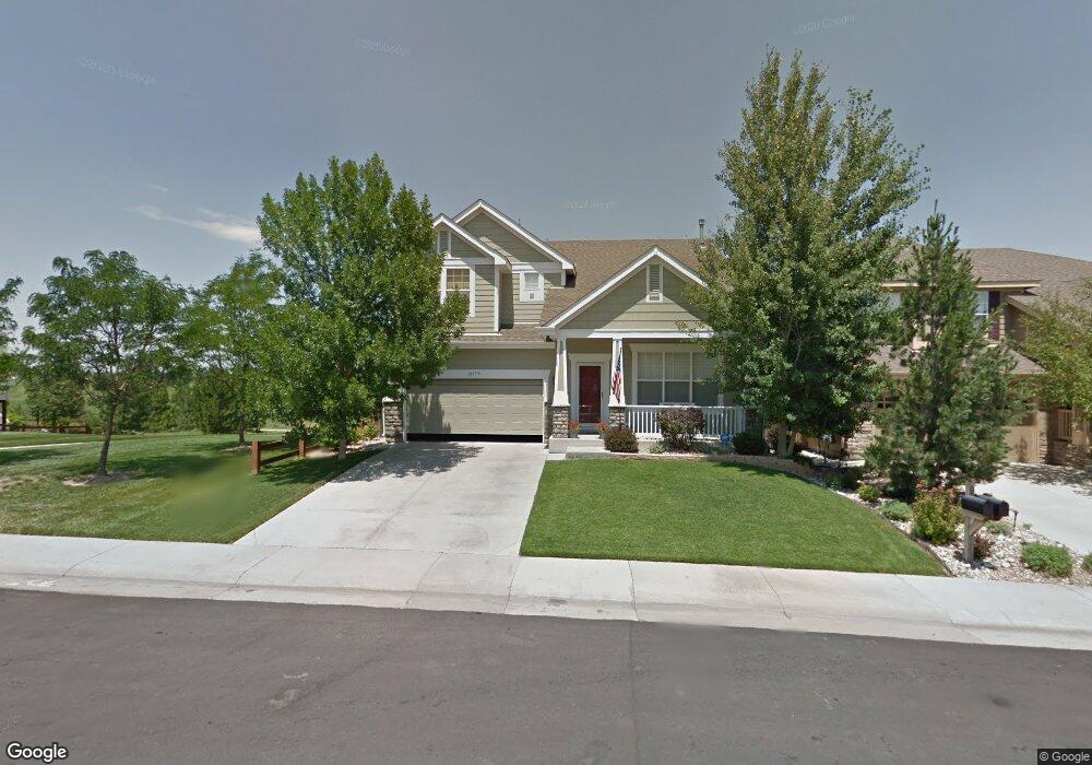
16179 Rock Crystal Dr Parker, CO 80134
Stonegate NeighborhoodEstimated Value: $682,809 - $772,000
4
Beds
3
Baths
2,517
Sq Ft
$293/Sq Ft
Est. Value
About This Home
This home is located at 16179 Rock Crystal Dr, Parker, CO 80134 and is currently estimated at $736,702, approximately $292 per square foot. 16179 Rock Crystal Dr is a home located in Douglas County with nearby schools including Mammoth Heights Elementary School, Sierra Middle School, and Chaparral High School.
Ownership History
Date
Name
Owned For
Owner Type
Purchase Details
Closed on
Apr 30, 2004
Sold by
Cutrell William R and Cutrell Penny D
Bought by
Nolte Eric K and Nolte Lisa L
Current Estimated Value
Home Financials for this Owner
Home Financials are based on the most recent Mortgage that was taken out on this home.
Original Mortgage
$304,650
Outstanding Balance
$141,631
Interest Rate
5.38%
Mortgage Type
Unknown
Estimated Equity
$595,071
Purchase Details
Closed on
Dec 28, 2001
Sold by
The Ryland Group Inc
Bought by
Cutrell William R and Cutrell Penny D
Home Financials for this Owner
Home Financials are based on the most recent Mortgage that was taken out on this home.
Original Mortgage
$251,100
Interest Rate
6.73%
Purchase Details
Closed on
Dec 21, 2000
Sold by
Westerra Stonegate Llc
Bought by
Ryland Group Inc
Create a Home Valuation Report for This Property
The Home Valuation Report is an in-depth analysis detailing your home's value as well as a comparison with similar homes in the area
Home Values in the Area
Average Home Value in this Area
Purchase History
| Date | Buyer | Sale Price | Title Company |
|---|---|---|---|
| Nolte Eric K | $338,500 | -- | |
| Cutrell William R | $313,909 | Cornerstone Title Co | |
| Ryland Group Inc | $6,720,300 | -- |
Source: Public Records
Mortgage History
| Date | Status | Borrower | Loan Amount |
|---|---|---|---|
| Open | Nolte Eric K | $304,650 | |
| Previous Owner | Cutrell William R | $251,100 |
Source: Public Records
Tax History Compared to Growth
Tax History
| Year | Tax Paid | Tax Assessment Tax Assessment Total Assessment is a certain percentage of the fair market value that is determined by local assessors to be the total taxable value of land and additions on the property. | Land | Improvement |
|---|---|---|---|---|
| 2024 | $6,062 | $50,140 | $8,730 | $41,410 |
| 2023 | $6,105 | $50,140 | $8,730 | $41,410 |
| 2022 | $4,601 | $34,760 | $6,030 | $28,730 |
| 2021 | $4,770 | $34,760 | $6,030 | $28,730 |
| 2020 | $4,547 | $34,000 | $7,200 | $26,800 |
| 2019 | $4,558 | $34,000 | $7,200 | $26,800 |
| 2018 | $4,145 | $30,640 | $6,470 | $24,170 |
| 2017 | $3,954 | $30,640 | $6,470 | $24,170 |
| 2016 | $3,712 | $28,840 | $6,410 | $22,430 |
| 2015 | $3,770 | $28,840 | $6,410 | $22,430 |
| 2014 | $3,517 | $24,620 | $6,220 | $18,400 |
Source: Public Records
Map
Nearby Homes
- 9865 Centre Cir
- 9792 Clandan Ct
- 15904 Stonebriar Dr
- 16136 Sequoia Dr
- 9551 Longford Way
- 15626 Greenstone Cir
- 9585 Pearl Cir Unit 203
- 9551 Pearl Cir Unit 202
- 9416 Ashbury Cir Unit 102
- 9531 Pearl Cir Unit 203
- 10056 Carnelian Place
- 9397 Las Ramblas Ct Unit C
- 15432 Greenstone Cir
- 9350 Amison Cir Unit 103
- 9335 Amison Cir Unit 101
- 10050 Granite Hill Dr
- 9370 Las Ramblas Ct Unit G
- 9370 Las Ramblas Ct Unit R
- 9555 Deerhorn Ct Unit 1
- 9363 Amison Cir Unit 106
- 16189 Rock Crystal Dr
- 16199 Rock Crystal Dr
- 9802 Amber Rock Dr
- 16151 Rock Crystal Dr
- 16215 Rock Crystal Dr
- 9812 Amber Rock Dr
- 9751 Stonebriar Ln
- 16233 Rock Crystal Dr
- 16154 Rock Crystal Dr
- 9759 Stonebriar Ln
- 9822 Amber Rock Dr
- 16121 Rock Crystal Dr
- 16138 Rock Crystal Dr
- 16251 Rock Crystal Dr
- 9767 Stonebriar Ln
- 9832 Amber Rock Dr
- 16105 Rock Crystal Dr
- 16114 Rock Crystal Dr
- 16267 Rock Crystal Dr
- 16147 Amber Rock Ct