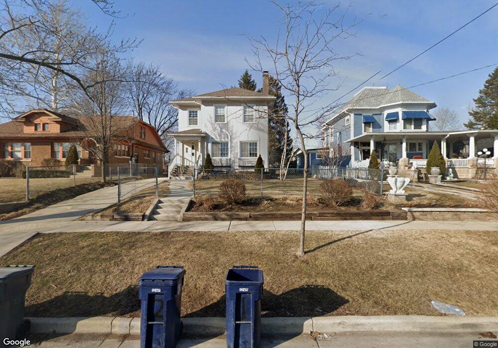
162 Harding St Unit 164 Elgin, IL 60123
Southwest Elgin NeighborhoodEstimated Value: $282,011 - $331,000
Studio
--
Bath
2,380
Sq Ft
$130/Sq Ft
Est. Value
About This Home
This home is located at 162 Harding St Unit 164, Elgin, IL 60123 and is currently estimated at $309,003, approximately $129 per square foot. 162 Harding St Unit 164 is a home located in Kane County with nearby schools including Lowrie Elementary School, Abbott Middle School, and Larkin High School.
Ownership History
Date
Name
Owned For
Owner Type
Purchase Details
Closed on
Apr 16, 2005
Sold by
Espinosa Gerardo and Espinosa Sarita
Bought by
Espinosa Gerardo and Arreola Maria Del Carmen
Current Estimated Value
Purchase Details
Closed on
Jun 16, 2000
Sold by
Oconnor Philip E
Bought by
Espinosa Gerardo and Espinosa Sarita
Home Financials for this Owner
Home Financials are based on the most recent Mortgage that was taken out on this home.
Original Mortgage
$156,655
Outstanding Balance
$56,564
Interest Rate
8.56%
Mortgage Type
Stand Alone First
Estimated Equity
$252,439
Create a Home Valuation Report for This Property
The Home Valuation Report is an in-depth analysis detailing your home's value as well as a comparison with similar homes in the area
Home Values in the Area
Average Home Value in this Area
Purchase History
| Date | Buyer | Sale Price | Title Company |
|---|---|---|---|
| Espinosa Gerardo | -- | -- | |
| Espinosa Gerardo | $165,000 | Chicago Title Insurance Co |
Source: Public Records
Mortgage History
| Date | Status | Borrower | Loan Amount |
|---|---|---|---|
| Open | Espinosa Gerardo | $156,655 |
Source: Public Records
Tax History
| Year | Tax Paid | Tax Assessment Tax Assessment Total Assessment is a certain percentage of the fair market value that is determined by local assessors to be the total taxable value of land and additions on the property. | Land | Improvement |
|---|---|---|---|---|
| 2024 | $6,163 | $85,007 | $13,630 | $71,377 |
| 2023 | $5,865 | $76,798 | $12,314 | $64,484 |
| 2022 | $5,088 | $64,681 | $11,228 | $53,453 |
| 2021 | $4,860 | $60,472 | $10,497 | $49,975 |
| 2020 | $4,718 | $57,730 | $10,021 | $47,709 |
| 2019 | $4,576 | $54,992 | $9,546 | $45,446 |
| 2018 | $4,529 | $51,806 | $8,993 | $42,813 |
| 2017 | $4,420 | $48,976 | $8,502 | $40,474 |
| 2016 | $4,206 | $45,437 | $7,888 | $37,549 |
| 2015 | -- | $41,647 | $7,230 | $34,417 |
| 2014 | -- | $41,133 | $7,141 | $33,992 |
| 2013 | -- | $42,218 | $7,329 | $34,889 |
Source: Public Records
Map
Nearby Homes
- 133 Oak St
- 3 National St Unit 3
- 7 National St Unit 7
- 410 Standish St
- 518 Raymond St
- 453 Orchard St
- 677 Wellington Ave
- 224 Moseley St
- 277 Gifford Place
- 162 Festival Ct
- 208 Moseley St
- 141 S Grove Ave
- 286 Villa St
- 211 Prairie St
- 96 S Crystal St
- 408 Bowen Ct
- 483 Barrett St
- 58 S Geneva St
- 315 Vandalia St
- 756 Walnut Ave
- 158 Harding St
- 166 Harding St Unit 168
- 168 Harding St Unit Duplex
- 168 Harding St
- 176 Harding St
- 417 S State St
- 165 Oak St
- 159 Harding St
- 157 Oak St
- 165 Harding St
- 413 S State St
- 178 Harding St
- 153 Oak St
- 169 Harding St
- 407 S State St
- 114 Harding St
- 436 Ryerson Ave
- 437 S State St
- 433 Ryerson Ave
- 403 S State St
Your Personal Tour Guide
Ask me questions while you tour the home.