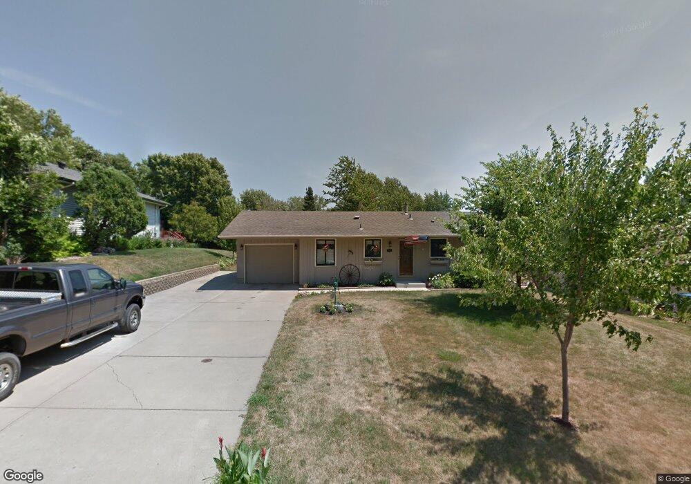
162 Juniper Ln Saint Paul, MN 55124
Redwood NeighborhoodEstimated Value: $369,380 - $408,000
3
Beds
2
Baths
988
Sq Ft
$393/Sq Ft
Est. Value
About This Home
This home is located at 162 Juniper Ln, Saint Paul, MN 55124 and is currently estimated at $387,845, approximately $392 per square foot. 162 Juniper Ln is a home located in Dakota County with nearby schools including Westview Elementary School, Valley Middle School, and Apple Valley Senior High School.
Ownership History
Date
Name
Owned For
Owner Type
Purchase Details
Closed on
Jul 17, 2018
Sold by
Langguth Bernadine M and Langguth Scott A
Bought by
Bennett Duane Russell and Bennett Patricia L
Current Estimated Value
Purchase Details
Closed on
Jan 3, 2012
Sold by
Geis Michael L and Geis Jayne Kae
Bought by
Geis Michael L and Geis Jayne Kae
Home Financials for this Owner
Home Financials are based on the most recent Mortgage that was taken out on this home.
Original Mortgage
$119,200
Interest Rate
3.98%
Mortgage Type
New Conventional
Purchase Details
Closed on
Apr 16, 2001
Sold by
Olson Mark and Olson Debra
Bought by
Geis Michael
Purchase Details
Closed on
Aug 17, 2000
Sold by
Bolstad Norman Jerome and Bolstad Linda A
Bought by
Olson Mark D and Olson Debra J
Create a Home Valuation Report for This Property
The Home Valuation Report is an in-depth analysis detailing your home's value as well as a comparison with similar homes in the area
Home Values in the Area
Average Home Value in this Area
Purchase History
| Date | Buyer | Sale Price | Title Company |
|---|---|---|---|
| Bennett Duane Russell | $321,230 | On Site Title Llc | |
| Geis Michael L | -- | Fat | |
| Geis Michael | $163,800 | -- | |
| Olson Mark D | $125,000 | -- |
Source: Public Records
Mortgage History
| Date | Status | Borrower | Loan Amount |
|---|---|---|---|
| Previous Owner | Geis Michael L | $119,200 |
Source: Public Records
Tax History
| Year | Tax Paid | Tax Assessment Tax Assessment Total Assessment is a certain percentage of the fair market value that is determined by local assessors to be the total taxable value of land and additions on the property. | Land | Improvement |
|---|---|---|---|---|
| 2024 | $3,676 | $335,600 | $84,600 | $251,000 |
| 2023 | $3,466 | $330,200 | $84,700 | $245,500 |
| 2022 | $3,202 | $331,800 | $84,500 | $247,300 |
| 2021 | $3,014 | $284,200 | $73,500 | $210,700 |
| 2020 | $3,036 | $263,500 | $70,000 | $193,500 |
| 2019 | $2,564 | $257,800 | $66,600 | $191,200 |
| 2018 | $2,527 | $231,100 | $63,400 | $167,700 |
| 2017 | $2,471 | $219,200 | $60,400 | $158,800 |
| 2016 | $2,357 | $205,200 | $57,600 | $147,600 |
| 2015 | $2,250 | $175,310 | $47,289 | $128,021 |
| 2014 | -- | $168,443 | $45,257 | $123,186 |
| 2013 | -- | $154,164 | $41,087 | $113,077 |
Source: Public Records
Map
Nearby Homes
- 14709 White Oak Dr
- 1237 Summit Oaks Dr
- 193 150th St W
- 1500 Rushmore Dr
- 14391 Hickory Way
- 14349 Hemlock Ct S
- 14797 Haven Dr
- 1118 E 145th St
- 1309 Keller Lake Rd
- 1025 E 145th St
- 801 Southcross Dr E
- 891 Garden View Dr
- 805 Southcross Dr E
- 14160 Heritage Ct
- 14168 Heywood Path
- 837 E 145th St
- 13820 Holyoke Path
- 14116 Frontier Ln
- 14726 Southampton Dr
- 13763 Hollybrook Dr
Your Personal Tour Guide
Ask me questions while you tour the home.