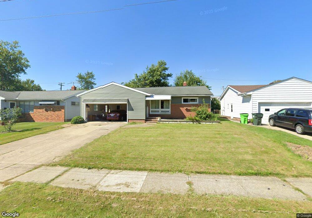
1620 Mallard Dr Cleveland, OH 44124
Estimated Value: $215,323 - $257,000
3
Beds
2
Baths
1,254
Sq Ft
$192/Sq Ft
Est. Value
About This Home
This home is located at 1620 Mallard Dr, Cleveland, OH 44124 and is currently estimated at $241,081, approximately $192 per square foot. 1620 Mallard Dr is a home located in Cuyahoga County with nearby schools including Mayfield High School, Corpus Christi Academy, and Hawken Lower-Middle School.
Ownership History
Date
Name
Owned For
Owner Type
Purchase Details
Closed on
Jul 24, 2010
Sold by
Amicone James and Amicone Roberta
Bought by
Amicone Irene G and Colnon Irene
Current Estimated Value
Home Financials for this Owner
Home Financials are based on the most recent Mortgage that was taken out on this home.
Original Mortgage
$35,229
Interest Rate
4.11%
Mortgage Type
New Conventional
Purchase Details
Closed on
Apr 2, 1985
Sold by
Amicone Edward and Amicone Rita M
Bought by
Amicone Edward
Purchase Details
Closed on
Jan 1, 1975
Bought by
Amicone Edward and Amicone Rita M
Create a Home Valuation Report for This Property
The Home Valuation Report is an in-depth analysis detailing your home's value as well as a comparison with similar homes in the area
Home Values in the Area
Average Home Value in this Area
Purchase History
| Date | Buyer | Sale Price | Title Company |
|---|---|---|---|
| Amicone Irene G | -- | Real Estate Title | |
| Amicone Edward | -- | -- | |
| Amicone Edward | -- | -- |
Source: Public Records
Mortgage History
| Date | Status | Borrower | Loan Amount |
|---|---|---|---|
| Closed | Amicone Irene G | $35,229 |
Source: Public Records
Tax History Compared to Growth
Tax History
| Year | Tax Paid | Tax Assessment Tax Assessment Total Assessment is a certain percentage of the fair market value that is determined by local assessors to be the total taxable value of land and additions on the property. | Land | Improvement |
|---|---|---|---|---|
| 2024 | $3,935 | $69,405 | $14,350 | $55,055 |
| 2023 | $2,929 | $50,370 | $13,020 | $37,350 |
| 2022 | $3,091 | $50,365 | $13,020 | $37,345 |
| 2021 | $3,059 | $50,370 | $13,020 | $37,350 |
| 2020 | $2,761 | $43,050 | $11,130 | $31,920 |
| 2019 | $2,677 | $123,000 | $31,800 | $91,200 |
| 2018 | $1,331 | $43,050 | $11,130 | $31,920 |
| 2017 | $2,515 | $38,960 | $9,210 | $29,750 |
| 2016 | $2,496 | $38,960 | $9,210 | $29,750 |
| 2015 | $2,256 | $38,960 | $9,210 | $29,750 |
| 2014 | $2,256 | $38,190 | $9,030 | $29,160 |
Source: Public Records
Map
Nearby Homes
- 5931 Mayberry Ave
- 1574 Hawthorne Dr
- 1590 Longwood Dr
- 1575 Lander Rd
- 1430 Belrose Rd
- 1722 Hawthorne Dr
- 1363 Ranchland Dr
- 1737 Mayfair Blvd
- 1572 Crestwood Rd
- 1763 Temple Ave
- 5688 Shawnee Dr
- 1379 Lander Rd
- 1391 Iroquois Ave
- 1337 Elmwood Rd
- 1328 Elmwood Rd
- 5960 Cantwell Dr
- 1775 Brainard Rd
- 1839 Caronia Dr
- 6132 Westerham Rd
- 5831 Alberta Dr
- 1616 Mallard Dr
- 1624 Mallard Dr
- 1612 Mallard Dr
- 1628 Mallard Dr
- 1617 Mallard Dr
- 1621 Mallard Dr
- 1608 Mallard Dr
- 1632 Mallard Dr
- 1613 Mallard Dr
- 1629 Mallard Dr
- 1609 Mallard Dr
- 1604 Mallard Dr
- 1633 Mallard Dr
- 5913 Mayflower Ave
- 5859 Marnell Ave
- 5851 Marnell Ave
- 1600 Mallard Dr
- 1601 Mallard Dr
- 5910 Mayflower Ave
- 5875 Marnell Ave