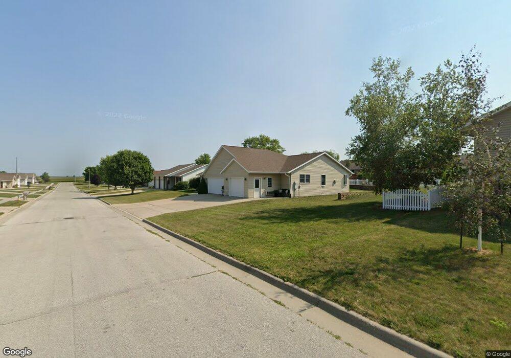
1620 Oakwood Dr Carroll, IA 51401
Estimated Value: $364,000 - $412,000
4
Beds
3
Baths
1,889
Sq Ft
$203/Sq Ft
Est. Value
About This Home
This home is located at 1620 Oakwood Dr, Carroll, IA 51401 and is currently estimated at $382,943, approximately $202 per square foot. 1620 Oakwood Dr is a home located in Carroll County with nearby schools including Fairview Elementary School, Adams Elementary School, and Carroll Middle School.
Ownership History
Date
Name
Owned For
Owner Type
Purchase Details
Closed on
Feb 7, 2011
Sold by
Albright Michael J and Albright Shirley
Bought by
Clausen Ronald L and Clausen Debra A
Current Estimated Value
Home Financials for this Owner
Home Financials are based on the most recent Mortgage that was taken out on this home.
Original Mortgage
$140,000
Outstanding Balance
$5,429
Interest Rate
4.89%
Mortgage Type
New Conventional
Estimated Equity
$377,514
Purchase Details
Closed on
Jan 15, 2007
Sold by
Cordes Robert J and Cordes Kathy S
Bought by
Albright Michael J and Albright Shirley
Home Financials for this Owner
Home Financials are based on the most recent Mortgage that was taken out on this home.
Original Mortgage
$142,425
Interest Rate
6.16%
Mortgage Type
New Conventional
Create a Home Valuation Report for This Property
The Home Valuation Report is an in-depth analysis detailing your home's value as well as a comparison with similar homes in the area
Home Values in the Area
Average Home Value in this Area
Purchase History
| Date | Buyer | Sale Price | Title Company |
|---|---|---|---|
| Clausen Ronald L | $190,000 | Security Title & Investment | |
| Albright Michael J | $190,000 | None Available |
Source: Public Records
Mortgage History
| Date | Status | Borrower | Loan Amount |
|---|---|---|---|
| Open | Clausen Ronald L | $140,000 | |
| Previous Owner | Albright Michael J | $142,425 |
Source: Public Records
Tax History Compared to Growth
Tax History
| Year | Tax Paid | Tax Assessment Tax Assessment Total Assessment is a certain percentage of the fair market value that is determined by local assessors to be the total taxable value of land and additions on the property. | Land | Improvement |
|---|---|---|---|---|
| 2025 | $4,504 | $394,240 | $39,910 | $354,330 |
| 2024 | $4,504 | $350,390 | $39,910 | $310,480 |
| 2023 | $4,323 | $350,390 | $39,910 | $310,480 |
| 2022 | $4,104 | $283,050 | $34,940 | $248,110 |
| 2021 | $4,104 | $283,050 | $34,940 | $248,110 |
| 2020 | $4,014 | $283,050 | $34,940 | $248,110 |
| 2019 | $3,910 | $283,050 | $34,940 | $248,110 |
| 2018 | $3,678 | $283,050 | $34,940 | $248,110 |
| 2017 | $3,678 | $268,837 | $31,158 | $237,679 |
| 2016 | $3,424 | $251,250 | $0 | $0 |
| 2015 | $3,424 | $257,130 | $0 | $0 |
| 2014 | $3,468 | $257,130 | $0 | $0 |
Source: Public Records
Map
Nearby Homes
- 1620 Edgewood Dr
- 1550 Edgewood Dr
- 746 Granada Rd
- 638 Capistrano Ave
- 621 Alta Vista Dr
- 265 Perch St
- 1137 High Ridge Rd
- 260 Bass St
- 1068 Amy Ave
- 222 Bass St
- 1102 Skyline Dr
- 1399 E 11th St
- 1401 E 11th St
- 1022 Skyline Dr
- 1601 Pike Ave
- 1037 Bella Vista Dr
- 1407 E 10th St
- 1409 E 10th St
- 1505 E 10th St
- 1206 Woodland Dr
- 1626 Oakwood Dr
- 1621 Oakwood Dr
- 1615 Oakwood Dr
- 1608 Oakwood Dr
- 1609 Oakwood Dr
- 1633 Oakwood Dr
- 1621 Edgewood Dr
- 1632 Oakwood Dr
- 1627 Edgewood Dr
- 1615 Edgewood Dr
- 1639 Oakwood Dr
- 1603 Oakwood Dr
- 1602 Oakwood Dr
- 1614 High Ridge Rd
- 1609 Edgewood Dr
- 1642 Oakwood Dr
- 0 Oakwood Dr
- 1632 High Ridge Rd
- 1647 Oakwood Dr