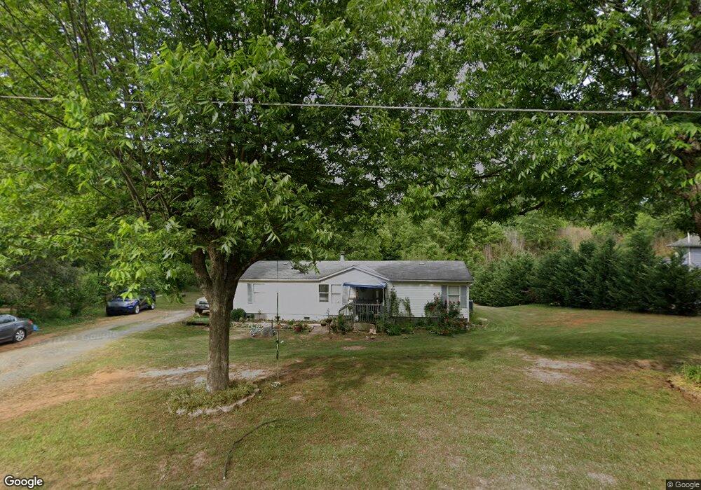
1620 Power Line Ave Newton, NC 28658
Estimated Value: $250,000 - $323,000
--
Bed
--
Bath
2,768
Sq Ft
$100/Sq Ft
Est. Value
About This Home
This home is located at 1620 Power Line Ave, Newton, NC 28658 and is currently estimated at $278,011, approximately $100 per square foot. 1620 Power Line Ave is a home with nearby schools including North Newton Elementary School, Newton-Conover Middle School, and Newton-Conover High School.
Ownership History
Date
Name
Owned For
Owner Type
Purchase Details
Closed on
May 25, 2010
Sold by
Quick Steven G
Bought by
Dollarhide Donald R and Dollarhide Deborah S
Current Estimated Value
Purchase Details
Closed on
Jan 29, 2008
Sold by
American General Financial Services Inc
Bought by
Peters Aghi
Purchase Details
Closed on
May 29, 2007
Sold by
Shook Christy S and Shook Donnie J
Bought by
American General Financial Services Inc
Purchase Details
Closed on
May 25, 2005
Sold by
Hall Jerry and Hall Polly
Bought by
Shook Donnie J and Shook Christy S
Create a Home Valuation Report for This Property
The Home Valuation Report is an in-depth analysis detailing your home's value as well as a comparison with similar homes in the area
Home Values in the Area
Average Home Value in this Area
Purchase History
| Date | Buyer | Sale Price | Title Company |
|---|---|---|---|
| Dollarhide Donald R | -- | None Available | |
| Peters Aghi | $25,000 | None Available | |
| American General Financial Services Inc | $51,461 | None Available | |
| Shook Donnie J | -- | None Available |
Source: Public Records
Tax History Compared to Growth
Tax History
| Year | Tax Paid | Tax Assessment Tax Assessment Total Assessment is a certain percentage of the fair market value that is determined by local assessors to be the total taxable value of land and additions on the property. | Land | Improvement |
|---|---|---|---|---|
| 2025 | $1,092 | $128,700 | $32,700 | $96,000 |
| 2024 | $1,092 | $128,700 | $32,700 | $96,000 |
| 2023 | $1,092 | $128,700 | $32,700 | $96,000 |
| 2022 | $849 | $76,100 | $32,700 | $43,400 |
| 2021 | $849 | $76,100 | $32,700 | $43,400 |
| 2020 | $849 | $76,100 | $32,700 | $43,400 |
| 2019 | $849 | $76,100 | $0 | $0 |
| 2018 | $871 | $78,100 | $32,700 | $45,400 |
| 2017 | $871 | $0 | $0 | $0 |
| 2016 | $871 | $0 | $0 | $0 |
| 2015 | $857 | $78,100 | $32,700 | $45,400 |
| 2014 | $857 | $84,900 | $32,700 | $52,200 |
Source: Public Records
Map
Nearby Homes
- The Piedmont Plan at Rowe Crossing
- The Braselton II Plan at Rowe Crossing
- The Caldwell Plan at Rowe Crossing
- The Benson II Plan at Rowe Crossing
- The Coleman Plan at Rowe Crossing
- The Reynolds Plan at Rowe Crossing
- The Harrington Plan at Rowe Crossing
- 2075 N Whisnant Ave
- 805 Mount Olive Church Rd
- 1128 McRee Heights Cir
- 932 Eastern Ridge Dr
- 1208 N Davis Ave
- 0000 Burris Rd
- 118 W 15th St
- 210 W 15th St
- 710 Mount Olive Church Rd
- 712 Mount Olive Church Rd
- 1687 Golden Cedar Ln
- 1208 N Ashe Ave
- 902 N Ashe Ave
- 1606 Power Line Ave
- 1672 Power Line Ave
- 1602 Power Line Ave
- 1700 Power Line Ave
- 1500 Power Line Ave
- 1709 Rowe Ave
- 1708 Rowe Ave
- 506 E 19th St
- 606 E 19th St
- 436 E 19th St
- 432 E 19th St
- 428 E 19th St
- 503 E 19th St
- 505 E 19th St
- 501 E 19th St
- 424 E 19th St
- 624 E 19th St
- 1900 Eastside Dr
- 1908 N Whisnant Ave
- 1907 N Whisnant Ave