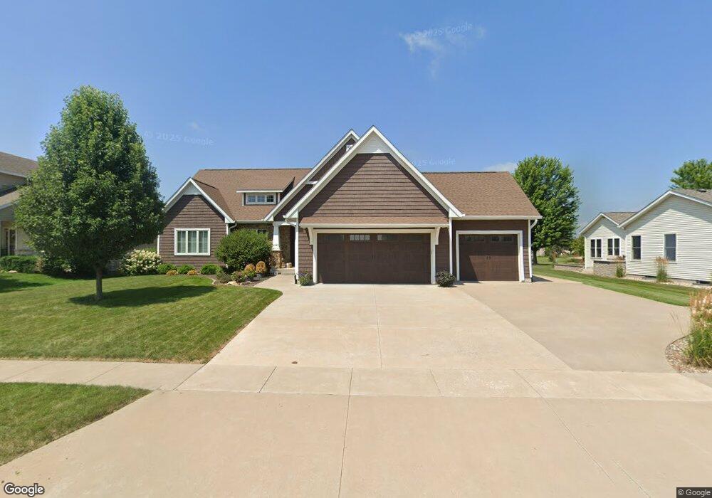
1620 S 11th Ave Eldridge, IA 52748
Estimated Value: $439,000 - $617,364
About This Home
This home is located at 1620 S 11th Ave, Eldridge, IA 52748 and is currently estimated at $552,091, approximately $229 per square foot. 1620 S 11th Ave is a home located in Scott County with nearby schools including Alan Shepard Elementary School, North Scott Junior High School, and North Scott Senior High School.
Ownership History
We collect this data history from publicly available records. To have your information removed, we recommend requesting removal directly through your county’s website.
Purchase Details
Purchase Details
Home Values in the Area
Average Home Value in this Area
Purchase History
We collect this data history from publicly available records. To have your information removed, we recommend requesting removal directly through your county’s website.
| Date | Buyer | Sale Price | Title Company |
|---|---|---|---|
| $75,000 | None Available | ||
| $53,000 | None Available |
Tax History
We collect this data history from publicly available records. To have your information removed, we recommend requesting removal directly through your county’s website.
| Year | Tax Paid | Tax Assessment Tax Assessment Total Assessment is a certain percentage of the fair market value that is determined by local assessors to be the total taxable value of land and additions on the property. | Land | Improvement |
|---|---|---|---|---|
| 2025 | $7,018 | $585,700 | $106,600 | $479,100 |
| 2024 | $6,838 | $557,700 | $106,600 | $451,100 |
| 2023 | $7,164 | $557,700 | $106,600 | $451,100 |
| 2022 | $6,944 | $501,490 | $71,400 | $430,090 |
| 2021 | $6,944 | $501,490 | $71,400 | $430,090 |
| 2020 | $6,954 | $491,620 | $71,400 | $420,220 |
| 2019 | $912 | $60,690 | $60,690 | $0 |
| 2018 | $932 | $60,690 | $60,690 | $0 |
| 2017 | $958 | $60,690 | $60,690 | $0 |
| 2016 | $936 | $60,690 | $0 | $0 |
| 2015 | $936 | $60,690 | $0 | $0 |
| 2014 | $952 | $6,800 | $0 | $0 |
| 2013 | $104 | $0 | $0 | $0 |
| 2012 | -- | $6,800 | $6,800 | $0 |
Map
- 920 Rustic View Ct
- 620 St Andrews Cir
- 1413 Colonial Ct
- 1400 Colonial Ct
- 1218 S 2nd St
- 00 Scott Park Rd
- 357 Country Club Ct Unit 24
- 602 E Sheridan Dr
- 1821 Redbud Cir
- 1867 Redbud Cir Unit 103
- 1867 Redbud Cir Unit 102
- 1867 Redbud Cir Unit 101
- 1875 Redbud Cir Unit 102
- 1875 Redbud Cir Unit 103
- 1704 Redbud Cir Unit 101
- 1704 Redbud Cir Unit 103
- 1704 Redbud Cir Unit 102
- 1868 Redbud Cir
- 1813 S 5th St
- 1831 S 5th St
- 1640 S 11th Ave
- 1075 Rustic View Ct
- 1621 S 10th Ave
- 1090 E Lincoln Rd
- 1641 S 10th Ave
- 1025 Rustic View Ct
- 1175 Rustic View Ct
- 1681 S 10th Ave
- 1631 S 11th Ave
- 1681 S 11th Ave
- 1080 Rustic View Ct
- 1120 Rustic View Ct
- 1040 Rustic View Ct
- 1205 Rustic View Ct
- 0 Rustic View Unit 4134678
- 0 Rustic View Unit 4136227
- 0 Rustic View Unit 4139655
- 0000 Rustic View
- 0 Rustic View Ct
- 0 S 10th Ave
Ask me questions while you tour the home.