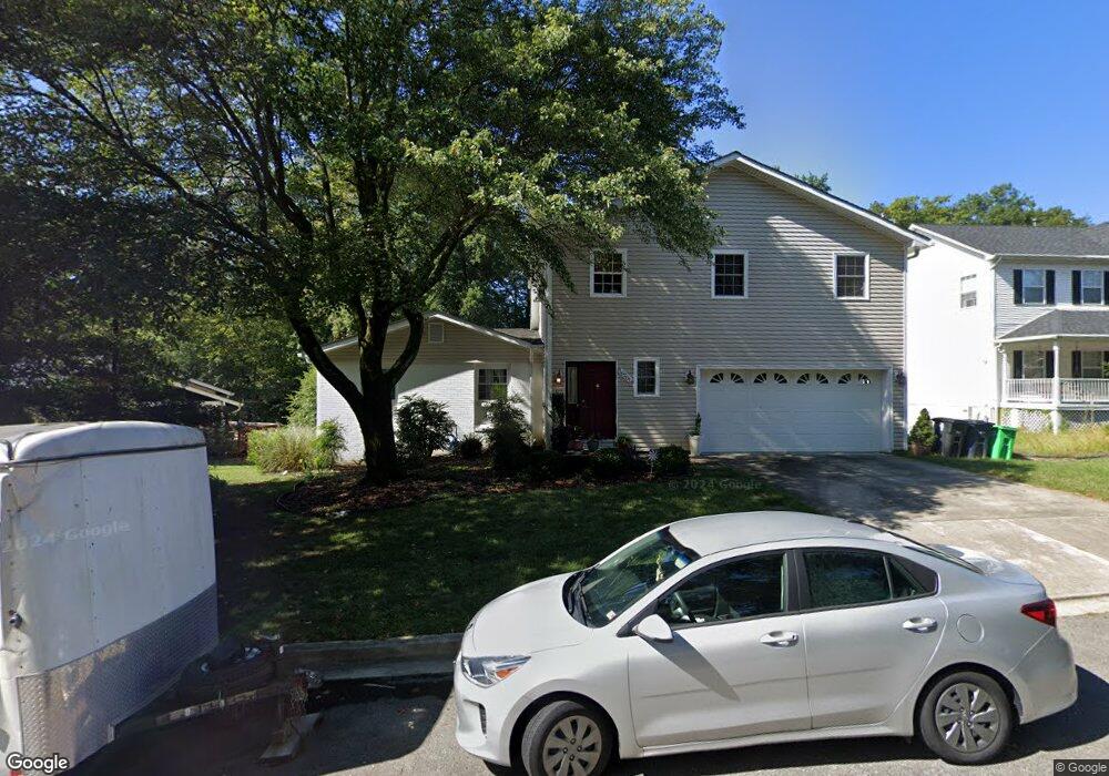
16201 Gales St Laurel, MD 20707
West Laurel NeighborhoodEstimated Value: $566,000 - $674,000
Studio
3
Baths
2,565
Sq Ft
$243/Sq Ft
Est. Value
About This Home
This home is located at 16201 Gales St, Laurel, MD 20707 and is currently estimated at $622,119, approximately $242 per square foot. 16201 Gales St is a home located in Prince George's County with nearby schools including Bond Mill Elementary, Martin Luther King Jr. Middle School, and Laurel High School.
Ownership History
Date
Name
Owned For
Owner Type
Purchase Details
Closed on
Jul 26, 2021
Sold by
Daly Kevin E and Powell Daly Marie
Bought by
Daly Kevin E and Powell Daly Marie
Current Estimated Value
Home Financials for this Owner
Home Financials are based on the most recent Mortgage that was taken out on this home.
Original Mortgage
$219,000
Outstanding Balance
$198,403
Interest Rate
2.8%
Mortgage Type
New Conventional
Estimated Equity
$423,716
Purchase Details
Closed on
Feb 21, 1992
Sold by
Tucker James E
Bought by
Daly Kevin E and Daly Marie T
Create a Home Valuation Report for This Property
The Home Valuation Report is an in-depth analysis detailing your home's value as well as a comparison with similar homes in the area
Home Values in the Area
Average Home Value in this Area
Purchase History
| Date | Buyer | Sale Price | Title Company |
|---|---|---|---|
| Daly Kevin E | -- | Eagle Title Agency Llc | |
| Daly Kevin E | -- | Eagle Title Agency Llc | |
| Daly Kevin E | $160,000 | -- |
Source: Public Records
Mortgage History
| Date | Status | Borrower | Loan Amount |
|---|---|---|---|
| Open | Daly Kevin E | $219,000 |
Source: Public Records
Tax History
| Year | Tax Paid | Tax Assessment Tax Assessment Total Assessment is a certain percentage of the fair market value that is determined by local assessors to be the total taxable value of land and additions on the property. | Land | Improvement |
|---|---|---|---|---|
| 2025 | $8,448 | $574,000 | $141,300 | $432,700 |
| 2024 | $8,448 | $541,633 | -- | -- |
| 2023 | $46 | $509,267 | $0 | $0 |
| 2022 | $7,485 | $476,900 | $101,300 | $375,600 |
| 2021 | $7,055 | $447,967 | $0 | $0 |
| 2020 | $13,249 | $419,033 | $0 | $0 |
| 2019 | $5,586 | $390,100 | $100,600 | $289,500 |
| 2018 | $5,953 | $379,267 | $0 | $0 |
| 2017 | $5,712 | $368,433 | $0 | $0 |
| 2016 | -- | $357,600 | $0 | $0 |
| 2015 | $3,709 | $342,467 | $0 | $0 |
| 2014 | $3,709 | $327,333 | $0 | $0 |
Source: Public Records
Map
Nearby Homes
- 6201 Goodman Rd
- 15611 Riding Stable Rd
- 6003 Windham Rd
- 14005 Barkham Ct
- 7004 Fitzpatrick Dr
- 7106 Donston Dr
- 7209 Brooklyn Bridge Rd
- 7019 Fitzpatrick Dr
- 16140 Kenny Rd
- 6918 Scotch Dr
- 7002 Scotch Dr
- 15712 Dorset Rd Unit 104
- 15708 Dorset Rd Unit 202
- 15706 Dorset Rd Unit 102
- 11375 Harding Rd
- 15603 Dorset Rd Unit 101
- 16001 Amina Dr
- 15743 Millbrook Ln
- 4402 Regalwood Terrace
- 4302 Regalwood Terrace
- 16101 Gales St
- 16203 Gales St
- 16207 Tilghman Ct
- 16205 Tilghman Ct
- 16097 Gales St
- 16206 Tilghman Ct
- 16200 Gales St
- 16221 Cissell Rd
- 16100 Gales St
- 16204 Gales St
- 16204 Tilghman Ct
- 6110 Tilghman Dr
- 6112 Tilghman Dr
- 16098 Gales St
- 6108 Tilghman Dr
- 6106 Tilghman Dr
- 6114 Tilghman Dr
- 16208 Gales St
- 16202 Tilghman Ct
- 16209 Gales St
Your Personal Tour Guide
Ask me questions while you tour the home.