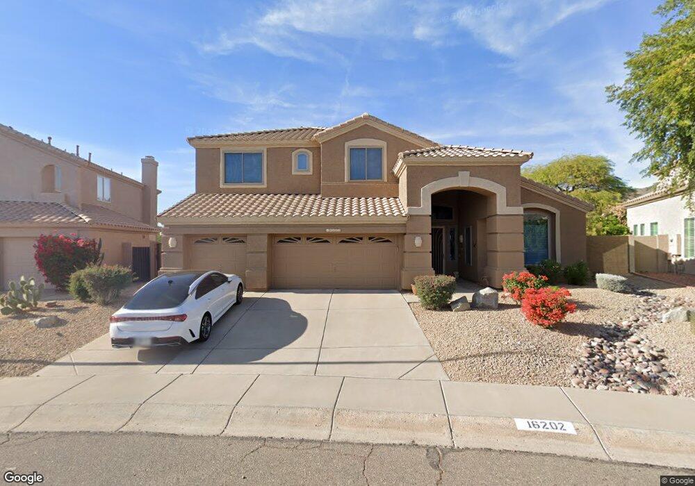
16202 S 1st Ave Phoenix, AZ 85045
Ahwatukee NeighborhoodEstimated Value: $778,660 - $931,000
Studio
4
Baths
3,152
Sq Ft
$274/Sq Ft
Est. Value
About This Home
This home is located at 16202 S 1st Ave, Phoenix, AZ 85045 and is currently estimated at $864,165, approximately $274 per square foot. 16202 S 1st Ave is a home located in Maricopa County with nearby schools including Kyrene de la Sierra Elementary School, Kyrene Altadeña Middle School, and Desert Vista High School.
Ownership History
Date
Name
Owned For
Owner Type
Purchase Details
Closed on
Nov 30, 2005
Sold by
Wolfe Charles D
Bought by
Wolfe Charles D and Wolfe Elaine F
Current Estimated Value
Purchase Details
Closed on
Dec 13, 2001
Sold by
Martin Daniel J
Bought by
Wolfe Charles D
Purchase Details
Closed on
Aug 9, 1999
Sold by
May Donald G and May Nancy
Bought by
Martin Daniel J
Home Financials for this Owner
Home Financials are based on the most recent Mortgage that was taken out on this home.
Original Mortgage
$257,600
Interest Rate
7.25%
Mortgage Type
New Conventional
Purchase Details
Closed on
Oct 26, 1994
Sold by
United Title Agency Of Arizona Inc
Bought by
May Donald G and May Nancy
Home Financials for this Owner
Home Financials are based on the most recent Mortgage that was taken out on this home.
Original Mortgage
$249,550
Interest Rate
8.7%
Mortgage Type
New Conventional
Create a Home Valuation Report for This Property
The Home Valuation Report is an in-depth analysis detailing your home's value as well as a comparison with similar homes in the area
Home Values in the Area
Average Home Value in this Area
Purchase History
| Date | Buyer | Sale Price | Title Company |
|---|---|---|---|
| Wolfe Charles D | -- | -- | |
| Wolfe Charles D | $379,900 | Security Title Agency | |
| Martin Daniel J | $322,000 | First American Title | |
| May Donald G | $272,111 | United Title Agency |
Source: Public Records
Mortgage History
| Date | Status | Borrower | Loan Amount |
|---|---|---|---|
| Previous Owner | Martin Daniel J | $257,600 | |
| Previous Owner | May Donald G | $249,550 |
Source: Public Records
Tax History
| Year | Tax Paid | Tax Assessment Tax Assessment Total Assessment is a certain percentage of the fair market value that is determined by local assessors to be the total taxable value of land and additions on the property. | Land | Improvement |
|---|---|---|---|---|
| 2025 | $4,726 | $50,602 | -- | -- |
| 2024 | $4,477 | $48,192 | -- | -- |
| 2023 | $4,477 | $57,670 | $11,530 | $46,140 |
| 2022 | $4,260 | $45,260 | $9,050 | $36,210 |
| 2021 | $4,384 | $41,630 | $8,320 | $33,310 |
| 2020 | $4,447 | $41,100 | $8,220 | $32,880 |
| 2019 | $4,392 | $39,900 | $7,980 | $31,920 |
| 2018 | $4,439 | $40,510 | $8,100 | $32,410 |
| 2017 | $4,227 | $41,430 | $8,280 | $33,150 |
| 2016 | $4,267 | $40,110 | $8,020 | $32,090 |
| 2015 | $3,769 | $40,100 | $8,020 | $32,080 |
Source: Public Records
Map
Nearby Homes
- 7 W Silverwood Dr
- 16225 S 1st St
- 615 W Mountain Vista Dr
- 16032 S 1st St
- 15825 S 1st Ave
- 15427 S 6th Dr
- 15550 S 5th Ave Unit 159
- 15550 S 5th Ave Unit 236
- 15550 S 5th Ave Unit 240
- 15550 S 5th Ave Unit 130
- 15550 S 5th Ave Unit 121
- 15426 S 4th Ave
- 1123 W Thunderhill Dr
- 15405 S 4th Ave
- 208 E South Fork Dr
- 414 E Redwood Ln
- 16635 S 12th Ave
- 333 E Redwood Ln
- 923 W Windsong Dr
- 404 E Mountain Sky Ave
- 16050 S 1st Ave
- 16044 S 1st Ave
- 16212 S 1st Ave
- 16209 S 1st Ave
- 16215 S 1st Ave
- 16216 S 1st Ave
- 17 W Silverwood Dr
- 16221 S 1st Ave
- 13 W Silverwood Dr
- 16032 S 1st Ave
- 16227 S 1st Ave
- 16026 S 1st Ave
- 16226 S 1st Ave
- 16 W Silverwood Dr
- 8 W Silverwood Dr
- 16020 S 1st Ave
- 16021 S 1st Ave
- 16016 S 1st Ave
- 16226 S 1st St
- 16222 S 1st St
Your Personal Tour Guide
Ask me questions while you tour the home.