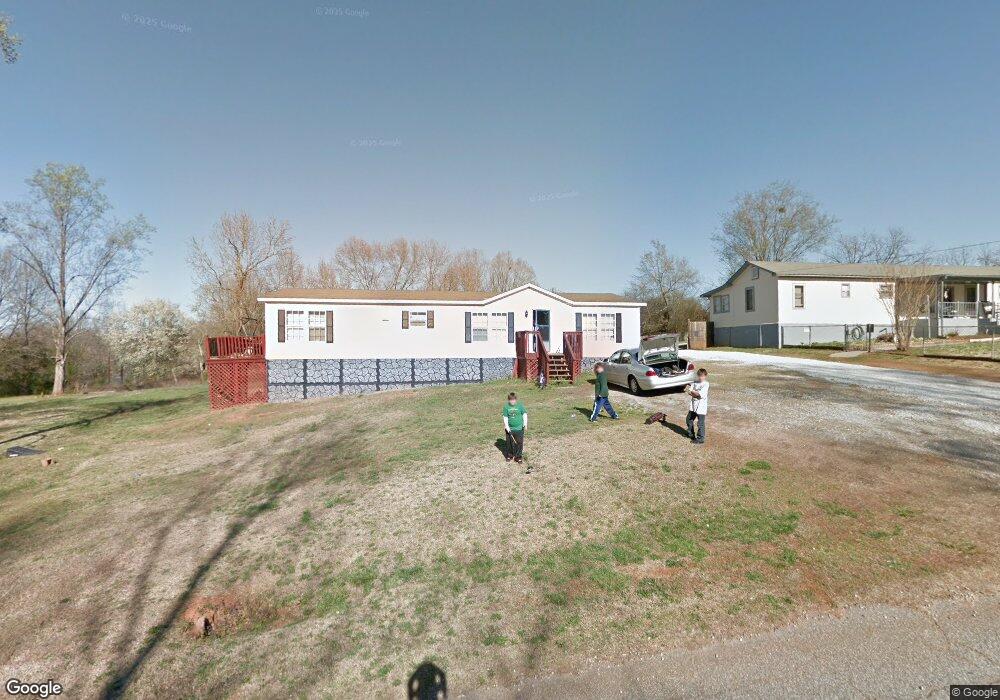
1621 Cherokee Cir Anderson, SC 29625
Estimated Value: $55,000 - $189,000
3
Beds
2
Baths
1,550
Sq Ft
$88/Sq Ft
Est. Value
About This Home
This home is located at 1621 Cherokee Cir, Anderson, SC 29625 and is currently estimated at $137,000, approximately $88 per square foot. 1621 Cherokee Cir is a home located in Anderson County with nearby schools including New Prospect Elementary School, Robert Anderson Middle School, and Westside High School.
Ownership History
Date
Name
Owned For
Owner Type
Purchase Details
Closed on
Jul 17, 2018
Sold by
Norris Jerry Dale
Bought by
Norris Brian S and Norris Jenifer J
Current Estimated Value
Purchase Details
Closed on
May 4, 2012
Sold by
Osborne Rick
Bought by
Norris Jerry Dale
Purchase Details
Closed on
Apr 1, 2004
Sold by
Garrison Brenda S
Bought by
Allen Brian C
Purchase Details
Closed on
Mar 31, 2004
Sold by
Federal Home Loan Mortgage Corporation
Bought by
Osborne Rick
Purchase Details
Closed on
Jan 26, 2004
Sold by
Master In Equity
Bought by
Federal Home Loan Mtg Co
Purchase Details
Closed on
Jul 19, 2002
Sold by
Adelburg Jeffrey W
Bought by
Schult Matthew T
Purchase Details
Closed on
Jul 12, 2002
Sold by
Moore Brud
Bought by
Duncan Raymond
Purchase Details
Closed on
May 10, 2002
Sold by
Firstar Bank Na
Bought by
Moore Brud
Purchase Details
Closed on
Apr 23, 2002
Sold by
Drew Ellis B
Bought by
Firstar Bank
Create a Home Valuation Report for This Property
The Home Valuation Report is an in-depth analysis detailing your home's value as well as a comparison with similar homes in the area
Home Values in the Area
Average Home Value in this Area
Purchase History
| Date | Buyer | Sale Price | Title Company |
|---|---|---|---|
| Norris Brian S | $2,500 | None Available | |
| Norris Jerry Dale | $10,000 | -- | |
| Allen Brian C | $152,000 | -- | |
| Osborne Rick | $23,000 | -- | |
| Federal Home Loan Mtg Co | $2,500 | -- | |
| Homecoming Financial Netwo | $2,500 | -- | |
| Schult Matthew T | $87,000 | -- | |
| Duncan Raymond | $63,000 | -- | |
| Moore Brud | $29,000 | -- | |
| Firstar Bank | $29,112 | -- |
Source: Public Records
Tax History Compared to Growth
Tax History
| Year | Tax Paid | Tax Assessment Tax Assessment Total Assessment is a certain percentage of the fair market value that is determined by local assessors to be the total taxable value of land and additions on the property. | Land | Improvement |
|---|---|---|---|---|
| 2024 | $221 | $700 | $700 | $0 |
| 2023 | $221 | $700 | $700 | $0 |
| 2022 | $215 | $700 | $700 | $0 |
| 2021 | $195 | $600 | $600 | $0 |
| 2020 | $192 | $600 | $600 | $0 |
| 2019 | $192 | $600 | $600 | $0 |
| 2018 | $174 | $600 | $600 | $0 |
| 2017 | -- | $600 | $600 | $0 |
| 2016 | $149 | $480 | $480 | $0 |
| 2015 | $150 | $480 | $480 | $0 |
| 2014 | $148 | $480 | $480 | $0 |
Source: Public Records
Map
Nearby Homes
- 1511 Cherokee Cir
- 121 Bridgeview Dr
- 125 Hidden Lake Dr
- Lot 113 Hidden Lake Dr
- 208 Springview Dr
- 103 Lissa Ln
- 4450 Highway 24 Hwy
- 101 Richfield Dr
- 100 Grandview Dr
- 118 Pritchards Dr
- 303 Plantation Point
- 114 Peartree Ln
- 144 Old Asbury Rd
- 110 Peartree Ln
- 426 Carole Ave
- 347 Knollwood Dr
- 202 Highway 187 S
- 1037 Pearl Harbor Way
- 109 Sugar Creek Ln
- 201 Knollwood Dr
- 1623 Cherokee Cir
- 1615 Cherokee Cir
- 1627 Cherokee Cir
- 1630 Cherokee Cir
- 1531 Cherokee Cir
- 1529 Cherokee Cir
- 1620 Cherokee Cir
- 1013 Sioux St
- 1631 Cherokee Cir
- 1523 Cherokee Cir
- 1614 Cherokee Cir
- 208 Lakeshore Dr
- 210 Lakeshore Dr
- 1521 Cherokee Cir
- 1633 Cherokee Cir
- 1022 Sioux St
- 200 Lakeshore Dr
- 1634 Cherokee Cir
- 1030 Sioux St
- 1005 Sioux St