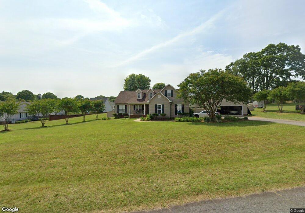
1621 Samaria Ln Conover, NC 28613
Estimated Value: $366,000 - $403,000
3
Beds
2
Baths
1,744
Sq Ft
$221/Sq Ft
Est. Value
About This Home
This home is located at 1621 Samaria Ln, Conover, NC 28613 and is currently estimated at $384,597, approximately $220 per square foot. 1621 Samaria Ln is a home located in Catawba County with nearby schools including Claremont Elementary School, River Bend Middle School, and Bunker Hill High School.
Ownership History
Date
Name
Owned For
Owner Type
Purchase Details
Closed on
Feb 11, 2011
Sold by
Widener Darrin W and Widener Juda C
Bought by
Widener Darrin W and Widener Juda C
Current Estimated Value
Home Financials for this Owner
Home Financials are based on the most recent Mortgage that was taken out on this home.
Original Mortgage
$24,086
Outstanding Balance
$15,674
Interest Rate
4.08%
Mortgage Type
Future Advance Clause Open End Mortgage
Estimated Equity
$368,923
Purchase Details
Closed on
Mar 18, 2004
Purchase Details
Closed on
Jan 22, 2001
Create a Home Valuation Report for This Property
The Home Valuation Report is an in-depth analysis detailing your home's value as well as a comparison with similar homes in the area
Home Values in the Area
Average Home Value in this Area
Purchase History
| Date | Buyer | Sale Price | Title Company |
|---|---|---|---|
| Widener Darrin W | -- | None Available | |
| -- | $159,000 | -- | |
| -- | $22,000 | -- |
Source: Public Records
Mortgage History
| Date | Status | Borrower | Loan Amount |
|---|---|---|---|
| Open | Widener Darrin W | $24,086 |
Source: Public Records
Tax History
| Year | Tax Paid | Tax Assessment Tax Assessment Total Assessment is a certain percentage of the fair market value that is determined by local assessors to be the total taxable value of land and additions on the property. | Land | Improvement |
|---|---|---|---|---|
| 2025 | $1,824 | $357,200 | $34,600 | $322,600 |
| 2024 | $1,824 | $357,200 | $34,600 | $322,600 |
| 2023 | $1,754 | $357,200 | $34,600 | $322,600 |
| 2022 | $1,581 | $224,300 | $27,600 | $196,700 |
| 2021 | $1,536 | $224,300 | $27,600 | $196,700 |
| 2020 | $1,536 | $224,300 | $27,600 | $196,700 |
| 2019 | $1,492 | $224,300 | $0 | $0 |
| 2018 | $1,399 | $210,400 | $27,900 | $182,500 |
| 2017 | $1,399 | $0 | $0 | $0 |
| 2016 | $1,378 | $0 | $0 | $0 |
| 2015 | $1,186 | $210,370 | $27,900 | $182,470 |
| 2014 | $1,186 | $214,400 | $40,700 | $173,700 |
Source: Public Records
Map
Nearby Homes
- 1611 Emmaus Walk
- 1545 Antioch Dr
- 1737 Bush Dr
- 2474 Cedar Valley Dr
- 1223 Creekside Dr
- 1213 Creekside Dr
- 1383 Sandiwood Ct
- 3360 Tolley St
- 2347 Plainfield Dr
- 2109 Kyle Ct SE
- 1254 Little Rd
- 1636 Mayfair Dr
- 4275 Bethany Church Rd
- 7.03 acres 5 W Hwy 10 Hwy
- 0000 Burris Rd
- 3275 White Oak Ct
- 2320 Claremont Rd
- 1687 Golden Cedar Ln
- 1452 Edisons Bright Way
- 1071 Caleb Setzer Rd
- 2754 Judea Dr
- 2762 Judea Dr
- 1626 Emmaus Walk
- 1628 Samaria Ln
- 1614 Samaria Ln
- 1637 Samaria Ln
- 2740 Judea Dr
- 2780 Judea Dr
- 1638 Emmaus Walk
- 1629 Damascus Cir
- 2753 Judea Dr
- 2794 Judea Dr
- 2765 Judea Dr
- 1613 Damascus Cir
- 1635 Emmaus Walk
- 2773 Judea Dr
- 1625 Emmaus Walk
- 2741 Judea Dr
- 1 Judea Dr Unit 1
- 2808 Judea Dr