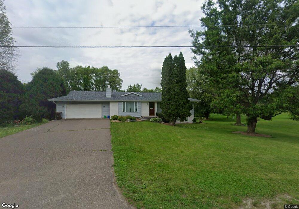
16210 Territorial Rd Maple Grove, MN 55369
Estimated Value: $659,000 - $692,000
4
Beds
3
Baths
1,307
Sq Ft
$514/Sq Ft
Est. Value
About This Home
This home is located at 16210 Territorial Rd, Maple Grove, MN 55369 and is currently estimated at $671,628, approximately $513 per square foot. 16210 Territorial Rd is a home located in Hennepin County with nearby schools including Fernbrook Elementary School, Osseo Middle School, and Maple Grove Senior High School.
Ownership History
Date
Name
Owned For
Owner Type
Purchase Details
Closed on
Jan 10, 2025
Sold by
Peddycoart Duff A and Thies Julie M
Bought by
Telemarketing International Inc
Current Estimated Value
Home Financials for this Owner
Home Financials are based on the most recent Mortgage that was taken out on this home.
Original Mortgage
$500,000
Outstanding Balance
$487,668
Interest Rate
6.69%
Mortgage Type
New Conventional
Estimated Equity
$183,960
Purchase Details
Closed on
Dec 5, 2019
Sold by
Peddycoart Duff A and Thies Julie M
Bought by
Peddycoart Duff A and Thies Julie M
Purchase Details
Closed on
Jan 28, 1999
Sold by
Maus Steven M
Bought by
Peddycoart Duff A and Peddycoart Caral L
Create a Home Valuation Report for This Property
The Home Valuation Report is an in-depth analysis detailing your home's value as well as a comparison with similar homes in the area
Home Values in the Area
Average Home Value in this Area
Purchase History
| Date | Buyer | Sale Price | Title Company |
|---|---|---|---|
| Telemarketing International Inc | $650,000 | Great North Title | |
| Peddycoart Duff A | -- | None Available | |
| Peddycoart Duff A | $170,000 | -- |
Source: Public Records
Mortgage History
| Date | Status | Borrower | Loan Amount |
|---|---|---|---|
| Open | Telemarketing International Inc | $500,000 |
Source: Public Records
Tax History
| Year | Tax Paid | Tax Assessment Tax Assessment Total Assessment is a certain percentage of the fair market value that is determined by local assessors to be the total taxable value of land and additions on the property. | Land | Improvement |
|---|---|---|---|---|
| 2024 | $5,949 | $473,100 | $218,800 | $254,300 |
| 2023 | $5,597 | $448,700 | $192,500 | $256,200 |
| 2022 | $4,987 | $441,000 | $193,000 | $248,000 |
| 2021 | $5,107 | $367,000 | $154,000 | $213,000 |
| 2020 | $5,552 | $361,000 | $154,000 | $207,000 |
| 2019 | $5,392 | $371,000 | $166,000 | $205,000 |
| 2018 | $5,236 | $347,000 | $145,000 | $202,000 |
| 2017 | $4,938 | $312,000 | $133,000 | $179,000 |
| 2016 | $5,041 | $313,000 | $149,000 | $164,000 |
| 2015 | $4,988 | $304,000 | $140,000 | $164,000 |
| 2014 | -- | $280,000 | $145,000 | $135,000 |
Source: Public Records
Map
Nearby Homes
- 11071 Sundance Ridge
- 16310 Comstock Ln N
- 16471 Territorial Trail
- 16430 110th Ave N
- 16440 110th Ave N
- 16340 Comstock Ln N
- 16320 Comstock Ln N
- 16460 Comstock Ln N
- 11080 Comstock Ln N
- 16450 Comstock Ln N
- 16330 Comstock Ln N
- 000 110th Ave N
- 16611 Territorial Trail
- 15442 111th Ave N
- 15450 110th Ave N
- 15531 111th Ave N
- 15650 112th Ave N
- 15351 110th Ave N
- 15350 110th Ave N
- 16755 106th Place N
- 16220 Territorial Rd
- 16030 Fair Meadows Ln
- 16040 Fair Meadows Ln
- 16020 Fair Meadows Ln
- 16221 Territorial Rd
- 15980 Rush Creek Rd
- 15980 Rush Creek Rd
- 16050 Fair Meadows Ln
- 16060 Fair Meadows Ln
- 10990 French Lake Rd
- 10990 E French Lake Rd
- 16070 Fair Meadows Ln
- 11001 Fair Meadows Ct
- 16010 Fair Meadows Ln
- 16011 Fair Meadows Ln
- 16051 Fair Meadows Ln
- 11011 Fair Meadows Ct
- 16075 Territorial Rd
- 16001 Fair Meadows Ln
- 16000 Fair Meadows Ln
Your Personal Tour Guide
Ask me questions while you tour the home.