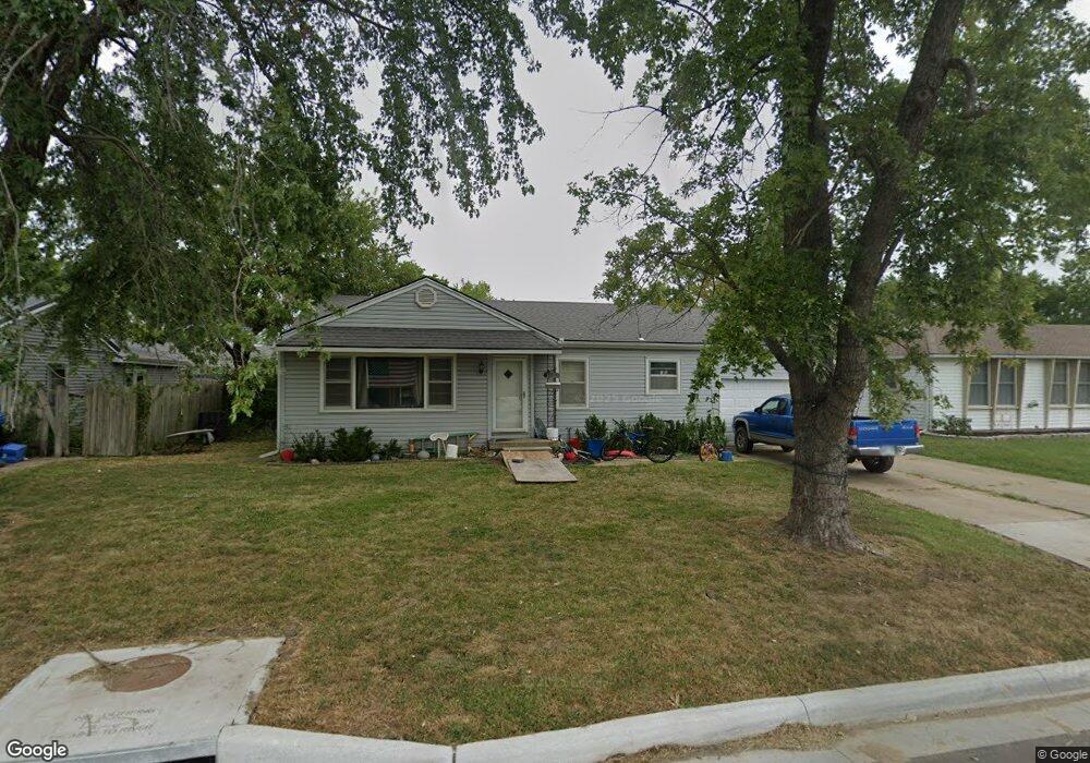
1622 Main St Osawatomie, KS 66064
Estimated Value: $204,000 - $218,351
3
Beds
2
Baths
1,515
Sq Ft
$140/Sq Ft
Est. Value
About This Home
This home is located at 1622 Main St, Osawatomie, KS 66064 and is currently estimated at $212,588, approximately $140 per square foot. 1622 Main St is a home located in Miami County with nearby schools including Swenson Early Childhood Education Center, Trojan Elementary School, and Osawatomie Middle School.
Ownership History
Date
Name
Owned For
Owner Type
Purchase Details
Closed on
Feb 27, 2025
Sold by
Mersman Rachel L and Mersman Brian S
Bought by
Brian S Mersman And Rachel L Mersman Family T and Mersman
Current Estimated Value
Purchase Details
Closed on
Feb 5, 2025
Sold by
Runnells Kathryn J
Bought by
Mersman Rachel L
Purchase Details
Closed on
Apr 30, 2020
Sold by
Provin Claudia H
Bought by
Provin Family Trust
Purchase Details
Closed on
Feb 18, 2015
Sold by
Mersman Brian S
Bought by
Provin Claudia H
Create a Home Valuation Report for This Property
The Home Valuation Report is an in-depth analysis detailing your home's value as well as a comparison with similar homes in the area
Home Values in the Area
Average Home Value in this Area
Purchase History
| Date | Buyer | Sale Price | Title Company |
|---|---|---|---|
| Brian S Mersman And Rachel L Mersman Family T | -- | None Listed On Document | |
| Mersman Rachel L | -- | None Listed On Document | |
| Mersman Rachel L | -- | None Listed On Document | |
| Provin Family Trust | -- | First United Title Svcs | |
| Provin Claudia H | -- | First United Title |
Source: Public Records
Tax History Compared to Growth
Tax History
| Year | Tax Paid | Tax Assessment Tax Assessment Total Assessment is a certain percentage of the fair market value that is determined by local assessors to be the total taxable value of land and additions on the property. | Land | Improvement |
|---|---|---|---|---|
| 2025 | $4,644 | $25,858 | $775 | $25,083 |
| 2024 | $4,502 | $25,105 | $696 | $24,409 |
| 2023 | $4,400 | $24,031 | $657 | $23,374 |
| 2022 | $3,879 | $20,332 | $897 | $19,435 |
| 2021 | $3,155 | $0 | $0 | $0 |
| 2020 | $2,632 | $0 | $0 | $0 |
| 2019 | $2,331 | $0 | $0 | $0 |
| 2018 | $2,261 | $0 | $0 | $0 |
| 2017 | $2,188 | $0 | $0 | $0 |
| 2016 | -- | $0 | $0 | $0 |
| 2015 | -- | $0 | $0 | $0 |
| 2014 | -- | $0 | $0 | $0 |
| 2013 | -- | $0 | $0 | $0 |
Source: Public Records
Map
Nearby Homes
- 1612 Brown Ave
- 1612 Main St
- 1548 Brown Ave
- 1711 Lockhart Ln
- 1734 Main Street Terrace
- 1734 Main St Unit Terrace
- 612 17th St
- 501 18th St
- 1324 Pacific Ave
- 1512 Charles Ave
- 1109 Main St
- 1117 Walnut Ave
- 1015 Main St
- 1103 Chestnut St
- 1017 Pacific Ave
- 1045 Chestnut Ave
- 716 10th St
- 934 Pacific St
- 921 Brown Ave
- 835 Brown Ave
- 1614 Main St
- 1628 Main St
- 1614 Main Street Terrace
- 1621 Main St
- 1615 Main St
- 1615 Main St
- 1625 Main St
- 1634 Main St
- 1617 Main Street Terrace
- 1627 Main St
- 1611 Main St
- 1629 Main St
- 1631 Main St
- 1631 Main Street Terrace
- 1636 Main Street Terrace
- 1636 Main St
- 1617 Main St
- 1635 Main St
- 1639 Main St
- 1602 Main Street Terrace