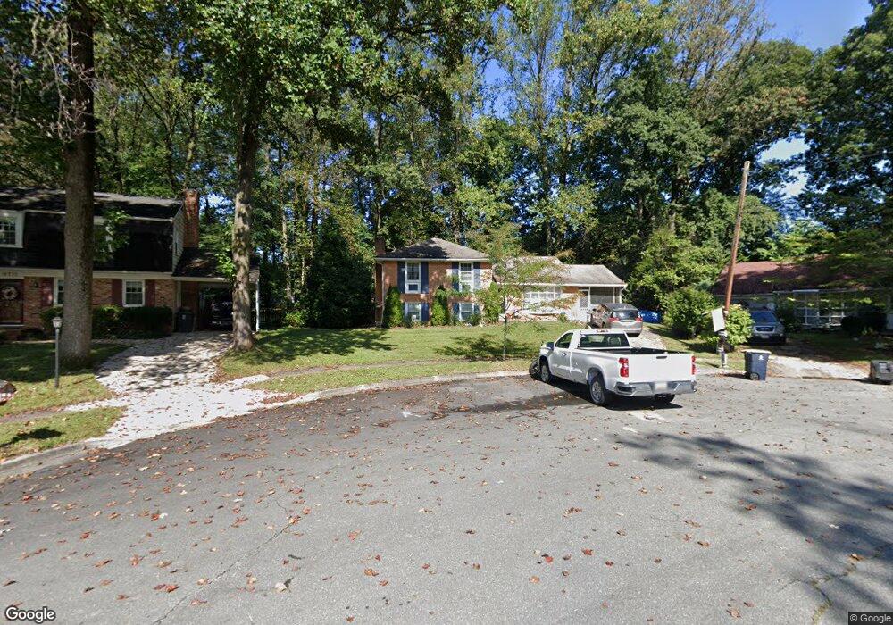
16220 Jerald Rd Laurel, MD 20707
West Laurel NeighborhoodEstimated Value: $481,393 - $572,000
Studio
2
Baths
2,388
Sq Ft
$223/Sq Ft
Est. Value
About This Home
This home is located at 16220 Jerald Rd, Laurel, MD 20707 and is currently estimated at $531,348, approximately $222 per square foot. 16220 Jerald Rd is a home located in Prince George's County with nearby schools including Bond Mill Elementary, Martin Luther King Jr. Middle School, and Laurel High School.
Ownership History
Date
Name
Owned For
Owner Type
Purchase Details
Closed on
May 17, 2006
Sold by
Smith Clarence H
Bought by
Hendershot Thomas R and Hendershot Jennifer M
Current Estimated Value
Home Financials for this Owner
Home Financials are based on the most recent Mortgage that was taken out on this home.
Original Mortgage
$328,500
Outstanding Balance
$183,434
Interest Rate
5.78%
Mortgage Type
Purchase Money Mortgage
Estimated Equity
$347,914
Purchase Details
Closed on
Sep 27, 2005
Sold by
Smith Clarence H
Bought by
Hendershot Thomas R and Hendershot Jennifer M
Home Financials for this Owner
Home Financials are based on the most recent Mortgage that was taken out on this home.
Original Mortgage
$328,500
Interest Rate
5.78%
Mortgage Type
Purchase Money Mortgage
Purchase Details
Closed on
Oct 29, 1974
Sold by
Green Charles F
Bought by
Smith Clarence H and Smith Judith E
Create a Home Valuation Report for This Property
The Home Valuation Report is an in-depth analysis detailing your home's value as well as a comparison with similar homes in the area
Home Values in the Area
Average Home Value in this Area
Purchase History
| Date | Buyer | Sale Price | Title Company |
|---|---|---|---|
| Hendershot Thomas R | $365,000 | -- | |
| Hendershot Thomas R | $365,000 | -- | |
| Smith Clarence H | $52,000 | -- |
Source: Public Records
Mortgage History
| Date | Status | Borrower | Loan Amount |
|---|---|---|---|
| Open | Hendershot Thomas R | $328,500 | |
| Previous Owner | Hendershot Thomas R | $328,500 |
Source: Public Records
Tax History
| Year | Tax Paid | Tax Assessment Tax Assessment Total Assessment is a certain percentage of the fair market value that is determined by local assessors to be the total taxable value of land and additions on the property. | Land | Improvement |
|---|---|---|---|---|
| 2025 | $5,271 | $436,700 | $126,300 | $310,400 |
| 2024 | $5,271 | $410,100 | -- | -- |
| 2023 | $5,057 | $383,500 | $0 | $0 |
| 2022 | $4,794 | $356,900 | $101,300 | $255,600 |
| 2021 | $4,646 | $352,333 | $0 | $0 |
| 2020 | $4,598 | $347,767 | $0 | $0 |
| 2019 | $4,527 | $343,200 | $100,600 | $242,600 |
| 2018 | $4,399 | $331,700 | $0 | $0 |
| 2017 | $4,296 | $320,200 | $0 | $0 |
| 2016 | -- | $308,700 | $0 | $0 |
| 2015 | $3,671 | $298,300 | $0 | $0 |
| 2014 | $3,671 | $287,900 | $0 | $0 |
Source: Public Records
Map
Nearby Homes
- 6201 Goodman Rd
- 6003 Windham Rd
- 15611 Riding Stable Rd
- 14005 Barkham Ct
- 7004 Fitzpatrick Dr
- 7106 Donston Dr
- 7019 Fitzpatrick Dr
- 7209 Brooklyn Bridge Rd
- 16140 Kenny Rd
- 6918 Scotch Dr
- 7002 Scotch Dr
- 15712 Dorset Rd Unit 104
- 15708 Dorset Rd Unit 202
- 15706 Dorset Rd Unit 102
- 15603 Dorset Rd Unit 101
- 15743 Millbrook Ln
- 11375 Harding Rd
- 10681 Old Bond Mill Rd
- 16001 Amina Dr
- 7620 S Arbory Ln
- 16218 Jerald Rd
- 16222 Jerald Rd
- 16301 Gales St
- 6310 Kaybro St
- 16221 Gales St
- 6312 Kaybro St
- 16303 Gales St
- 16223 Jerald Rd
- 16219 Gales St
- 16305 Gales St
- 16219 Jerald Rd
- 16221 Jerald Rd
- 6308 Kaybro St
- 16301 Gales Ct
- 16217 Jerald Rd
- 16302 Gales St
- 16212 Jerald Rd
- 16300 Gales Ct
- 16215 Jerald Rd
- 16307 Gales St
Your Personal Tour Guide
Ask me questions while you tour the home.