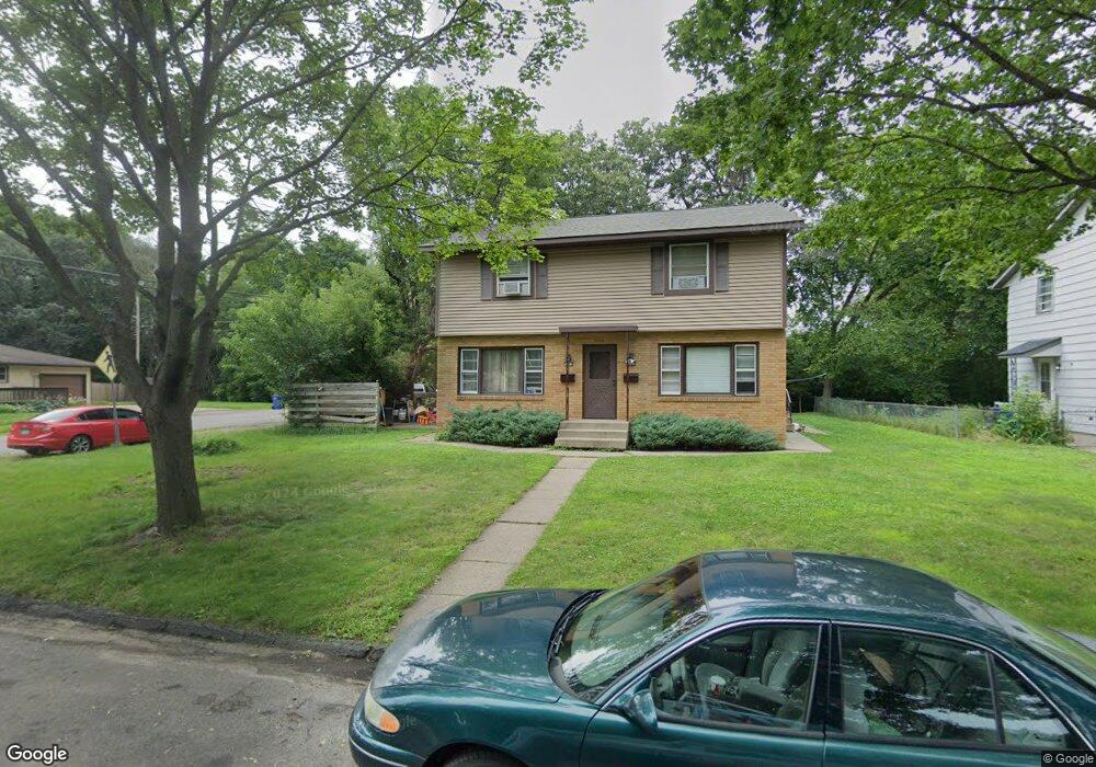
1623 Mcafee St Saint Paul, MN 55106
Estimated Value: $301,480 - $407,000
4
Beds
2
Baths
1,760
Sq Ft
$212/Sq Ft
Est. Value
About This Home
This home is located at 1623 Mcafee St, Saint Paul, MN 55106 and is currently estimated at $373,620, approximately $212 per square foot. 1623 Mcafee St is a home located in Ramsey County with nearby schools including Frost Lake Elementary School, Txuj Ci HMong Language and Culture Upper Campus, and Johnson Senior High School.
Ownership History
Date
Name
Owned For
Owner Type
Purchase Details
Closed on
Dec 21, 2015
Sold by
Ruza Daniel J and Ruza Suzanne
Bought by
Ruza Daniel J and Ruza Suzanne
Current Estimated Value
Home Financials for this Owner
Home Financials are based on the most recent Mortgage that was taken out on this home.
Original Mortgage
$160,200
Interest Rate
4.15%
Create a Home Valuation Report for This Property
The Home Valuation Report is an in-depth analysis detailing your home's value as well as a comparison with similar homes in the area
Home Values in the Area
Average Home Value in this Area
Purchase History
| Date | Buyer | Sale Price | Title Company |
|---|---|---|---|
| Ruza Daniel J | -- | First American Title Insuran |
Source: Public Records
Mortgage History
| Date | Status | Borrower | Loan Amount |
|---|---|---|---|
| Previous Owner | Ruza Daniel J | $160,200 |
Source: Public Records
Tax History Compared to Growth
Tax History
| Year | Tax Paid | Tax Assessment Tax Assessment Total Assessment is a certain percentage of the fair market value that is determined by local assessors to be the total taxable value of land and additions on the property. | Land | Improvement |
|---|---|---|---|---|
| 2025 | $5,844 | $310,800 | $30,000 | $280,800 |
| 2023 | $5,844 | $286,700 | $25,000 | $261,700 |
| 2022 | $5,020 | $285,200 | $25,000 | $260,200 |
| 2021 | $4,644 | $230,200 | $25,000 | $205,200 |
| 2020 | $4,482 | $224,300 | $16,600 | $207,700 |
| 2019 | $4,286 | $200,100 | $16,600 | $183,500 |
| 2018 | $3,610 | $188,300 | $16,600 | $171,700 |
| 2017 | $3,562 | $163,700 | $16,600 | $147,100 |
| 2016 | $3,408 | $0 | $0 | $0 |
| 2015 | $3,508 | $143,000 | $16,600 | $126,400 |
| 2014 | $2,958 | $0 | $0 | $0 |
Source: Public Records
Map
Nearby Homes
- 1639 Clarence St
- 1567 Atlantic St
- 1672 Manton St
- 1730 Atlantic St
- 1751 Clarence St
- 1714 Duluth St
- 1435 Price Ave
- 1450 Arlington Ave E
- 1532 Larpenteur Ave E
- 1377 Clarence St
- 1357 Birmingham St
- 1870 Clarence St
- 1869 Birmingham St
- 1583 Nevada Ave E
- 1607 Hoyt Ave E
- 1854 Barclay St
- 1627 Christie Place
- 1637 Iowa Ave E
- 866 Clear Ave E
- 1844 E Shore Dr
- 1631 Mcafee St
- 1619 Mcafee St
- 1637 Mcafee St
- 1341 Idaho Ave E
- 1615 Mcafee St
- 1634 Mcafee St
- 1620 Mcafee St
- 1624 English St
- 1628 English St
- 1640 Mcafee St
- 1616 Mcafee St
- 1609 Mcafee St
- 1634 English St
- 1645 Mcafee St
- 1618 English St
- 1638 English St
- 1614 English St
- 1646 Mcafee St
- 1605 Mcafee St
- 1605 1605 McAfee-street-