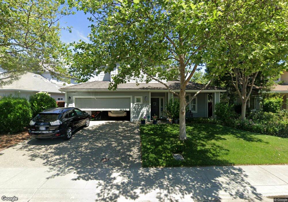
1627 Hampton Dr Davis, CA 95616
West Davis NeighborhoodEstimated Value: $832,000 - $1,059,000
4
Beds
3
Baths
2,431
Sq Ft
$389/Sq Ft
Est. Value
About This Home
This home is located at 1627 Hampton Dr, Davis, CA 95616 and is currently estimated at $945,522, approximately $388 per square foot. 1627 Hampton Dr is a home located in Yolo County with nearby schools including Robert E. Willett Elementary School, Ralph Waldo Emerson Junior High School, and Davis Senior High School.
Ownership History
Date
Name
Owned For
Owner Type
Purchase Details
Closed on
Nov 30, 2005
Sold by
Kesling W Dawson and Kesling Leslie C
Bought by
Kesling William Dawson and Kesling Leslie Christine
Current Estimated Value
Purchase Details
Closed on
Jan 25, 2000
Sold by
Roe Eric
Bought by
Kesling W Dawson and Kesling Leslie C
Home Financials for this Owner
Home Financials are based on the most recent Mortgage that was taken out on this home.
Original Mortgage
$160,000
Interest Rate
7.96%
Create a Home Valuation Report for This Property
The Home Valuation Report is an in-depth analysis detailing your home's value as well as a comparison with similar homes in the area
Home Values in the Area
Average Home Value in this Area
Purchase History
| Date | Buyer | Sale Price | Title Company |
|---|---|---|---|
| Kesling William Dawson | -- | None Available | |
| Kesling W Dawson | $320,000 | Placer Title Company |
Source: Public Records
Mortgage History
| Date | Status | Borrower | Loan Amount |
|---|---|---|---|
| Previous Owner | Kesling W Dawson | $160,000 |
Source: Public Records
Tax History
| Year | Tax Paid | Tax Assessment Tax Assessment Total Assessment is a certain percentage of the fair market value that is determined by local assessors to be the total taxable value of land and additions on the property. | Land | Improvement |
|---|---|---|---|---|
| 2025 | $7,483 | $493,856 | $145,999 | $347,857 |
| 2023 | $7,483 | $474,681 | $140,331 | $334,350 |
| 2022 | $7,196 | $465,375 | $137,580 | $327,795 |
| 2021 | $7,041 | $456,251 | $134,883 | $321,368 |
| 2020 | $6,930 | $451,573 | $133,500 | $318,073 |
| 2019 | $6,626 | $442,720 | $130,883 | $311,837 |
| 2018 | $6,232 | $434,040 | $128,317 | $305,723 |
| 2017 | $6,100 | $423,765 | $125,801 | $297,964 |
| 2016 | $5,929 | $415,457 | $123,335 | $292,122 |
| 2015 | $5,754 | $409,218 | $121,483 | $287,735 |
| 2014 | $5,754 | $401,203 | $119,104 | $282,099 |
Source: Public Records
Map
Nearby Homes
- 1211 Arthur St
- 1418 Yukon St
- 1837 Tahoe Place
- 1427 Brown Dr
- 1013 Plum Ln
- 1018 Plum Ln
- 1651 Joshua Tree St
- 638 Arthur St Unit 640
- 1114 Purdue Dr
- 1560 Drake Dr
- 2144 Calaveras Ave
- 1577 Drake Dr
- 2216 Bryce Ln
- 36100 Russell Blvd
- 2406 Overhill Ln
- 3360 Houser Ct
- 3368 Houser Ct
- 3303 Houser Ct
- 1932 Chasen Ln
- 710 Villanova Dr
- 1621 Hampton Dr
- 1633 Hampton Dr
- 1626 van Damme Dr
- 1620 van Damme Dr
- 1615 Hampton Dr
- 1705 Hampton Dr
- 1614 van Damme Dr
- 1700 van Damme Dr
- 1609 Hampton Dr
- 1711 Hampton Dr
- 1608 van Damme Dr
- 1706 van Damme Dr
- 1603 Hampton Dr
- 1717 Hampton Dr
- 1220 Arthur St
- 1682 Colusa Ave
- 1602 van Damme Dr
- 1617 van Damme Dr
- 1678 Colusa Ave
- 1623 van Damme Dr
Your Personal Tour Guide
Ask me questions while you tour the home.