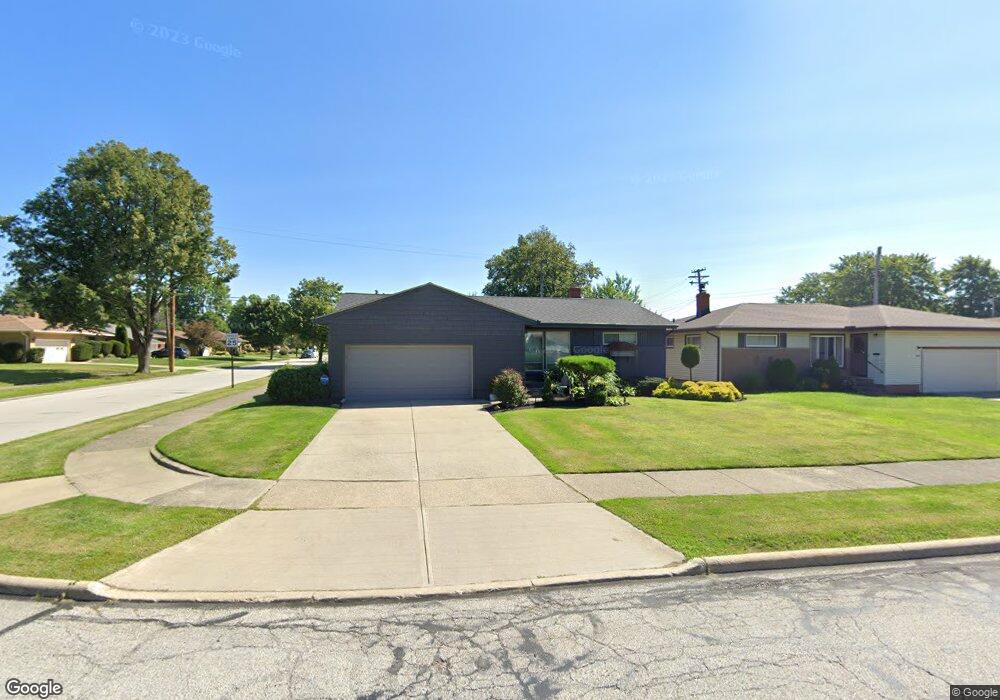
1629 Mallard Dr Cleveland, OH 44124
Estimated Value: $232,156 - $260,000
3
Beds
2
Baths
1,233
Sq Ft
$196/Sq Ft
Est. Value
About This Home
This home is located at 1629 Mallard Dr, Cleveland, OH 44124 and is currently estimated at $241,789, approximately $196 per square foot. 1629 Mallard Dr is a home located in Cuyahoga County with nearby schools including Mayfield High School, Corpus Christi Academy, and Hawken Lower-Middle School.
Ownership History
Date
Name
Owned For
Owner Type
Purchase Details
Closed on
Feb 8, 2013
Sold by
Amato Joan A
Bought by
Amato Joan A and Cantelberry Candace
Current Estimated Value
Purchase Details
Closed on
Sep 19, 2001
Sold by
Busch Celia T
Bought by
Amato Joseph A and Amato Joan A
Home Financials for this Owner
Home Financials are based on the most recent Mortgage that was taken out on this home.
Original Mortgage
$84,000
Interest Rate
7.5%
Purchase Details
Closed on
Sep 18, 1989
Sold by
Busch Betty
Bought by
Busch Sidney
Purchase Details
Closed on
Jan 27, 1981
Sold by
Heskin Esther
Bought by
Busch Betty
Purchase Details
Closed on
Jul 3, 1978
Sold by
Heskin Nathan
Bought by
Heskin Esther
Purchase Details
Closed on
Jan 1, 1975
Bought by
Heskin Nathan
Create a Home Valuation Report for This Property
The Home Valuation Report is an in-depth analysis detailing your home's value as well as a comparison with similar homes in the area
Home Values in the Area
Average Home Value in this Area
Purchase History
| Date | Buyer | Sale Price | Title Company |
|---|---|---|---|
| Amato Joan A | -- | Attorney | |
| Amato Joseph A | $120,000 | Chicago Title Insurance Comp | |
| Busch Sidney | -- | -- | |
| Busch Betty | -- | -- | |
| Heskin Esther | -- | -- | |
| Heskin Nathan | -- | -- |
Source: Public Records
Mortgage History
| Date | Status | Borrower | Loan Amount |
|---|---|---|---|
| Previous Owner | Amato Joseph A | $84,000 |
Source: Public Records
Tax History Compared to Growth
Tax History
| Year | Tax Paid | Tax Assessment Tax Assessment Total Assessment is a certain percentage of the fair market value that is determined by local assessors to be the total taxable value of land and additions on the property. | Land | Improvement |
|---|---|---|---|---|
| 2024 | $4,943 | $75,810 | $15,015 | $60,795 |
| 2023 | $4,125 | $56,740 | $13,650 | $43,090 |
| 2022 | $4,239 | $56,735 | $13,650 | $43,085 |
| 2021 | $4,198 | $56,740 | $13,650 | $43,090 |
| 2020 | $3,915 | $48,480 | $11,660 | $36,820 |
| 2019 | $3,796 | $138,500 | $33,300 | $105,200 |
| 2018 | $3,775 | $48,480 | $11,660 | $36,820 |
| 2017 | $3,877 | $46,630 | $9,700 | $36,930 |
| 2016 | $3,848 | $46,630 | $9,700 | $36,930 |
| 2015 | $3,496 | $46,630 | $9,700 | $36,930 |
| 2014 | $3,496 | $45,710 | $9,520 | $36,190 |
Source: Public Records
Map
Nearby Homes
- 5931 Mayberry Ave
- 1574 Hawthorne Dr
- 1590 Longwood Dr
- 1722 Hawthorne Dr
- 1737 Mayfair Blvd
- 1763 Temple Ave
- 1575 Lander Rd
- 5688 Shawnee Dr
- 1430 Belrose Rd
- 1572 Crestwood Rd
- 1363 Ranchland Dr
- 5960 Cantwell Dr
- 1839 Caronia Dr
- 1775 Brainard Rd
- 5831 Alberta Dr
- 1391 Iroquois Ave
- 1379 Lander Rd
- 1856 Bremerton Rd
- 6132 Westerham Rd
- 1337 Elmwood Rd
- 1633 Mallard Dr
- 5910 Mayflower Ave
- 1621 Mallard Dr
- 5883 Marnell Ave
- 5875 Marnell Ave
- 5913 Mayflower Ave
- 1628 Mallard Dr
- 1617 Mallard Dr
- 5891 Marnell Ave
- 1632 Mallard Dr
- 1624 Mallard Dr
- 5859 Marnell Ave
- 5899 Marnell Ave
- 5917 Mayflower Ave
- 1620 Mallard Dr
- 1613 Mallard Dr
- 5851 Marnell Ave
- 5905 Marnell Ave
- 1616 Mallard Dr
- 5921 Mayflower Ave