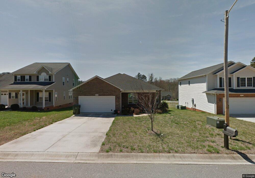
1629 Mayfair Dr Conover, NC 28613
Estimated Value: $309,000 - $342,000
3
Beds
2
Baths
1,692
Sq Ft
$191/Sq Ft
Est. Value
About This Home
This home is located at 1629 Mayfair Dr, Conover, NC 28613 and is currently estimated at $323,290, approximately $191 per square foot. 1629 Mayfair Dr is a home located in Catawba County with nearby schools including Claremont Elementary School, River Bend Middle School, and Bunker Hill High School.
Ownership History
Date
Name
Owned For
Owner Type
Purchase Details
Closed on
Oct 1, 2010
Sold by
Edmonds Michael S and Edmonds Smita P
Bought by
Macnaughton Rhonda M
Current Estimated Value
Purchase Details
Closed on
Feb 21, 2007
Sold by
Shook Builder Supply Co and Allison Dent F
Bought by
J & J Properties Of Hickory Inc
Home Financials for this Owner
Home Financials are based on the most recent Mortgage that was taken out on this home.
Original Mortgage
$120,000
Interest Rate
6.16%
Mortgage Type
Seller Take Back
Create a Home Valuation Report for This Property
The Home Valuation Report is an in-depth analysis detailing your home's value as well as a comparison with similar homes in the area
Home Values in the Area
Average Home Value in this Area
Purchase History
| Date | Buyer | Sale Price | Title Company |
|---|---|---|---|
| Macnaughton Rhonda M | $148,000 | None Available | |
| J & J Properties Of Hickory Inc | $16,000 | None Available |
Source: Public Records
Mortgage History
| Date | Status | Borrower | Loan Amount |
|---|---|---|---|
| Previous Owner | J & J Properties Of Hickory Inc | $120,000 |
Source: Public Records
Tax History
| Year | Tax Paid | Tax Assessment Tax Assessment Total Assessment is a certain percentage of the fair market value that is determined by local assessors to be the total taxable value of land and additions on the property. | Land | Improvement |
|---|---|---|---|---|
| 2025 | $2,347 | $276,600 | $15,100 | $261,500 |
| 2024 | $2,347 | $276,600 | $15,100 | $261,500 |
| 2023 | $2,347 | $276,600 | $15,100 | $261,500 |
| 2022 | $1,960 | $175,800 | $15,100 | $160,700 |
| 2021 | $1,960 | $175,800 | $15,100 | $160,700 |
| 2020 | $1,960 | $175,800 | $15,100 | $160,700 |
| 2019 | $1,960 | $175,800 | $0 | $0 |
| 2018 | $1,730 | $155,200 | $15,100 | $140,100 |
| 2017 | $1,730 | $0 | $0 | $0 |
| 2016 | $1,730 | $0 | $0 | $0 |
| 2015 | $1,617 | $155,170 | $15,100 | $140,070 |
| 2014 | $1,617 | $160,100 | $16,200 | $143,900 |
Source: Public Records
Map
Nearby Homes
- 1636 Mayfair Dr
- 0000 Burris Rd
- 1687 Golden Cedar Ln
- 2109 Kyle Ct SE
- 805 Mount Olive Church Rd
- 7.03 acres 5 W Hwy 10 Hwy
- 2474 Cedar Valley Dr
- 736 E 11th St
- 1128 McRee Heights Cir
- 2081 N Whisnant Ave
- 907 Goforth Rd
- 1071 Caleb Setzer Rd
- 1818 N Rankin Ave
- 1820 N Hewitt Ave
- 2347 Plainfield Dr
- 1708 Emmanuel Church Rd
- 1611 Emmaus Walk
- 827 E 9th St
- 1522 Cannan Mountain Dr
- 1118 St Michaels Dr SE
- 1635 Mayfair Dr
- 1623 Mayfair Dr
- 1617 Mayfair Dr
- 1643 Mayfair Dr
- 1491 Mayfair Dr
- 1497 Mayfair Dr Unit 64
- 1497 Mayfair Dr
- 1503 Mayfair Dr
- 1503 Mayfair Dr Unit 63
- 1479 Mayfair Dr Unit 66
- 1479 Mayfair Dr
- 1630 Mayfair Dr
- 1644 Mayfair Dr Unit 8
- 1644 Mayfair Dr
- 1467 Mayfair Dr Unit 45
- 1467 Mayfair Dr
- 1509 Mayfair Dr
- 1622 Mayfair Dr
- 1650 Mayfair Dr
- 1605 Mayfair Dr
Your Personal Tour Guide
Ask me questions while you tour the home.