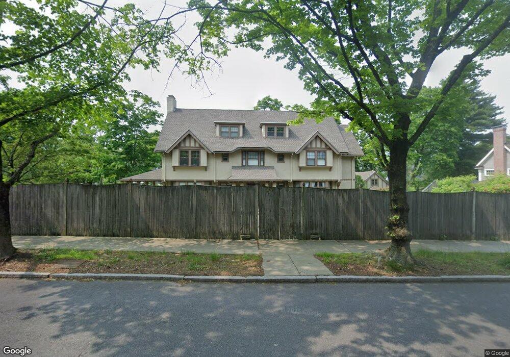
163 Dean Rd Brookline, MA 02445
Cleveland Circle NeighborhoodEstimated Value: $3,503,000 - $3,879,000
8
Beds
5
Baths
5,027
Sq Ft
$735/Sq Ft
Est. Value
About This Home
This home is located at 163 Dean Rd, Brookline, MA 02445 and is currently estimated at $3,692,978, approximately $734 per square foot. 163 Dean Rd is a home located in Norfolk County with nearby schools including John D. Runkle School, Torah Academy, and Brimmer & May School.
Ownership History
Date
Name
Owned For
Owner Type
Purchase Details
Closed on
May 17, 2013
Sold by
Zocchi Mary E
Bought by
Tucker Rt and Zocchi
Current Estimated Value
Purchase Details
Closed on
May 9, 1985
Bought by
Zocchi Mary E
Create a Home Valuation Report for This Property
The Home Valuation Report is an in-depth analysis detailing your home's value as well as a comparison with similar homes in the area
Home Values in the Area
Average Home Value in this Area
Purchase History
| Date | Buyer | Sale Price | Title Company |
|---|---|---|---|
| Tucker Rt | -- | -- | |
| Zocchi Mary E | -- | -- |
Source: Public Records
Tax History Compared to Growth
Tax History
| Year | Tax Paid | Tax Assessment Tax Assessment Total Assessment is a certain percentage of the fair market value that is determined by local assessors to be the total taxable value of land and additions on the property. | Land | Improvement |
|---|---|---|---|---|
| 2025 | $34,459 | $3,491,300 | $2,064,700 | $1,426,600 |
| 2024 | $32,833 | $3,360,600 | $1,985,200 | $1,375,400 |
| 2023 | $28,619 | $2,870,500 | $1,418,400 | $1,452,100 |
| 2022 | $31,130 | $3,055,000 | $1,672,100 | $1,382,900 |
| 2021 | $28,788 | $2,937,500 | $1,607,800 | $1,329,700 |
| 2020 | $26,213 | $2,773,900 | $1,461,600 | $1,312,300 |
| 2019 | $24,754 | $2,641,800 | $1,392,000 | $1,249,800 |
| 2018 | $25,205 | $2,664,400 | $1,434,200 | $1,230,200 |
| 2017 | $24,834 | $2,513,600 | $1,353,000 | $1,160,600 |
| 2016 | $24,479 | $2,349,200 | $1,264,500 | $1,084,700 |
| 2015 | $23,448 | $2,195,500 | $1,181,800 | $1,013,700 |
| 2014 | $23,067 | $2,025,200 | $1,074,400 | $950,800 |
Source: Public Records
Map
Nearby Homes
- 9 Willard Rd
- 8 Strathmore Rd Unit G
- 17 Strathmore Rd Unit 2
- 540 Chestnut Hill Ave
- 1880 Beacon St Unit 6
- 1856 Beacon St Unit 2C
- 3 Englewood Ave Unit 9
- 44 Orkney Rd Unit 3
- 19-21 Orkney Rd
- 31 Orkney Rd Unit 54
- 41 Orkney Rd
- 6 Sutherland Rd Unit 41
- 2400 Beacon St Unit 112
- 47 Englewood Ave
- 37 Englewood Ave Unit 3
- 30 Ackers Ave
- 333 Clark Rd
- 65 Strathmore Rd Unit 49
- 1763 Beacon St Unit A
- 1778 Beacon St Unit 302
- 19 Willard Rd
- 244 Fisher Ave
- 234 Fisher Ave
- 153 Dean Rd
- 2 Willard Rd
- 18 Willard Rd
- 177 Dean Rd
- 25 Willard Rd
- 260 Fisher Ave
- 185 Dean Rd
- 164 Dean Rd
- 156 Dean Rd
- 172 Dean Rd
- 474 Chestnut Hill Ave
- 474 Chestnut Hill Ave Unit 2N
- 474 Chestnut Hill Ave Unit 3
- 266 Fisher Ave
- 184 Dean Rd
- 462 Chestnut Hill Ave
- 462 Chestnut Hill Ave Unit 2