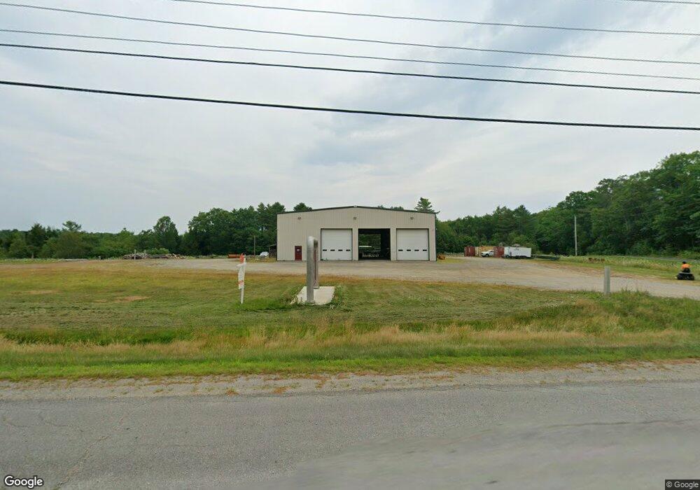
163 Main Rd N Frankfort, ME 04438
Estimated Value: $335,000 - $982,022
--
Bed
--
Bath
6,400
Sq Ft
$120/Sq Ft
Est. Value
About This Home
This home is located at 163 Main Rd N, Frankfort, ME 04438 and is currently estimated at $766,506, approximately $119 per square foot. 163 Main Rd N is a home located in Waldo County.
Ownership History
Date
Name
Owned For
Owner Type
Purchase Details
Closed on
Aug 28, 2023
Sold by
Tripp Wayne
Bought by
Johnson Matthew A and Johnson Bobbi L
Current Estimated Value
Home Financials for this Owner
Home Financials are based on the most recent Mortgage that was taken out on this home.
Original Mortgage
$500,000
Outstanding Balance
$488,444
Interest Rate
6.96%
Mortgage Type
Purchase Money Mortgage
Estimated Equity
$278,062
Purchase Details
Closed on
May 2, 2014
Sold by
1A Truck N Auto Repair
Bought by
Tripp Wayne
Home Financials for this Owner
Home Financials are based on the most recent Mortgage that was taken out on this home.
Original Mortgage
$283,500
Interest Rate
4.32%
Mortgage Type
New Conventional
Create a Home Valuation Report for This Property
The Home Valuation Report is an in-depth analysis detailing your home's value as well as a comparison with similar homes in the area
Home Values in the Area
Average Home Value in this Area
Purchase History
| Date | Buyer | Sale Price | Title Company |
|---|---|---|---|
| Johnson Matthew A | $850,000 | None Available | |
| Tripp Wayne | -- | -- | |
| Tripp Wayne | -- | -- |
Source: Public Records
Mortgage History
| Date | Status | Borrower | Loan Amount |
|---|---|---|---|
| Open | Johnson Matthew A | $500,000 | |
| Previous Owner | Tripp Wayne | $283,500 |
Source: Public Records
Tax History Compared to Growth
Tax History
| Year | Tax Paid | Tax Assessment Tax Assessment Total Assessment is a certain percentage of the fair market value that is determined by local assessors to be the total taxable value of land and additions on the property. | Land | Improvement |
|---|---|---|---|---|
| 2024 | $3,315 | $247,377 | $35,688 | $211,689 |
| 2023 | $3,030 | $247,377 | $35,688 | $211,689 |
| 2022 | $2,820 | $197,901 | $28,550 | $169,351 |
| 2021 | $2,741 | $197,901 | $28,550 | $169,351 |
| 2020 | $2,909 | $197,901 | $28,550 | $169,351 |
| 2019 | $2,974 | $197,901 | $28,550 | $169,351 |
| 2018 | $2,747 | $197,901 | $28,550 | $169,351 |
| 2017 | $2,524 | $189,060 | $28,550 | $160,510 |
| 2016 | $2,467 | $189,060 | $28,550 | $160,510 |
| 2015 | $2,600 | $189,060 | $28,550 | $160,510 |
| 2013 | $2,562 | $189,060 | $28,550 | $160,510 |
Source: Public Records
Map
Nearby Homes
- 41 Mountainview Dr
- 175 Loggin Rd
- 52 Mechanic St
- 297 S Main St
- 4 Church St
- 19 Rob Clark St
- 177 Lebanon Rd
- 187 Lebanon Rd
- 31 Dean St
- 203 Stream Rd
- 33 Coles Corner Rd
- 307 Lebanon Rd
- 69 Laffin Rd
- 405 Town Farm Rd
- 1 Pineview Dr
- Lot 3 Hamm Rd
- 34 Blind Owl Ln
- 313 Town Farm Rd
- M1L431E-5 Sally MacK Rd
- M1L431E-4 Sally MacK Rd