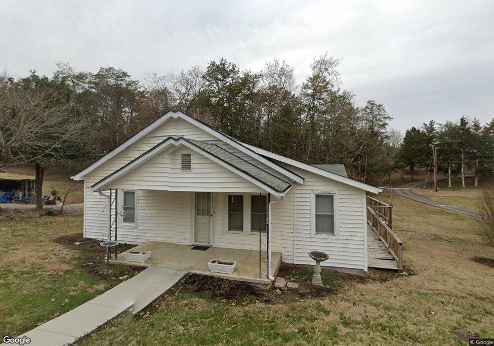
163 Walters St Luttrell, TN 37779
Estimated Value: $154,695 - $214,000
Studio
1
Bath
1,260
Sq Ft
$141/Sq Ft
Est. Value
About This Home
This home is located at 163 Walters St, Luttrell, TN 37779 and is currently estimated at $177,174, approximately $140 per square foot. 163 Walters St is a home located in Union County with nearby schools including Luttrell Elementary School, H Maynard Middle School, and Union County High School.
Ownership History
Date
Name
Owned For
Owner Type
Purchase Details
Closed on
Jul 20, 1994
Current Estimated Value
Purchase Details
Closed on
Jun 21, 1971
Bought by
Martin Martin R and Martin Roxy
Purchase Details
Closed on
Sep 14, 1946
Create a Home Valuation Report for This Property
The Home Valuation Report is an in-depth analysis detailing your home's value as well as a comparison with similar homes in the area
Home Values in the Area
Average Home Value in this Area
Purchase History
We collect this data history from publicly available records. To have your information removed, we recommend requesting removal directly through your county’s website.
| Date | Buyer | Sale Price | Title Company |
|---|---|---|---|
| -- | $26,500 | -- | |
| -- | $26,500 | -- | |
| Martin Martin R | -- | -- | |
| Martin Martin R | -- | -- | |
| -- | -- | -- | |
| -- | -- | -- |
Source: Public Records
Tax History
| Year | Tax Paid | Tax Assessment Tax Assessment Total Assessment is a certain percentage of the fair market value that is determined by local assessors to be the total taxable value of land and additions on the property. | Land | Improvement |
|---|---|---|---|---|
| 2025 | $557 | $29,325 | $3,750 | $25,575 |
| 2024 | $557 | $29,325 | $3,750 | $25,575 |
| 2023 | $557 | $29,325 | $3,750 | $25,575 |
| 2022 | $466 | $29,325 | $3,750 | $25,575 |
| 2021 | $357 | $16,700 | $2,475 | $14,225 |
| 2020 | $357 | $16,700 | $2,475 | $14,225 |
| 2019 | $357 | $16,700 | $2,475 | $14,225 |
| 2018 | $357 | $16,700 | $2,475 | $14,225 |
| 2017 | $357 | $16,700 | $2,475 | $14,225 |
| 2016 | $325 | $14,975 | $2,800 | $12,175 |
| 2015 | $325 | $14,975 | $2,800 | $12,175 |
| 2014 | $268 | $14,983 | $0 | $0 |
Source: Public Records
Map
Nearby Homes
- 3002 Highway 61 E
- 0 Wolfenbarger Tract 1 Unit 1294792
- 394 Jim Town Rd
- 0 Tazewell Pike Unit 1312170
- 738 & 742 Archer Rd
- 1617 Bull Run Rd
- 204 Archer Rd
- 417 Wolfe Rd
- 110 Wenger Park Ln
- 259 Little Tater Valley Rd
- 232 Sallings Rd
- 560 Prospect Rd
- 8259 Corryton Luttrell Rd
- 700 Damewood Hollow Rd
- 110 3rd St
- 113 2nd St
- 540 Monday Rd
- 741 Clinch Valley Rd
- 122 2nd St
- 0 Long Acres Rd Unit 1319102
- 157 Walters St
- 170 Walters St
- 175 Walters St
- 149 Walters St
- 154 Walters St
- 3310 Highway 61 E
- 142 Walters St
- 167 Walters St
- 3244 Highway 61 E
- 171 Tazewell Pike
- 130 Walters St
- 3234 Highway 61 E
- 3234 Hwy 61e
- 3242 Highway 61 E
- 3303 Highway 61 E
- 122 Walters St
- 3241 Highway 61 E
- 3324 Highway 61 E
- 127 Walters St
- 3245 Highway 61 E
Your Personal Tour Guide
Ask me questions while you tour the home.