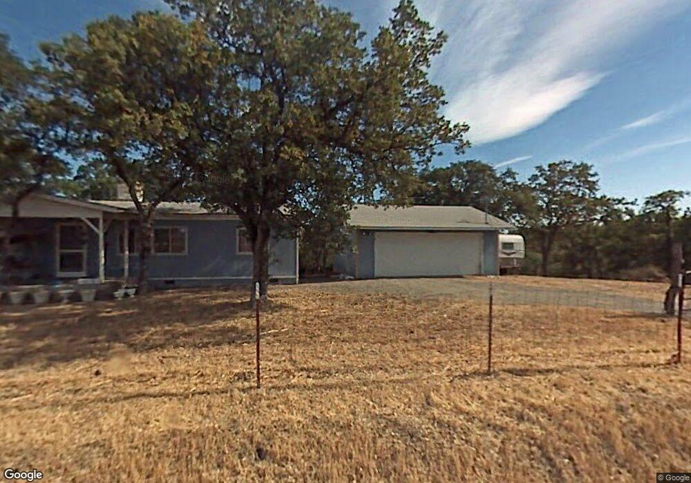
16343 Lariat Loop Corning, CA 96021
Estimated Value: $104,000 - $244,000
2
Beds
2
Baths
1,056
Sq Ft
$158/Sq Ft
Est. Value
About This Home
This home is located at 16343 Lariat Loop, Corning, CA 96021 and is currently estimated at $166,770, approximately $157 per square foot. 16343 Lariat Loop is a home located in Tehama County with nearby schools including Rancho Tehama Elementary School, Maywood Middle School, and Corning High School.
Ownership History
Date
Name
Owned For
Owner Type
Purchase Details
Closed on
Sep 25, 2002
Sold by
Federal National Mortgage Association
Bought by
Sullivan Richard A
Current Estimated Value
Home Financials for this Owner
Home Financials are based on the most recent Mortgage that was taken out on this home.
Original Mortgage
$76,317
Outstanding Balance
$31,738
Interest Rate
6.05%
Mortgage Type
FHA
Estimated Equity
$135,032
Purchase Details
Closed on
Jun 3, 2002
Sold by
Salazar Richard and Salazar Joan
Bought by
Federal National Mortgage Association
Create a Home Valuation Report for This Property
The Home Valuation Report is an in-depth analysis detailing your home's value as well as a comparison with similar homes in the area
Purchase History
| Date | Buyer | Sale Price | Title Company |
|---|---|---|---|
| Sullivan Richard A | $77,000 | Fidelity National Title | |
| Federal National Mortgage Association | $49,953 | Northern California Title Co |
Source: Public Records
Mortgage History
| Date | Status | Borrower | Loan Amount |
|---|---|---|---|
| Open | Sullivan Richard A | $76,317 |
Source: Public Records
Tax History
| Year | Tax Paid | Tax Assessment Tax Assessment Total Assessment is a certain percentage of the fair market value that is determined by local assessors to be the total taxable value of land and additions on the property. | Land | Improvement |
|---|---|---|---|---|
| 2025 | $938 | $87,095 | $25,806 | $61,289 |
| 2023 | $938 | $87,095 | $25,806 | $61,289 |
| 2022 | $942 | $87,095 | $25,806 | $61,289 |
| 2021 | $842 | $79,177 | $23,460 | $55,717 |
| 2020 | $859 | $79,177 | $23,460 | $55,717 |
| 2019 | $841 | $79,177 | $23,460 | $55,717 |
| 2018 | $858 | $79,177 | $23,460 | $55,717 |
| 2017 | $868 | $79,177 | $23,460 | $55,717 |
| 2016 | $826 | $79,177 | $23,460 | $55,717 |
| 2015 | -- | $79,177 | $23,460 | $55,717 |
| 2014 | $727 | $68,850 | $20,400 | $48,450 |
Source: Public Records
Map
Nearby Homes
- 16368 Lariat Loop
- 6917 Earpe Ct
- 16438 Longhorn Ln
- 16298 Lariat Loop
- 16298 Lariat Loop Unit Lot 127
- 16318 Longhorn Ln
- 6962 Roundup Dr
- 16405 Hillcrest Dr
- 6915 Remunda Rd
- 6920 Remunda Rd
- 16495 Hillcrest Dr Unit Lot 1269
- 16495 Hillcrest Dr
- 16305 Hillcrest Dr
- 16295 Hillcrest Dr
- 16380 Hillcrest Dr
- 16380 Hillcrest Dr Unit Lot 1104
- 16370 Oakridge Rd
- 16015 Apache Trail Unit Lot 1141
- 16015 Apache Trail
- 16080 Oakridge Rd
- 6849 Sparrow Ct
- 16358 Lariat Loop
- 6838 Stallion Dr
- 1242 Silver Spur
- 16401 Longhorn Ln Unit 16361 Longhorn Lane
- 16401 Longhorn Ln Unit Lots 1169/1170
- 6816 Stirrup Ct
- 16368 Lariat Loop Unit Lot 1211
- 16368 Lariat Loop
- 6809 Silver Spur Dr
- 1166 Earpe Ct
- 16293 Lariat Loop
- 1223 Lariat Loop
- 1301 Lariat Loop
- 16388 Lariat Loop
- 16328 Lariat Loop
- 16403 Lariat Loop
- 16383 Lariat Loop
- 0 Lariat Loop Unit TC201140310
- 1355 Lariat Loop
Your Personal Tour Guide
Ask me questions while you tour the home.