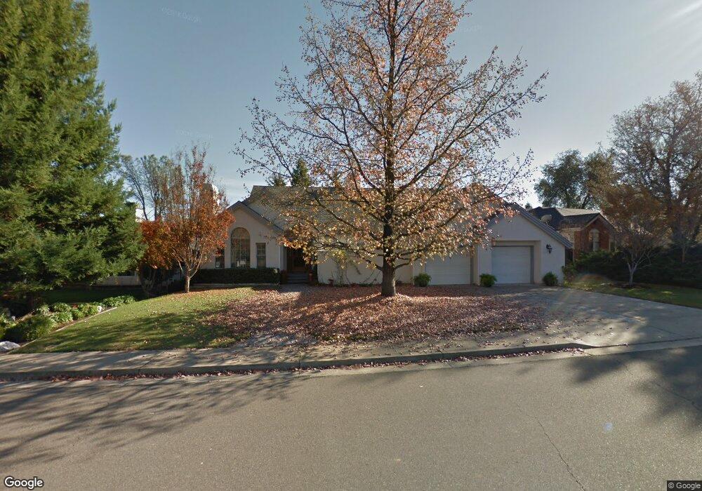
1639 Saint Andrews Dr Redding, CA 96003
Gold Hills NeighborhoodEstimated Value: $461,000 - $547,000
3
Beds
2
Baths
2,341
Sq Ft
$210/Sq Ft
Est. Value
About This Home
This home is located at 1639 Saint Andrews Dr, Redding, CA 96003 and is currently estimated at $491,764, approximately $210 per square foot. 1639 Saint Andrews Dr is a home located in Shasta County with nearby schools including Columbia Elementary School, Mountain View Middle School, and Foothill High School.
Ownership History
Date
Name
Owned For
Owner Type
Purchase Details
Closed on
Jun 7, 2011
Sold by
Federal National Mortgage Association
Bought by
Malmsten Catharine
Current Estimated Value
Home Financials for this Owner
Home Financials are based on the most recent Mortgage that was taken out on this home.
Original Mortgage
$225,000
Outstanding Balance
$155,692
Interest Rate
4.71%
Mortgage Type
New Conventional
Estimated Equity
$336,072
Purchase Details
Closed on
Jun 17, 2010
Sold by
Sarnik Joyce A
Bought by
Federal National Mortgage Association
Purchase Details
Closed on
May 26, 2005
Sold by
Sarnik Gene N
Bought by
Sarnik Joyce A
Home Financials for this Owner
Home Financials are based on the most recent Mortgage that was taken out on this home.
Original Mortgage
$42,900
Interest Rate
5.84%
Mortgage Type
Stand Alone Second
Purchase Details
Closed on
May 19, 2005
Sold by
Oconnor William G and Oconnor Julie E
Bought by
Sarnik Joyce A
Home Financials for this Owner
Home Financials are based on the most recent Mortgage that was taken out on this home.
Original Mortgage
$42,900
Interest Rate
5.84%
Mortgage Type
Stand Alone Second
Purchase Details
Closed on
Aug 26, 2002
Sold by
Oconnor William G and Oconnor Julie E
Bought by
Oconnor William G and Oconnor Julie E
Home Financials for this Owner
Home Financials are based on the most recent Mortgage that was taken out on this home.
Original Mortgage
$132,000
Interest Rate
6.43%
Mortgage Type
Purchase Money Mortgage
Purchase Details
Closed on
Aug 24, 2001
Sold by
Oconnor William G and Oconnor Julie E
Bought by
Oconnor William G and Oconnor Julie E
Purchase Details
Closed on
May 8, 2000
Sold by
Trust Ellisen Donald L & Eileen A Family and Ellisen Donald L
Bought by
Oconnor William G and Oconnor Julie E
Home Financials for this Owner
Home Financials are based on the most recent Mortgage that was taken out on this home.
Original Mortgage
$130,000
Interest Rate
8.22%
Mortgage Type
Purchase Money Mortgage
Create a Home Valuation Report for This Property
The Home Valuation Report is an in-depth analysis detailing your home's value as well as a comparison with similar homes in the area
Home Values in the Area
Average Home Value in this Area
Purchase History
| Date | Buyer | Sale Price | Title Company |
|---|---|---|---|
| Malmsten Catharine | $250,000 | Lawyers Title Company | |
| Federal National Mortgage Association | $363,215 | First American Title Ins Co | |
| Sarnik Joyce A | -- | Fidelity Natl Title Co Of Ca | |
| Sarnik Joyce A | $429,000 | Fidelity Natl Title Co Of Ca | |
| Oconnor William G | -- | Fidelity National Title Co | |
| Oconnor William G | -- | Fidelity National Title Co | |
| Oconnor William G | -- | -- | |
| Oconnor William G | $230,000 | Fidelity National Title Co |
Source: Public Records
Mortgage History
| Date | Status | Borrower | Loan Amount |
|---|---|---|---|
| Open | Malmsten Catharine | $225,000 | |
| Previous Owner | Sarnik Joyce A | $42,900 | |
| Previous Owner | Oconnor William G | $132,000 | |
| Previous Owner | Oconnor William G | $130,000 |
Source: Public Records
Tax History
| Year | Tax Paid | Tax Assessment Tax Assessment Total Assessment is a certain percentage of the fair market value that is determined by local assessors to be the total taxable value of land and additions on the property. | Land | Improvement |
|---|---|---|---|---|
| 2025 | $3,664 | $320,280 | $96,082 | $224,198 |
| 2024 | $3,674 | $314,001 | $94,199 | $219,802 |
| 2023 | $3,674 | $307,845 | $92,352 | $215,493 |
| 2022 | $3,538 | $301,810 | $90,542 | $211,268 |
| 2021 | $3,525 | $295,893 | $88,767 | $207,126 |
| 2020 | $3,500 | $292,860 | $87,857 | $205,003 |
| 2019 | $3,421 | $287,119 | $86,135 | $200,984 |
| 2018 | $3,436 | $281,491 | $84,447 | $197,044 |
| 2017 | $3,474 | $275,973 | $82,792 | $193,181 |
| 2016 | $3,261 | $270,563 | $81,169 | $189,394 |
| 2015 | $3,210 | $266,500 | $79,950 | $186,550 |
| 2014 | $3,123 | $261,280 | $78,384 | $182,896 |
Source: Public Records
Map
Nearby Homes
- 1672 Saint Andrews Dr
- 6173 Brassie Way
- 1779 Player Ct
- 6040 Constitution Way
- 5890 Shadow Glen Dr
- 5808 Constitution Way
- 1546 Gold Hills Dr
- 11632 Ridgewood Rd
- 5513 Diamond Ridge Dr
- 2132 Hope Ln
- 6014 Mid Drive Trail
- 19340 Carnegie Ct
- 19324 Hollow Ln
- 948 & 950 Hawley
- 12009 Theresa Ln
- 19011 Freda Ln
- 1102 Hope Ln
- 662 Ansley Ct
- 19219 Nike Ct
- 6298 Oasis Rd
- 1655 Saint Andrews Dr
- 1625 Saint Andrews Dr
- 6116 Brassie Way
- 1663 St Andrews Dr
- 1663 Saint Andrews Dr
- 6128 Brassie Way
- 1644 Saint Andrews Dr
- 1658 Saint Andrews Dr
- 1630 Saint Andrews Dr Unit 1
- 1630 Saint Andrews Dr
- 1616 St Andrews Dr
- 1616 Saint Andrews Dr
- 1677 St Andrews Dr
- 1677 Saint Andrews Dr
- 6140 Brassie Way
- 1681 Saint Andrews Dr
- 1538 Saint Andrews Dr
- #78 Saint Andrews Dr
- 0000 Saint Andrews Dr
- 0 Saint Andrews Dr
Your Personal Tour Guide
Ask me questions while you tour the home.