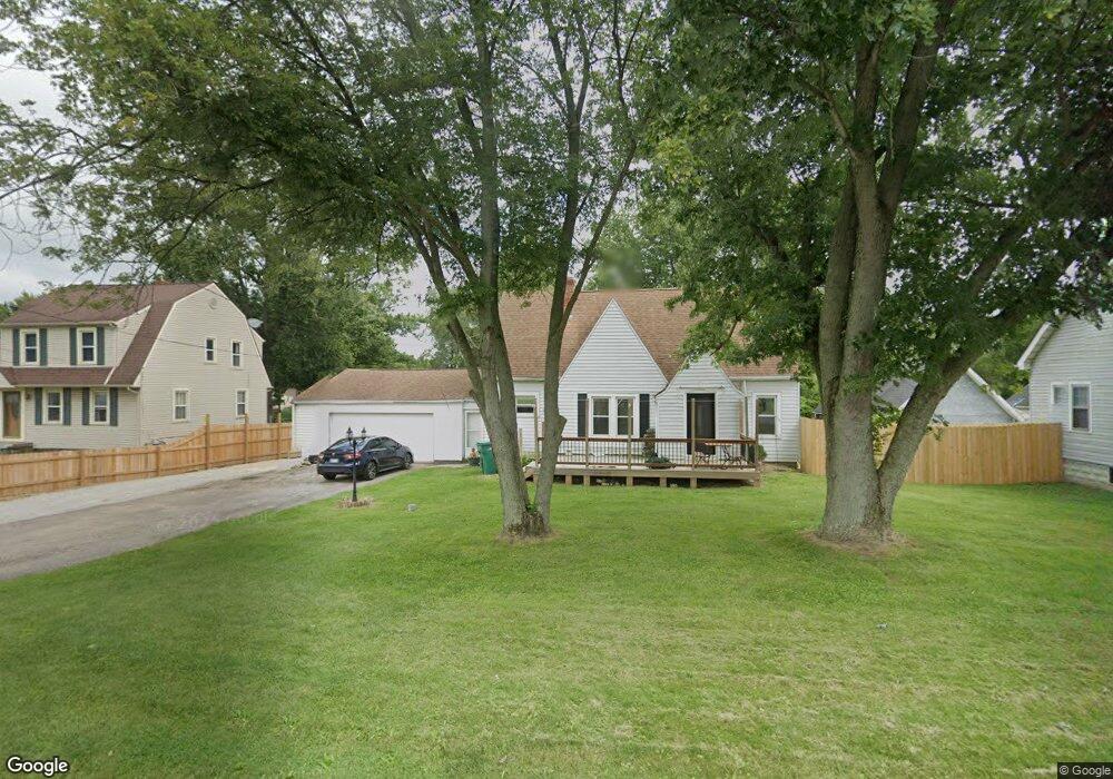
1640 S Burnett Rd Springfield, OH 45505
Estimated Value: $191,000 - $229,000
3
Beds
2
Baths
1,306
Sq Ft
$159/Sq Ft
Est. Value
About This Home
This home is located at 1640 S Burnett Rd, Springfield, OH 45505 and is currently estimated at $207,274, approximately $158 per square foot. 1640 S Burnett Rd is a home located in Clark County with nearby schools including Possum Elementary School, Shawnee Middle School/High School, and Springfield Preparatory & Fitness Academy.
Ownership History
Date
Name
Owned For
Owner Type
Purchase Details
Closed on
Mar 25, 2016
Sold by
Wagner Patrick D and Wagner Kathryn J
Bought by
Dornon Cody A
Current Estimated Value
Home Financials for this Owner
Home Financials are based on the most recent Mortgage that was taken out on this home.
Original Mortgage
$91,805
Outstanding Balance
$73,509
Interest Rate
4.25%
Mortgage Type
FHA
Estimated Equity
$133,765
Purchase Details
Closed on
Jul 11, 2001
Sold by
Messer Mark F and Messer Janet A
Bought by
Wagner Patrick D and Wagner Kathryn J
Home Financials for this Owner
Home Financials are based on the most recent Mortgage that was taken out on this home.
Original Mortgage
$91,100
Interest Rate
7.27%
Purchase Details
Closed on
Mar 18, 1994
Create a Home Valuation Report for This Property
The Home Valuation Report is an in-depth analysis detailing your home's value as well as a comparison with similar homes in the area
Home Values in the Area
Average Home Value in this Area
Purchase History
| Date | Buyer | Sale Price | Title Company |
|---|---|---|---|
| Dornon Cody A | $93,500 | Team Title & Closing Service | |
| Wagner Patrick D | $95,900 | -- | |
| -- | $68,000 | -- |
Source: Public Records
Mortgage History
| Date | Status | Borrower | Loan Amount |
|---|---|---|---|
| Open | Dornon Cody A | $91,805 | |
| Previous Owner | Wagner Patrick D | $91,100 |
Source: Public Records
Tax History
| Year | Tax Paid | Tax Assessment Tax Assessment Total Assessment is a certain percentage of the fair market value that is determined by local assessors to be the total taxable value of land and additions on the property. | Land | Improvement |
|---|---|---|---|---|
| 2025 | $2,398 | $61,460 | $17,090 | $44,370 |
| 2024 | $2,127 | $47,660 | $12,370 | $35,290 |
| 2023 | $2,127 | $43,510 | $12,370 | $31,140 |
| 2022 | $2,110 | $43,510 | $12,370 | $31,140 |
| 2021 | $1,831 | $33,810 | $9,590 | $24,220 |
| 2020 | $1,846 | $33,810 | $9,590 | $24,220 |
| 2019 | $1,876 | $33,810 | $9,590 | $24,220 |
| 2018 | $1,736 | $30,870 | $8,720 | $22,150 |
| 2017 | $1,781 | $30,867 | $8,719 | $22,148 |
| 2016 | $1,607 | $30,867 | $8,719 | $22,148 |
| 2015 | $1,619 | $30,087 | $8,719 | $21,368 |
| 2014 | $1,624 | $30,087 | $8,719 | $21,368 |
| 2013 | $1,411 | $30,087 | $8,719 | $21,368 |
Source: Public Records
Map
Nearby Homes
- 2560 Kenton St
- 2218 Tanager Rd
- 2108 Sunset Ave
- 2040 N Hadley Rd
- 2809 Morton Dr
- 1011 Mount Joy St
- 1724 S Belmont Ave
- 2670 Duncan St
- 2076-2078 Stowe Dr
- 2076 Stowe Dr
- 2210 Hackberry St
- 1806 N Sweetbriar Ln
- 2214 Hackberry St
- 2216 Hackberry St
- 2215 Hackberry St
- 2338 Dellwood Dr
- 1225 Beacon St
- 1714 Kenton St
- 1621 Victory Dr
- 2804 Lowman St
- 1630 S Burnett Rd
- 1648 S Burnett Rd
- 1706 S Burnett Rd
- 1610 S Burnett Rd
- 1610 S Burnett Rd
- 1708 S Burnett Rd
- 1629 S Burnett Rd
- 2621 Sunset Ave
- 2565 Sunset Ave
- 1713 S Burnett Rd
- 1641 S Burnett Rd
- 2623 Sunset Ave
- 1715 S Burnett Rd
- 1649 S Burnett Rd
- 2561 Sunset Ave
- 2561 Sunset Ave
- 2635 Sunset Ave
- 1724 S Burnett Rd
- 2639 Sunset Ave
- 1534 S Burnett Rd
Your Personal Tour Guide
Ask me questions while you tour the home.