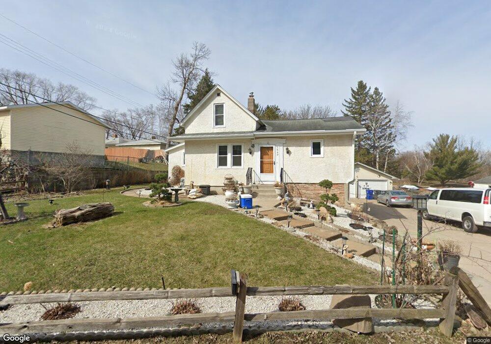
1649 Desoto St Saint Paul, MN 55130
Payne-Phalen NeighborhoodEstimated Value: $288,813 - $331,000
3
Beds
2
Baths
1,361
Sq Ft
$229/Sq Ft
Est. Value
About This Home
This home is located at 1649 Desoto St, Saint Paul, MN 55130 and is currently estimated at $311,203, approximately $228 per square foot. 1649 Desoto St is a home located in Ramsey County with nearby schools including Bruce F Vento Elementary School, Washington Technology Magnet School, and Creative Arts Secondary School.
Ownership History
Date
Name
Owned For
Owner Type
Purchase Details
Closed on
Dec 6, 2012
Sold by
Xenexai Licho
Bought by
Zenexai May Pa H
Current Estimated Value
Purchase Details
Closed on
Nov 30, 2012
Sold by
Vang Xia and Yang Kristen
Bought by
Yang Shong and Yang Zoua
Purchase Details
Closed on
Jul 30, 2010
Sold by
Federal National Mortgage Association
Bought by
Pogliano Christopher
Purchase Details
Closed on
Jan 11, 2005
Sold by
Lang Andrew T
Bought by
Lang Frank
Purchase Details
Closed on
Apr 30, 1998
Sold by
Seeger Constance V
Bought by
Lang Andrew T
Create a Home Valuation Report for This Property
The Home Valuation Report is an in-depth analysis detailing your home's value as well as a comparison with similar homes in the area
Home Values in the Area
Average Home Value in this Area
Purchase History
| Date | Buyer | Sale Price | Title Company |
|---|---|---|---|
| Zenexai May Pa H | $515 | None Available | |
| Yang Shong | $82,424 | Titlesmart Inc | |
| Pogliano Christopher | $70,125 | -- | |
| Lang Frank | $175,000 | -- | |
| Lang Andrew T | $104,900 | -- |
Source: Public Records
Tax History Compared to Growth
Tax History
| Year | Tax Paid | Tax Assessment Tax Assessment Total Assessment is a certain percentage of the fair market value that is determined by local assessors to be the total taxable value of land and additions on the property. | Land | Improvement |
|---|---|---|---|---|
| 2025 | $4,206 | $279,300 | $45,000 | $234,300 |
| 2023 | $4,206 | $279,100 | $37,500 | $241,600 |
| 2022 | $3,286 | $286,000 | $37,500 | $248,500 |
| 2021 | $3,112 | $215,900 | $37,500 | $178,400 |
| 2020 | $2,848 | $212,500 | $25,000 | $187,500 |
| 2019 | $2,662 | $185,000 | $25,000 | $160,000 |
| 2018 | $2,178 | $172,500 | $25,000 | $147,500 |
| 2017 | $2,076 | $150,000 | $25,000 | $125,000 |
| 2016 | $2,074 | $0 | $0 | $0 |
| 2015 | $1,748 | $144,900 | $25,000 | $119,900 |
| 2014 | $1,172 | $0 | $0 | $0 |
Source: Public Records
Map
Nearby Homes
- 1615 Payne Ave
- XXXX Larpenteur Ave E
- 1477 Arkwright St Unit A
- 1426 Burr St
- 721 California Ave E
- 1436 Payne Ave
- 1415 Payne Ave
- 692 Wheelock Pkwy E
- 740 Hoyt Ave E
- 1418 Payne Ave
- 762 Maple Hills Dr E Unit C
- 321 Summer Place E
- 662 Sherwood Ave
- 727 Maple Hills Dr Unit A
- 322 Cottage Ave E
- 739 Maple Hills Dr E Unit H
- 144 Larpenteur Ave E
- 760 Wheelock Pkwy E
- 727 Cottage Ave E
- 1984 Arkwright St
- 495 Idaho Ave E
- 489 Idaho Ave E
- 501 Idaho Ave E
- 477 Idaho Ave E
- 1652 Desoto St
- 461 Idaho Ave E
- 461 Idaho Ave E
- 515 Idaho Ave E
- 494 Idaho Ave E
- 488 Idaho Ave E
- 488 Larpenteur Ave E
- 500 Idaho Ave E
- 482 Idaho Ave E
- 516 California Ave E
- 1621 Wheelock Ridge Rd
- 506 Idaho Ave E
- 476 Idaho Ave E
- 480 Larpenteur Ave E Unit 123
- 480 Larpenteur Ave E Unit 121
- 488 Larpenteur Ave E Unit 109
