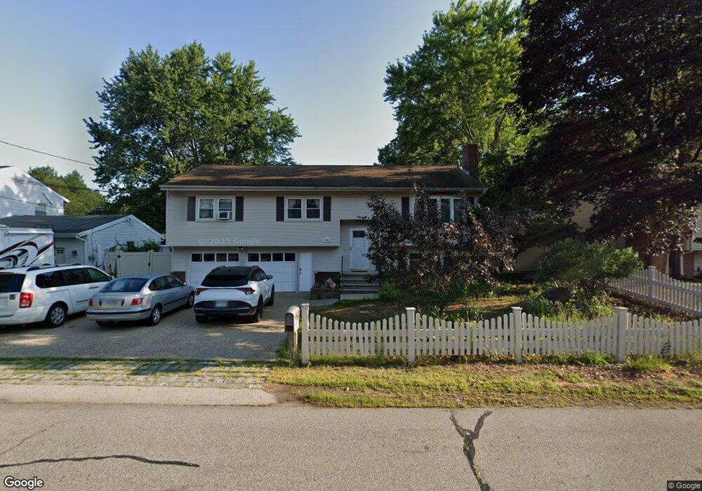
165 Cypress Ln Nashua, NH 03063
Northwest Nashua NeighborhoodEstimated Value: $627,000 - $743,000
3
Beds
4
Baths
2,930
Sq Ft
$235/Sq Ft
Est. Value
About This Home
This home is located at 165 Cypress Ln, Nashua, NH 03063 and is currently estimated at $689,078, approximately $235 per square foot. 165 Cypress Ln is a home located in Hillsborough County with nearby schools including Birch Hill Elementary School, Elm Street Middle School, and Nashua High School North.
Ownership History
Date
Name
Owned For
Owner Type
Purchase Details
Closed on
Jul 30, 2009
Sold by
Raitt One Ft and Raitt
Bought by
Daly Scott R and Daly Juan Yu
Current Estimated Value
Home Financials for this Owner
Home Financials are based on the most recent Mortgage that was taken out on this home.
Original Mortgage
$170,000
Outstanding Balance
$111,628
Interest Rate
5.43%
Mortgage Type
Purchase Money Mortgage
Estimated Equity
$577,450
Create a Home Valuation Report for This Property
The Home Valuation Report is an in-depth analysis detailing your home's value as well as a comparison with similar homes in the area
Home Values in the Area
Average Home Value in this Area
Purchase History
| Date | Buyer | Sale Price | Title Company |
|---|---|---|---|
| Daly Scott R | $340,000 | -- |
Source: Public Records
Mortgage History
| Date | Status | Borrower | Loan Amount |
|---|---|---|---|
| Open | Daly Scott R | $170,000 | |
| Previous Owner | Daly Scott R | $100,000 | |
| Previous Owner | Daly Scott R | $188,400 | |
| Previous Owner | Daly Scott R | $200,000 |
Source: Public Records
Tax History Compared to Growth
Tax History
| Year | Tax Paid | Tax Assessment Tax Assessment Total Assessment is a certain percentage of the fair market value that is determined by local assessors to be the total taxable value of land and additions on the property. | Land | Improvement |
|---|---|---|---|---|
| 2024 | $9,632 | $605,800 | $171,600 | $434,200 |
| 2023 | $9,188 | $504,000 | $137,300 | $366,700 |
| 2022 | $9,107 | $504,000 | $137,300 | $366,700 |
| 2021 | $8,508 | $366,400 | $96,100 | $270,300 |
| 2020 | $8,327 | $368,300 | $96,100 | $272,200 |
| 2019 | $8,014 | $368,300 | $96,100 | $272,200 |
| 2018 | $7,812 | $368,300 | $96,100 | $272,200 |
| 2017 | $8,402 | $325,800 | $79,300 | $246,500 |
| 2016 | $8,168 | $325,800 | $79,300 | $246,500 |
| 2015 | $7,960 | $324,500 | $79,300 | $245,200 |
| 2014 | $7,804 | $324,500 | $79,300 | $245,200 |
Source: Public Records
Map
Nearby Homes
- 19 Dunloggin Rd
- 7 Robert Dr
- 3 Wright Rd
- 239 Broad St
- 74 Profile Cir
- 22 Berkshire Rd
- 123 Cannongate III
- 5 Chatfield Dr Unit U18
- 4 Jared Cir Unit U21
- 33 Ferry Rd
- 11 Amherst Terrace
- 31 Ashland St
- 3 Paddington Place
- 0 Baldwin St
- 17 Danbury Rd
- 7 Bitirnas St Unit U7
- 424 Broad St
- 61 Manchester St
- 4 Reservoir St
- 31 Juliana Ave
- 163 Cypress Ln
- 167 Cypress Ln
- 169 Cypress Ln
- 29 Dunloggin Rd
- 27 Dunloggin Rd
- 161 Cypress Ln
- 31 Dunloggin Rd
- 162 Cypress Ln
- 164 Cypress Ln
- 60 Northwood Dr
- 25 Dunloggin Rd
- 171 Cypress Ln
- 39 Dunloggin Rd
- 35 Dunloggin Rd
- 18 Hinsdale Ave
- 28 Dunloggin Rd
- 58 Northwood Dr
- 23 Dunloggin Rd
- 30 Dunloggin Rd
- 26 Dunloggin Rd