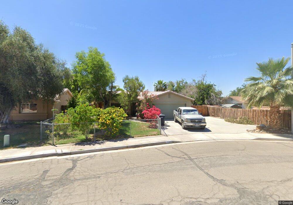
165 Eunice Cir Blythe, CA 92225
Estimated Value: $242,000 - $355,000
3
Beds
2
Baths
1,422
Sq Ft
$195/Sq Ft
Est. Value
About This Home
This home is located at 165 Eunice Cir, Blythe, CA 92225 and is currently estimated at $277,654, approximately $195 per square foot. 165 Eunice Cir is a home located in Riverside County with nearby schools including Palo Verde High School and Scale Leadership Academy - East.
Ownership History
Date
Name
Owned For
Owner Type
Purchase Details
Closed on
Sep 18, 2006
Sold by
Bedoya Joshua C and Bedoya Naomi Smith
Bought by
Clark Judith D
Current Estimated Value
Purchase Details
Closed on
Mar 10, 2004
Sold by
Poff Allan Odell and Poff Lucienne Marie
Bought by
Bedoya Joshua C and Smith Naomi
Home Financials for this Owner
Home Financials are based on the most recent Mortgage that was taken out on this home.
Original Mortgage
$115,600
Interest Rate
5.35%
Mortgage Type
Purchase Money Mortgage
Purchase Details
Closed on
Feb 2, 1993
Sold by
Siefker Development Co Inc
Bought by
Poff Allan Odell and Poff Lucienne Marie
Home Financials for this Owner
Home Financials are based on the most recent Mortgage that was taken out on this home.
Original Mortgage
$99,300
Interest Rate
8.3%
Create a Home Valuation Report for This Property
The Home Valuation Report is an in-depth analysis detailing your home's value as well as a comparison with similar homes in the area
Home Values in the Area
Average Home Value in this Area
Purchase History
| Date | Buyer | Sale Price | Title Company |
|---|---|---|---|
| Clark Judith D | $235,000 | New Century Title Company | |
| Bedoya Joshua C | $144,500 | Stewart Title Company | |
| Poff Allan Odell | $105,000 | First American Title Ins Co |
Source: Public Records
Mortgage History
| Date | Status | Borrower | Loan Amount |
|---|---|---|---|
| Previous Owner | Bedoya Joshua C | $115,600 | |
| Previous Owner | Poff Allan Odell | $99,300 |
Source: Public Records
Tax History
| Year | Tax Paid | Tax Assessment Tax Assessment Total Assessment is a certain percentage of the fair market value that is determined by local assessors to be the total taxable value of land and additions on the property. | Land | Improvement |
|---|---|---|---|---|
| 2025 | $3,426 | $314,824 | $78,699 | $236,125 |
| 2023 | $3,426 | $302,601 | $75,644 | $226,957 |
| 2022 | $3,108 | $280,380 | $69,357 | $211,023 |
| 2021 | $2,511 | $227,951 | $56,388 | $171,563 |
| 2020 | $2,242 | $203,528 | $50,346 | $153,182 |
| 2019 | $2,200 | $197,600 | $48,880 | $148,720 |
| 2018 | $2,021 | $190,000 | $47,000 | $143,000 |
| 2017 | $1,849 | $174,000 | $43,000 | $131,000 |
| 2016 | $1,685 | $157,000 | $39,000 | $118,000 |
| 2015 | $1,500 | $139,000 | $35,000 | $104,000 |
| 2014 | $1,367 | $129,000 | $32,000 | $97,000 |
Source: Public Records
Map
Nearby Homes
- 161 Eunice Cir
- 158 Eunice Cir
- 821 Cypress Ln
- 9481 N Broadway
- 251 W Juniper Trail
- 266 Shannon St
- 1007 N Broadway
- 560 Parker Place
- 570 Holley Ln
- 521 W Oregon St
- 518 N Eucalyptus Ave
- 0 W Lane c
- 1053 Catalina Dr
- 1159 N Broadway
- 9 Acres N 7th St
- 630 N 6th St
- 0 Blythe Unit 219122850DA
- 0 Blythe Unit 219122849DA
- 0 Blythe Unit PW26026036
- 0 SW 1 4 of Sec 25 Tp 6 S R 20 E Unit RS26038543
- 788 N Broadway
- 157 Eunice Cir
- 180 Eunice Cir
- 151 Eunice Cir
- 181 Eunice Cir
- 186 Eunice Cir
- 760 Oleander Ln
- 750 Oleander Ln
- 187 Eunice Cir
- 740 Oleander Ln
- 145 Eunice Cir
- 150 Eunice Cir
- 780 Oleander Ln
- 194 Eunice Cir
- 730 Oleander Ln
- 195 Eunice Cir
- 190 E Oasis St
- 804 N Broadway
- 790 Oleander Ln
- 720 Oleander Ln
Your Personal Tour Guide
Ask me questions while you tour the home.