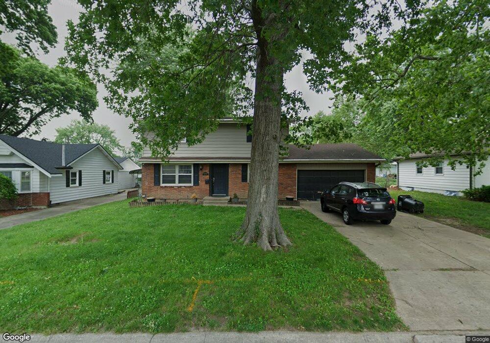
16516 E Ellison Way Independence, MO 64055
Glendale NeighborhoodEstimated Value: $234,000 - $267,000
4
Beds
2
Baths
1,458
Sq Ft
$172/Sq Ft
Est. Value
About This Home
This home is located at 16516 E Ellison Way, Independence, MO 64055 and is currently estimated at $250,573, approximately $171 per square foot. 16516 E Ellison Way is a home located in Jackson County with nearby schools including Glendale Elementary School, Bridger Middle School, and Pioneer Ridge Middle School.
Ownership History
Date
Name
Owned For
Owner Type
Purchase Details
Closed on
Jan 16, 2009
Sold by
Bank Of New York
Bought by
Brown Nicole
Current Estimated Value
Home Financials for this Owner
Home Financials are based on the most recent Mortgage that was taken out on this home.
Original Mortgage
$99,170
Outstanding Balance
$61,774
Interest Rate
4.91%
Mortgage Type
FHA
Estimated Equity
$188,799
Purchase Details
Closed on
Aug 22, 2008
Sold by
Stafford Lynette K
Bought by
Bank Of New York and Certificateholders Of Cwabs 2004-05
Purchase Details
Closed on
Mar 18, 1997
Sold by
Horn John B and Horn Charlotte M
Bought by
Stafford Lynette K
Home Financials for this Owner
Home Financials are based on the most recent Mortgage that was taken out on this home.
Original Mortgage
$84,407
Interest Rate
7.65%
Mortgage Type
FHA
Create a Home Valuation Report for This Property
The Home Valuation Report is an in-depth analysis detailing your home's value as well as a comparison with similar homes in the area
Home Values in the Area
Average Home Value in this Area
Purchase History
| Date | Buyer | Sale Price | Title Company |
|---|---|---|---|
| Brown Nicole | -- | First American Title Co | |
| Bank Of New York | $86,400 | None Available | |
| Stafford Lynette K | -- | Old Republic Title Company |
Source: Public Records
Mortgage History
| Date | Status | Borrower | Loan Amount |
|---|---|---|---|
| Open | Brown Nicole | $99,170 | |
| Previous Owner | Stafford Lynette K | $84,407 |
Source: Public Records
Tax History
| Year | Tax Paid | Tax Assessment Tax Assessment Total Assessment is a certain percentage of the fair market value that is determined by local assessors to be the total taxable value of land and additions on the property. | Land | Improvement |
|---|---|---|---|---|
| 2025 | $2,435 | $35,150 | $5,518 | $29,632 |
| 2024 | $3,143 | $35,150 | $5,442 | $29,708 |
| 2023 | $3,143 | $46,416 | $5,062 | $41,354 |
| 2022 | $2,147 | $29,070 | $4,227 | $24,843 |
| 2021 | $2,146 | $29,070 | $4,227 | $24,843 |
| 2020 | $1,927 | $25,354 | $4,227 | $21,127 |
| 2019 | $1,896 | $25,354 | $4,227 | $21,127 |
| 2018 | $1,728 | $22,065 | $3,678 | $18,387 |
| 2016 | $1,712 | $21,638 | $3,523 | $18,115 |
Source: Public Records
Map
Nearby Homes
- 16409 E 31st St S
- 16403 E Ellison Way
- 0 Multi Address N A Unit HMS2588688
- 16901 E 31st St S
- 16824 E 31st St S
- 3219 Vest St
- 2900 S M 291 Hwy
- 17201 E 32nd St S Unit 9
- 17201 E 32nd St S Unit 3
- 15917 E 29th Street Ct S
- 2816 Berry Ln
- 16100 E 34th Terrace S
- 3416 S Marshall Ct
- 3011 Cedar Crest Dr Unit B
- 15804 E 27th St S
- 2724 S Woodbury Dr
- 2800 S Woodbury Dr
- 2608 Baker Rd
- 2705 S Haden Ct
- 3416 S Maybrook Ave
- 16520 E Ellison Way
- 16519 E Cogan Rd
- 16511 E Cogan Rd
- 3008 Porter Rd
- 16508 E Ellison Way
- 16600 E Ellison Way
- 16525 E Cogan Rd
- 16505 E Cogan Rd
- 3009 Porter Rd
- 16531 E Cogan Rd
- 3013 Porter Rd
- 16504 E Ellison Way
- 16604 E Ellison Way
- 3012 Porter Rd
- 16501 E Cogan Rd
- 3009 Venus St
- 16607 E Cogan Rd
- 16607 E Cogan Rd
- 3008 S Erin Ln
- 3013 Venus St
Your Personal Tour Guide
Ask me questions while you tour the home.