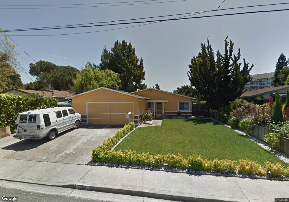
1652 Michael Dr Pinole, CA 94564
El Sobrante Manor NeighborhoodEstimated Value: $603,000 - $701,000
3
Beds
2
Baths
1,044
Sq Ft
$624/Sq Ft
Est. Value
About This Home
This home is located at 1652 Michael Dr, Pinole, CA 94564 and is currently estimated at $651,893, approximately $624 per square foot. 1652 Michael Dr is a home located in Contra Costa County with nearby schools including Stewart Elementary School, Pinole Middle School, and Pinole Valley High School.
Ownership History
Date
Name
Owned For
Owner Type
Purchase Details
Closed on
Feb 16, 2021
Sold by
Breckenridge Property Fund 2016 Llc
Bought by
Chung Yolando
Current Estimated Value
Home Financials for this Owner
Home Financials are based on the most recent Mortgage that was taken out on this home.
Original Mortgage
$445,000
Outstanding Balance
$394,908
Interest Rate
2.65%
Mortgage Type
Commercial
Estimated Equity
$256,985
Purchase Details
Closed on
Sep 25, 2020
Sold by
Leung Kam Yin
Bought by
Breckenridge Property Fund 2016 Llc
Purchase Details
Closed on
Sep 30, 2003
Sold by
Leung Kam Yin
Bought by
Leung Kam Yin
Home Financials for this Owner
Home Financials are based on the most recent Mortgage that was taken out on this home.
Original Mortgage
$83,000
Interest Rate
6.22%
Mortgage Type
Purchase Money Mortgage
Purchase Details
Closed on
Mar 20, 2000
Sold by
Leung Kam Yin Tre
Bought by
Leung Kam Yin
Create a Home Valuation Report for This Property
The Home Valuation Report is an in-depth analysis detailing your home's value as well as a comparison with similar homes in the area
Home Values in the Area
Average Home Value in this Area
Purchase History
| Date | Buyer | Sale Price | Title Company |
|---|---|---|---|
| Chung Yolando | $594,000 | Fidelity National Title | |
| Breckenridge Property Fund 2016 Llc | $415,000 | Synrgo Inc | |
| Leung Kam Yin | -- | Commonwealth Title | |
| Leung Kam Yin | -- | -- |
Source: Public Records
Mortgage History
| Date | Status | Borrower | Loan Amount |
|---|---|---|---|
| Open | Chung Yolando | $445,000 | |
| Previous Owner | Leung Kam Yin | $83,000 |
Source: Public Records
Tax History
| Year | Tax Paid | Tax Assessment Tax Assessment Total Assessment is a certain percentage of the fair market value that is determined by local assessors to be the total taxable value of land and additions on the property. | Land | Improvement |
|---|---|---|---|---|
| 2025 | $9,550 | $642,962 | $432,972 | $209,990 |
| 2024 | $9,282 | $630,356 | $424,483 | $205,873 |
| 2023 | $9,059 | $617,997 | $416,160 | $201,837 |
| 2022 | $8,978 | $605,880 | $408,000 | $197,880 |
| 2021 | $10,578 | $216,672 | $97,068 | $119,604 |
| 2019 | $3,760 | $210,247 | $94,190 | $116,057 |
| 2018 | $3,645 | $206,126 | $92,344 | $113,782 |
| 2017 | $3,565 | $202,085 | $90,534 | $111,551 |
| 2016 | $3,522 | $198,123 | $88,759 | $109,364 |
| 2015 | $3,511 | $195,148 | $87,426 | $107,722 |
| 2014 | $4,150 | $191,326 | $85,714 | $105,612 |
Source: Public Records
Map
Nearby Homes
- 1704 Dalessi Dr
- 1703 Dalessi Dr
- 1820 Dalessi Ln
- 213 N Rancho Place
- 209 N Rancho Place
- 2075 Costa Ct
- 923 Kelvin Rd
- 765 Bayview Ct
- 691 Rincon Rd
- 1566 Mann Dr
- 2842 Cornelius Dr
- 2312 Granada Ct
- 5026 Hilltop Dr
- 1313 Black Oak Ct
- 0 Sobrante Ave Unit 41123160
- 5406 Sobrante Ave
- 15 Aspen Ct
- 534 Rincon Rd
- 1590 Kildare Way
- 677 Renfrew Rd
- 1658 Michael Dr
- 1646 Michael Dr
- 1640 Michael Dr
- 1664 Michael Dr
- 1634 Michael Dr
- 1670 Michael Dr
- 2594 Rebecca Dr
- 1628 Michael Dr
- 1657 Michael Dr
- 1633 Michael Dr
- 2589 Rebecca Dr
- 1622 Michael Dr
- 1663 Michael Dr
- 1664 Sandra Ct
- 2599 Lynn Dr
- 2588 Rebecca Dr
- 1616 Michael Dr
- 1670 Sandra Ct
- 2595 Lynn Dr
- 2582 Rebecca Dr
Your Personal Tour Guide
Ask me questions while you tour the home.