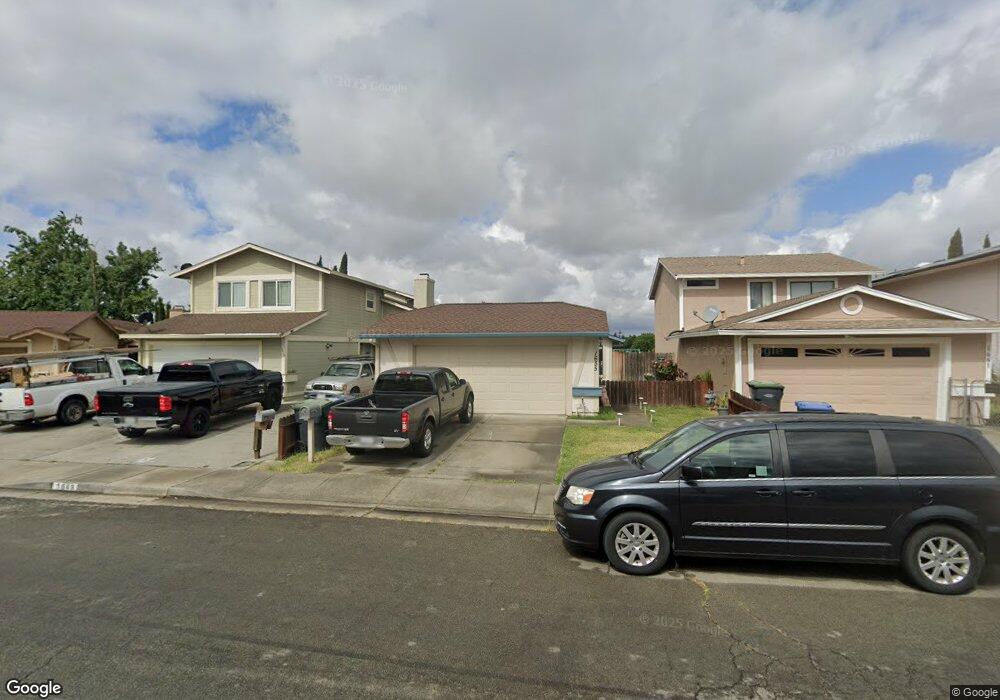
1655 Matthew Dr Fairfield, CA 94533
Estimated Value: $456,000 - $477,954
3
Beds
2
Baths
1,196
Sq Ft
$390/Sq Ft
Est. Value
About This Home
This home is located at 1655 Matthew Dr, Fairfield, CA 94533 and is currently estimated at $465,989, approximately $389 per square foot. 1655 Matthew Dr is a home located in Solano County with nearby schools including Cleo Gordon Elementary School, Grange Middle School, and Fairfield High School.
Ownership History
Date
Name
Owned For
Owner Type
Purchase Details
Closed on
Nov 20, 2012
Sold by
Harper Tamara and Harper Robert
Bought by
Harper Robert and Harper Tamara
Current Estimated Value
Home Financials for this Owner
Home Financials are based on the most recent Mortgage that was taken out on this home.
Original Mortgage
$217,745
Outstanding Balance
$149,465
Interest Rate
3.25%
Mortgage Type
FHA
Estimated Equity
$316,524
Purchase Details
Closed on
Mar 1, 2008
Sold by
Deutsche Bank National Trust
Bought by
Tom Tamara and Harper Robert
Home Financials for this Owner
Home Financials are based on the most recent Mortgage that was taken out on this home.
Original Mortgage
$220,386
Interest Rate
6.04%
Mortgage Type
FHA
Purchase Details
Closed on
Nov 27, 2007
Sold by
Johnson Leevester S
Bought by
Deutsche Bank National Trust Co
Create a Home Valuation Report for This Property
The Home Valuation Report is an in-depth analysis detailing your home's value as well as a comparison with similar homes in the area
Home Values in the Area
Average Home Value in this Area
Purchase History
| Date | Buyer | Sale Price | Title Company |
|---|---|---|---|
| Harper Robert | -- | None Available | |
| Tom Tamara | $223,500 | Lsi Title | |
| Deutsche Bank National Trust Co | $322,000 | None Available |
Source: Public Records
Mortgage History
| Date | Status | Borrower | Loan Amount |
|---|---|---|---|
| Open | Harper Robert | $217,745 | |
| Closed | Tom Tamara | $220,386 |
Source: Public Records
Tax History Compared to Growth
Tax History
| Year | Tax Paid | Tax Assessment Tax Assessment Total Assessment is a certain percentage of the fair market value that is determined by local assessors to be the total taxable value of land and additions on the property. | Land | Improvement |
|---|---|---|---|---|
| 2025 | $3,292 | $293,562 | $144,483 | $149,079 |
| 2024 | $3,292 | $287,806 | $141,650 | $146,156 |
| 2023 | $3,191 | $282,164 | $138,873 | $143,291 |
| 2022 | $3,152 | $276,632 | $136,150 | $140,482 |
| 2021 | $3,121 | $271,209 | $133,481 | $137,728 |
| 2020 | $3,048 | $268,429 | $132,113 | $136,316 |
| 2019 | $2,973 | $263,167 | $129,523 | $133,644 |
| 2018 | $3,069 | $258,008 | $126,984 | $131,024 |
| 2017 | $2,928 | $252,950 | $124,495 | $128,455 |
| 2016 | $2,903 | $247,991 | $122,054 | $125,937 |
| 2015 | $2,710 | $244,267 | $120,221 | $124,046 |
| 2014 | $2,480 | $221,000 | $106,000 | $115,000 |
Source: Public Records
Map
Nearby Homes
- 919 Brandon Way
- 987 Daniel St
- 1695 Blossom Ave
- 1185 Camellia Ln
- 1870 San Pedro Ct
- 1653 San Diego St
- 1125 Strawberry Ln
- 1113 Strawberry Ln
- 1100 Camellia Ln
- 1105 Strawberry Ln
- 141 Summertime Ln
- 145 Summertime Ln
- 1941 Grande Cir Unit 45
- 1048 E Tabor Ave
- 1960 Grande Cir Unit 41
- 1940 Grande Cir Unit 13
- 507 Kings Way Unit B
- 1970 Grande Cir Unit 20
- 518 Carolina St
- 1920 Grande Cir Unit 92
- 1649 Matthew Dr
- 1661 Matthew Dr
- 1667 Matthew Dr
- 1643 Matthew Dr
- 1673 Matthew Dr
- 1637 Matthew Dr
- 1622 Matthew Dr
- 1679 Matthew Dr
- 1633 Matthew Dr
- 1631 Matthew Dr
- 903 Daniel St
- 1616 Matthew Dr
- 1625 Matthew Dr
- 1619 Matthew Dr
- 907 Daniel St
- 1604 Matthew Dr
- 932 Matthew Ct
- 928 Matthew Ct
- 1607 Matthew Dr
- 911 Daniel St