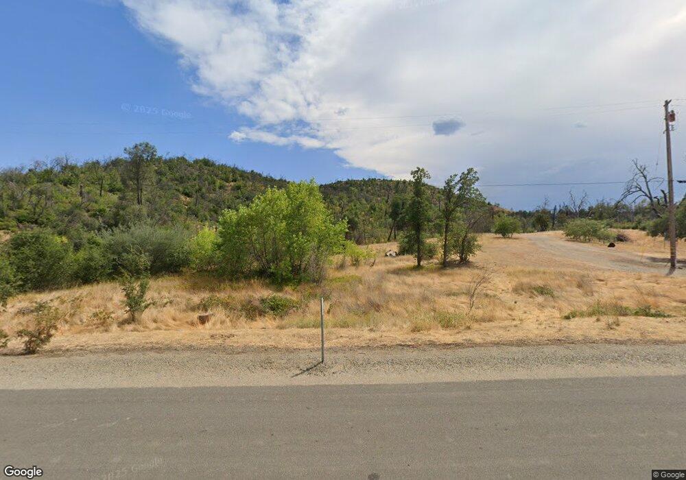
16565 State Highway 299 W Redding, CA 96001
Shasta NeighborhoodEstimated Value: $56,000 - $368,000
2
Beds
1
Bath
832
Sq Ft
$255/Sq Ft
Est. Value
About This Home
This home is located at 16565 State Highway 299 W, Redding, CA 96001 and is currently estimated at $212,000, approximately $254 per square foot. 16565 State Highway 299 W is a home located in Shasta County with nearby schools including Shasta Elementary School, Shasta High School, and University Preparatory.
Ownership History
Date
Name
Owned For
Owner Type
Purchase Details
Closed on
Jul 8, 2021
Sold by
Hagstrom Mariah D
Bought by
Hagstrom Mariah D and Twisted Madrone Trust
Current Estimated Value
Purchase Details
Closed on
May 22, 2012
Sold by
Snow Terrie A
Bought by
Snow Gregory E
Home Financials for this Owner
Home Financials are based on the most recent Mortgage that was taken out on this home.
Original Mortgage
$45,000
Outstanding Balance
$31,105
Interest Rate
3.85%
Mortgage Type
Unknown
Estimated Equity
$180,895
Purchase Details
Closed on
Nov 18, 1996
Sold by
Schneider Patricia M
Bought by
Schneider Patricia M
Create a Home Valuation Report for This Property
The Home Valuation Report is an in-depth analysis detailing your home's value as well as a comparison with similar homes in the area
Home Values in the Area
Average Home Value in this Area
Purchase History
| Date | Buyer | Sale Price | Title Company |
|---|---|---|---|
| Hagstrom Mariah D | -- | None Available | |
| Snow Gregory E | -- | First American Title Company | |
| Hagstrom Mariah D | -- | First American Title Company | |
| Schneider Patricia M | -- | -- |
Source: Public Records
Mortgage History
| Date | Status | Borrower | Loan Amount |
|---|---|---|---|
| Open | Hagstrom Mariah D | $45,000 |
Source: Public Records
Tax History Compared to Growth
Tax History
| Year | Tax Paid | Tax Assessment Tax Assessment Total Assessment is a certain percentage of the fair market value that is determined by local assessors to be the total taxable value of land and additions on the property. | Land | Improvement |
|---|---|---|---|---|
| 2025 | $408 | $37,676 | $37,676 | -- |
| 2024 | $382 | $36,938 | $36,938 | -- |
| 2023 | $382 | $36,214 | $36,214 | $0 |
| 2022 | $393 | $35,504 | $35,504 | $0 |
| 2021 | $384 | $34,808 | $34,808 | $0 |
| 2020 | $384 | $34,452 | $34,452 | $0 |
| 2019 | $374 | $33,777 | $33,777 | $0 |
| 2018 | $369 | $71,749 | $33,115 | $38,634 |
| 2017 | $769 | $70,343 | $32,466 | $37,877 |
| 2016 | $725 | $68,965 | $31,830 | $37,135 |
| 2015 | $715 | $67,930 | $31,352 | $36,578 |
| 2014 | -- | $66,600 | $30,738 | $35,862 |
Source: Public Records
Map
Nearby Homes
- 4771 Lower Springs Rd
- 15871 Lower Springs Rd
- 866 Congaree Ln
- Plan 1615 at Arroyo
- Plan 1567 at Arroyo
- 845 Congaree Ln
- 847 Congaree Ln
- 831 Congaree Ln
- 4601 Lower Springs Rd
- 4720 Lower Springs Rd
- Plan 1825 at Harlen at Salt Creek - Harlen
- Plan 2035 at Harlen at Salt Creek - Harlen
- Plan 2538 at Harlen at Salt Creek - Harlen
- 4205 Acadia Place
- 903 Katmai Place
- 4181 Haleakala Ave
- 4124 Acadia Place
- 4648 Kilkee Dr
- 4056 Acadia Place
- 4016 Acadia Place
- 16953 W Highway 299 W
- 4466 Eureka Way
- 16625 State Highway 299 W
- 4504 Eureka Way Unit 2
- 4504 Eureka Way
- 16483 Lower Springs Rd
- 898 Congaree Ln
- 890 Congaree Ln Lot 59
- 896 Congaree Ln
- 4771 Lower Springs Rd
- 894 Congaree Ln
- 888 & 886 Congaree Ln
- 888 Congaree Ln
- 890 Congaree Ln
- 886 Congaree Ln
- 884 Congaree Ln
- 878 Congaree Ln
- 878 Congaree Ln
- 880 Congaree Ln
- 16441 Lower Springs Rd
