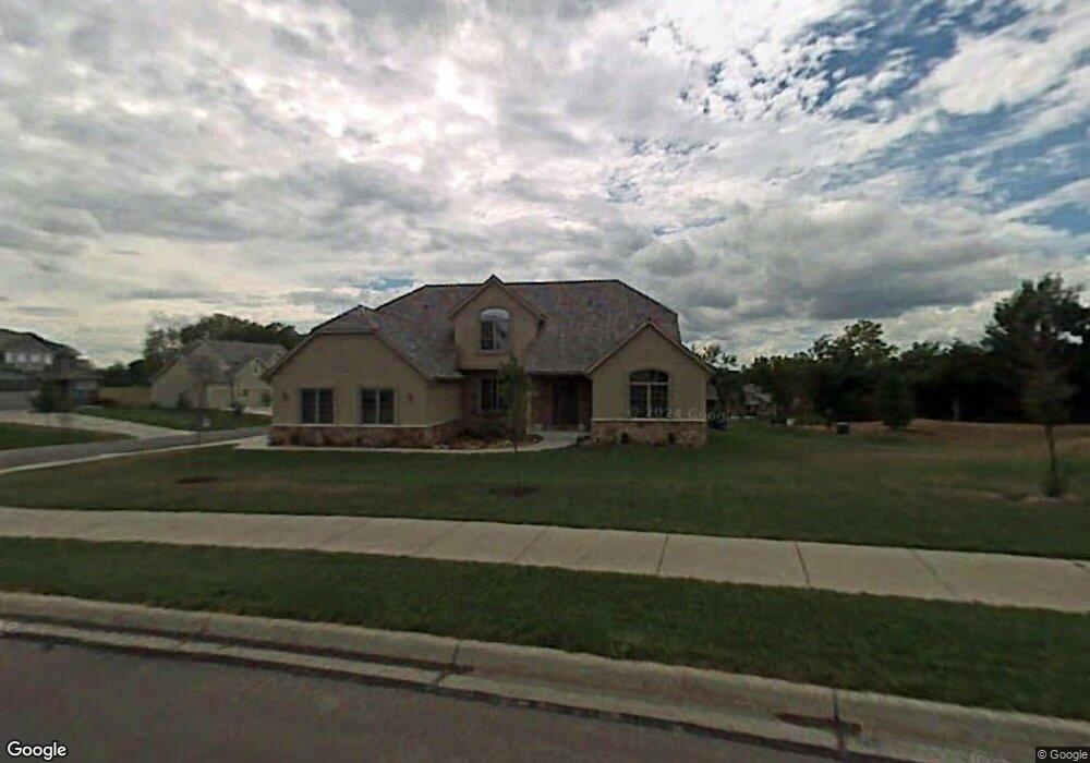
1659 George Williams Way Lawrence, KS 66047
West Lawrence NeighborhoodEstimated Value: $636,419 - $794,000
5
Beds
5
Baths
4,269
Sq Ft
$164/Sq Ft
Est. Value
About This Home
This home is located at 1659 George Williams Way, Lawrence, KS 66047 and is currently estimated at $699,855, approximately $163 per square foot. 1659 George Williams Way is a home located in Douglas County with nearby schools including Langston Hughes Elementary School, Southwest Middle School, and Lawrence High School.
Ownership History
Date
Name
Owned For
Owner Type
Purchase Details
Closed on
Mar 12, 2009
Sold by
Callahan Mark A and Callahan Robin A
Bought by
Ryan George W and Ryan Carol E
Current Estimated Value
Home Financials for this Owner
Home Financials are based on the most recent Mortgage that was taken out on this home.
Original Mortgage
$250,000
Outstanding Balance
$158,375
Interest Rate
5.06%
Mortgage Type
Purchase Money Mortgage
Estimated Equity
$541,480
Purchase Details
Closed on
Nov 15, 2005
Sold by
Ezell Morgan Construction Co Inc
Bought by
Callahan Mark A and Callahan Robin A
Home Financials for this Owner
Home Financials are based on the most recent Mortgage that was taken out on this home.
Original Mortgage
$179,900
Interest Rate
6.12%
Mortgage Type
Fannie Mae Freddie Mac
Create a Home Valuation Report for This Property
The Home Valuation Report is an in-depth analysis detailing your home's value as well as a comparison with similar homes in the area
Home Values in the Area
Average Home Value in this Area
Purchase History
| Date | Buyer | Sale Price | Title Company |
|---|---|---|---|
| Ryan George W | -- | Kansas Secured Title | |
| Callahan Mark A | -- | Commerce Title |
Source: Public Records
Mortgage History
| Date | Status | Borrower | Loan Amount |
|---|---|---|---|
| Open | Ryan George W | $250,000 | |
| Previous Owner | Callahan Mark A | $179,900 |
Source: Public Records
Tax History Compared to Growth
Tax History
| Year | Tax Paid | Tax Assessment Tax Assessment Total Assessment is a certain percentage of the fair market value that is determined by local assessors to be the total taxable value of land and additions on the property. | Land | Improvement |
|---|---|---|---|---|
| 2025 | $8,895 | $70,714 | $9,200 | $61,514 |
| 2024 | $8,710 | $69,230 | $8,625 | $60,605 |
| 2023 | $8,603 | $66,344 | $8,625 | $57,719 |
| 2022 | $7,971 | $61,086 | $8,632 | $52,454 |
| 2021 | $7,005 | $52,210 | $8,632 | $43,578 |
| 2020 | $6,810 | $51,026 | $8,632 | $42,394 |
| 2019 | $6,735 | $50,520 | $8,632 | $41,888 |
| 2018 | $6,512 | $48,496 | $8,632 | $39,864 |
| 2017 | $6,425 | $47,323 | $8,632 | $38,691 |
| 2016 | $5,938 | $45,689 | $6,901 | $38,788 |
| 2015 | $6,124 | $47,104 | $6,901 | $40,203 |
| 2014 | $5,786 | $44,953 | $6,901 | $38,052 |
Source: Public Records
Map
Nearby Homes
- 1709 Lake Alvamar Dr
- 1604 Bob White Dr
- 1526 Legend Trail Dr Unit B
- 1528 Legend Trail Dr Unit A
- 5710 Goff Ct
- 1564 Fountain Dr
- 1549 Legend Trail Dr Unit A
- 1347 Kanza Dr
- 1120 Klein Ct
- 1601 Research Park Dr
- 1115 Renaissance Dr
- 6204 Berando Ct
- 1315 Research Park Dr
- 1033 Stonecreek Dr
- 1040 Stonecreek Dr
- 1202 Little Knife
- 1017 Stoneridge Dr
- 1300 Research Park Dr
- 4709 Carmel Place
- 843 N 1500 Rd
- 1711 Bob White Dr
- 1655 George Williams Way
- 1647 Bob White Dr
- 1702 Bob White Dr
- 1651 George Williams Way
- 1717 Bob White Dr
- 1706 Bob White Dr
- 1650 Bob White Dr
- 1710 Bob White Dr
- 1646 Bob White Dr
- 1714 Bob White Dr
- 1714 Bob White Dr Unit 1714 Bob White
- 1643 Bob White Dr
- 1650 George Williams Way
- 1718 Bob White Dr
- 1642 Bob White Dr
- 1643 George Williams Way
- 1646 George Williams Way
- 1621 Cog Hill Ct
- 1722 Bob White Dr