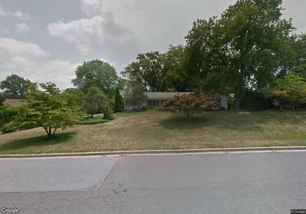
16607 Dougherty Ave Laurel, MD 20707
West Laurel NeighborhoodEstimated Value: $497,269 - $534,000
3
Beds
2
Baths
1,825
Sq Ft
$284/Sq Ft
Est. Value
About This Home
This home is located at 16607 Dougherty Ave, Laurel, MD 20707 and is currently estimated at $517,423, approximately $283 per square foot. 16607 Dougherty Ave is a home located in Prince George's County with nearby schools including Bond Mill Elementary, Martin Luther King Jr. Middle School, and Laurel High School.
Ownership History
Date
Name
Owned For
Owner Type
Purchase Details
Closed on
Oct 27, 2010
Sold by
Ambrose Raymond and Ambrose Martha
Bought by
Glassner Tonci
Current Estimated Value
Home Financials for this Owner
Home Financials are based on the most recent Mortgage that was taken out on this home.
Original Mortgage
$355,379
Outstanding Balance
$234,989
Interest Rate
4.39%
Mortgage Type
VA
Estimated Equity
$282,434
Purchase Details
Closed on
Aug 1, 2003
Sold by
Smith James B
Bought by
Ambrose Raymond and Ambrose Martha
Purchase Details
Closed on
Oct 4, 1989
Sold by
Ott James R
Bought by
Smith James B
Create a Home Valuation Report for This Property
The Home Valuation Report is an in-depth analysis detailing your home's value as well as a comparison with similar homes in the area
Home Values in the Area
Average Home Value in this Area
Purchase History
| Date | Buyer | Sale Price | Title Company |
|---|---|---|---|
| Glassner Tonci | $347,900 | -- | |
| Ambrose Raymond | $295,800 | -- | |
| Smith James B | $180,000 | -- |
Source: Public Records
Mortgage History
| Date | Status | Borrower | Loan Amount |
|---|---|---|---|
| Open | Glassner Tonci | $355,379 |
Source: Public Records
Tax History
| Year | Tax Paid | Tax Assessment Tax Assessment Total Assessment is a certain percentage of the fair market value that is determined by local assessors to be the total taxable value of land and additions on the property. | Land | Improvement |
|---|---|---|---|---|
| 2025 | $399 | $357,700 | $128,800 | $228,900 |
| 2024 | $399 | $355,600 | -- | -- |
| 2023 | $398 | $353,500 | $0 | $0 |
| 2022 | $398 | $351,400 | $103,800 | $247,600 |
| 2021 | $398 | $351,400 | $103,800 | $247,600 |
| 2020 | $398 | $351,400 | $103,800 | $247,600 |
| 2019 | $398 | $364,600 | $101,900 | $262,700 |
| 2018 | $5,576 | $348,433 | $0 | $0 |
| 2017 | $5,335 | $332,267 | $0 | $0 |
| 2016 | -- | $316,100 | $0 | $0 |
| 2015 | $4,577 | $309,267 | $0 | $0 |
| 2014 | $4,577 | $302,433 | $0 | $0 |
Source: Public Records
Map
Nearby Homes
- 6201 Goodman Rd
- 7106 Donston Dr
- 7209 Brooklyn Bridge Rd
- 16140 Kenny Rd
- 7004 Fitzpatrick Dr
- 7019 Fitzpatrick Dr
- 15611 Riding Stable Rd
- 6003 Windham Rd
- 14005 Barkham Ct
- 7002 Scotch Dr
- 15712 Dorset Rd Unit 104
- 6918 Scotch Dr
- 15708 Dorset Rd Unit 202
- 6504 Walker Branch Dr
- 15706 Dorset Rd Unit 102
- 11375 Harding Rd
- 15603 Dorset Rd Unit 101
- 15743 Millbrook Ln
- 10571 Scaggsville Rd
- 8302 Spring Blossom Ct
- 6601 Weaver Ct
- 6512 Brooklyn Bridge Rd
- 6605 Weaver Ct
- 6516 Brooklyn Bridge Rd
- 6600 Weaver Ct
- 16700 Dougherty Ave
- 16704 Goldsborough Ave
- 6609 Weaver Ct
- 6504 Brooklyn Bridge Rd
- 6515 Brooklyn Bridge Rd
- 6600 Brooklyn Bridge Rd
- 6604 Weaver Ct
- 6519 Brooklyn Bridge Rd
- 6511 Brooklyn Bridge Rd
- 6507 Brooklyn Bridge Rd
- 6613 Weaver Ct
- 6200 Forest Mill Ln
- 16708 Goldsborough Ave
- 16801 Clark Terrace
- 6606 Brooklyn Bridge Rd
Your Personal Tour Guide
Ask me questions while you tour the home.