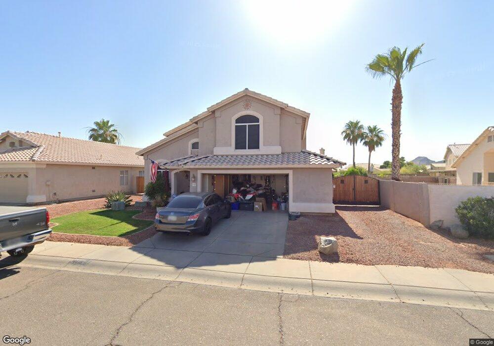
16615 N 10th Dr Phoenix, AZ 85023
North Central Phoenix NeighborhoodEstimated Value: $483,787 - $603,000
3
Beds
3
Baths
2,111
Sq Ft
$269/Sq Ft
Est. Value
About This Home
This home is located at 16615 N 10th Dr, Phoenix, AZ 85023 and is currently estimated at $566,947, approximately $268 per square foot. 16615 N 10th Dr is a home located in Maricopa County with nearby schools including John Jacobs Elementary School, Mountain Sky Jr. High School, and Thunderbird High School.
Ownership History
Date
Name
Owned For
Owner Type
Purchase Details
Closed on
Feb 26, 2003
Sold by
Mcdonald David H and Mcdonald Karen A
Bought by
Didomenico Edward P and Didomenico Toni L
Current Estimated Value
Home Financials for this Owner
Home Financials are based on the most recent Mortgage that was taken out on this home.
Original Mortgage
$175,200
Outstanding Balance
$74,823
Interest Rate
5.79%
Mortgage Type
New Conventional
Estimated Equity
$492,124
Purchase Details
Closed on
Jun 21, 2002
Sold by
Mcdonald David H and Mcdonald Karen A
Bought by
Mcdonald David H and Mcdonald Karen
Purchase Details
Closed on
Nov 9, 1994
Sold by
Pulte Home Corp
Bought by
Mcdonald David H and Mcdonald Karen A
Home Financials for this Owner
Home Financials are based on the most recent Mortgage that was taken out on this home.
Original Mortgage
$83,700
Interest Rate
8.86%
Mortgage Type
New Conventional
Create a Home Valuation Report for This Property
The Home Valuation Report is an in-depth analysis detailing your home's value as well as a comparison with similar homes in the area
Home Values in the Area
Average Home Value in this Area
Purchase History
| Date | Buyer | Sale Price | Title Company |
|---|---|---|---|
| Didomenico Edward P | $219,000 | Transnation Title Insurance | |
| Mcdonald David H | -- | -- | |
| Mcdonald David H | $143,670 | United Title Agency |
Source: Public Records
Mortgage History
| Date | Status | Borrower | Loan Amount |
|---|---|---|---|
| Open | Didomenico Edward P | $175,200 | |
| Previous Owner | Mcdonald David H | $83,700 |
Source: Public Records
Tax History Compared to Growth
Tax History
| Year | Tax Paid | Tax Assessment Tax Assessment Total Assessment is a certain percentage of the fair market value that is determined by local assessors to be the total taxable value of land and additions on the property. | Land | Improvement |
|---|---|---|---|---|
| 2025 | $2,721 | $25,398 | -- | -- |
| 2024 | $2,669 | $24,189 | -- | -- |
| 2023 | $2,669 | $40,070 | $8,010 | $32,060 |
| 2022 | $2,575 | $31,130 | $6,220 | $24,910 |
| 2021 | $2,639 | $28,360 | $5,670 | $22,690 |
| 2020 | $2,569 | $26,620 | $5,320 | $21,300 |
| 2019 | $2,522 | $23,980 | $4,790 | $19,190 |
| 2018 | $2,450 | $23,210 | $4,640 | $18,570 |
| 2017 | $2,443 | $23,010 | $4,600 | $18,410 |
| 2016 | $2,400 | $22,310 | $4,460 | $17,850 |
| 2015 | $2,226 | $20,230 | $4,040 | $16,190 |
Source: Public Records
Map
Nearby Homes
- 728 W Sandra Terrace
- 514 W Grandview Rd
- 911 W Campo Bello Dr
- 1427 W Anderson Dr
- 905 W Helena Dr Unit 3
- 16613 N 3rd Ave Unit 225
- 16607 N 3rd Ave Unit 222
- 16516 N 2nd Dr
- 16602 N 2nd Ln
- 16812 N 2nd Ln Unit 246
- 1120 W Marconi Ave
- 16332 N 2nd Dr
- 16622 N 2nd Dr Unit 182
- 1018 W Helena Dr
- 16822 N 2nd Dr Unit 263
- 16036 N 11th Ave Unit 1108
- 16036 N 11th Ave Unit 1120
- 926 W Angela Dr
- 17032 N 16th Dr Unit 8
- 503 W Helena Dr
- 16621 N 10th Dr
- 1014 W Aire Libre Ave
- 1006 W Aire Libre Ave
- 16614 N 10th Ave
- 16620 N 10th Ave
- 1025 W Kelton Ln
- 1021 W Kelton Ln
- 1002 W Aire Libre Ave
- 16614 N 10th Dr
- 16618 N 10th Dr
- 16610 N 10th Dr
- 1015 W Kelton Ln
- 16624 N 10th Dr
- 16606 N 10th Dr
- 1011 W Kelton Ln
- 16628 N 10th Dr
- 16602 N 10th Dr
- 16632 N 10th Dr
- 1011 W Aire Libre Ave
- 1015 W Aire Libre Ave