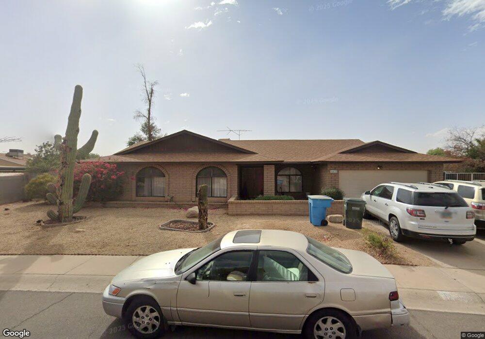
16632 N Landis Ln Glendale, AZ 85306
Deer Valley NeighborhoodEstimated Value: $409,030 - $511,000
--
Bed
2
Baths
2,131
Sq Ft
$219/Sq Ft
Est. Value
About This Home
This home is located at 16632 N Landis Ln, Glendale, AZ 85306 and is currently estimated at $466,258, approximately $218 per square foot. 16632 N Landis Ln is a home located in Maricopa County with nearby schools including Sunburst School, Desert Foothills Middle School, and Greenway High School.
Ownership History
Date
Name
Owned For
Owner Type
Purchase Details
Closed on
Jun 13, 1997
Sold by
Kirstein Mark A and Wagner Victoria A
Bought by
Long Dean M and Long Kathryn M
Current Estimated Value
Home Financials for this Owner
Home Financials are based on the most recent Mortgage that was taken out on this home.
Original Mortgage
$112,575
Outstanding Balance
$15,722
Interest Rate
7.7%
Mortgage Type
New Conventional
Estimated Equity
$450,536
Create a Home Valuation Report for This Property
The Home Valuation Report is an in-depth analysis detailing your home's value as well as a comparison with similar homes in the area
Home Values in the Area
Average Home Value in this Area
Purchase History
| Date | Buyer | Sale Price | Title Company |
|---|---|---|---|
| Long Dean M | $118,500 | Transnation Title Ins Co |
Source: Public Records
Mortgage History
| Date | Status | Borrower | Loan Amount |
|---|---|---|---|
| Open | Long Dean M | $112,575 |
Source: Public Records
Tax History Compared to Growth
Tax History
| Year | Tax Paid | Tax Assessment Tax Assessment Total Assessment is a certain percentage of the fair market value that is determined by local assessors to be the total taxable value of land and additions on the property. | Land | Improvement |
|---|---|---|---|---|
| 2025 | $2,193 | $20,469 | -- | -- |
| 2024 | $2,151 | $19,495 | -- | -- |
| 2023 | $2,151 | $35,260 | $7,050 | $28,210 |
| 2022 | $2,075 | $27,360 | $5,470 | $21,890 |
| 2021 | $2,127 | $25,060 | $5,010 | $20,050 |
| 2020 | $2,070 | $23,430 | $4,680 | $18,750 |
| 2019 | $2,032 | $22,820 | $4,560 | $18,260 |
| 2018 | $1,975 | $21,160 | $4,230 | $16,930 |
| 2017 | $1,969 | $18,370 | $3,670 | $14,700 |
| 2016 | $1,934 | $17,760 | $3,550 | $14,210 |
| 2015 | $1,794 | $17,420 | $3,480 | $13,940 |
Source: Public Records
Map
Nearby Homes
- 4628 W Kings Ave
- 4701 W Aire Libre Ave
- 4707 W Annette Cir
- 4841 W Aire Libre Ave
- 4430 W Keating Cir Unit 1
- 4732 W Davis Rd
- 4504 W Continental Dr
- 16405 N 49th Dr
- 4528 W Continental Dr
- 4530 W Continental Dr
- 16021 N 48th Dr
- 4332 W Monte Cristo Ave
- 4532 W Tierra Buena Ln
- 4417 W Sandra Cir
- 4144 W Hartford Ave
- 4635 W Libby St
- 17633 N Lindner Dr
- 17225 N 51st Dr
- 17819 N 46th Dr Unit 4
- 4212 W Tierra Buena Ln
- 16631 N 46th Ln
- 4654 W Aire Libre Ave
- 16637 N 46th Ln
- 4658 W Aire Libre Ave
- 4650 W Aire Libre Ave
- 16625 N 46th Ln
- 16644 N Landis Ln
- 4662 W Aire Libre Ave
- 16643 N Landis Ln
- 16643 N 46th Ln Unit 2
- 4646 W Aire Libre Ave
- 4653 W Aire Libre Ave
- 4649 W Aire Libre Ave
- 16619 N 46th Ln
- 4657 W Aire Libre Ave
- 4666 W Aire Libre Ave
- 16801 N Landis Ln
- 16802 N Landis Ln
- 16808 N Landis Ln
- 4645 W Aire Libre Ave