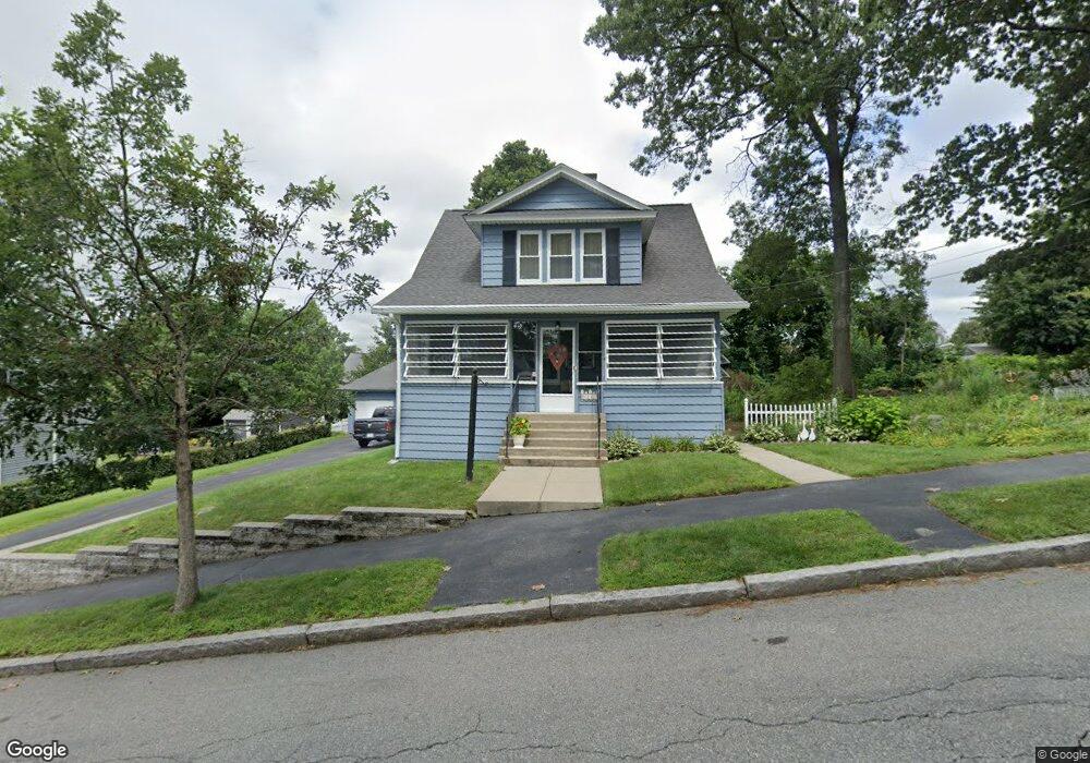
167 King Philip Rd Worcester, MA 01606
Greendale NeighborhoodEstimated Value: $411,494 - $459,000
3
Beds
2
Baths
1,276
Sq Ft
$346/Sq Ft
Est. Value
About This Home
This home is located at 167 King Philip Rd, Worcester, MA 01606 and is currently estimated at $441,124, approximately $345 per square foot. 167 King Philip Rd is a home located in Worcester County with nearby schools including Jacob Hiatt Magnet School, Chandler Magnet, and Thorndyke Road School.
Create a Home Valuation Report for This Property
The Home Valuation Report is an in-depth analysis detailing your home's value as well as a comparison with similar homes in the area
Home Values in the Area
Average Home Value in this Area
Tax History
| Year | Tax Paid | Tax Assessment Tax Assessment Total Assessment is a certain percentage of the fair market value that is determined by local assessors to be the total taxable value of land and additions on the property. | Land | Improvement |
|---|---|---|---|---|
| 2025 | $4,696 | $356,000 | $118,200 | $237,800 |
| 2024 | $4,613 | $335,500 | $118,200 | $217,300 |
| 2023 | $4,435 | $309,300 | $102,800 | $206,500 |
| 2022 | $4,063 | $267,100 | $82,200 | $184,900 |
| 2021 | $3,938 | $241,900 | $65,800 | $176,100 |
| 2020 | $3,873 | $227,800 | $65,800 | $162,000 |
| 2019 | $3,676 | $204,200 | $59,200 | $145,000 |
| 2018 | $3,672 | $194,200 | $59,200 | $135,000 |
| 2017 | $3,565 | $185,500 | $59,200 | $126,300 |
| 2016 | $3,526 | $171,100 | $43,200 | $127,900 |
| 2015 | $3,434 | $171,100 | $43,200 | $127,900 |
| 2014 | $3,343 | $171,100 | $43,200 | $127,900 |
Source: Public Records
Map
Nearby Homes
- 169 Whitmarsh Ave
- 39 Whitmarsh Ave
- 323 Burncoat St
- 331 Burncoat St
- 15 Ericsson St
- 18 Gosnold St
- 66 Eunice Ave
- 58 Osceola Ave
- 30 Danielles Way
- 18 Danielles Way
- 3205 Halcyon Dr Unit 3205
- 110 Beverly Rd
- 45 Goldthwaite Rd
- 44 Boardman St
- 13 Fatima Ln
- 31 Boardman St
- 15 Boardman St
- 30 Melrose St
- 12 Erie Ave
- 5 Wakefield St
- 159 King Philip Rd
- 171 King Philip Rd
- 166 Whitmarsh Ave
- 170 Whitmarsh Ave
- 162 Whitmarsh Ave
- 162 King Philip Rd
- 155 King Philip Rd
- 158 King Philip Rd
- 173 King Philip Rd
- 152 Whitmarsh Ave
- 178 Whitmarsh Ave
- 170 King Philip Rd
- 149 King Philip Rd
- 101 Kalmar St
- 150 King Philip Rd
- 150 Whitmarsh Ave
- 174 King Philip Rd
- 186 Whitmarsh Ave
- 181 King Philip Rd
- 165 Whitmarsh Ave
Your Personal Tour Guide
Ask me questions while you tour the home.