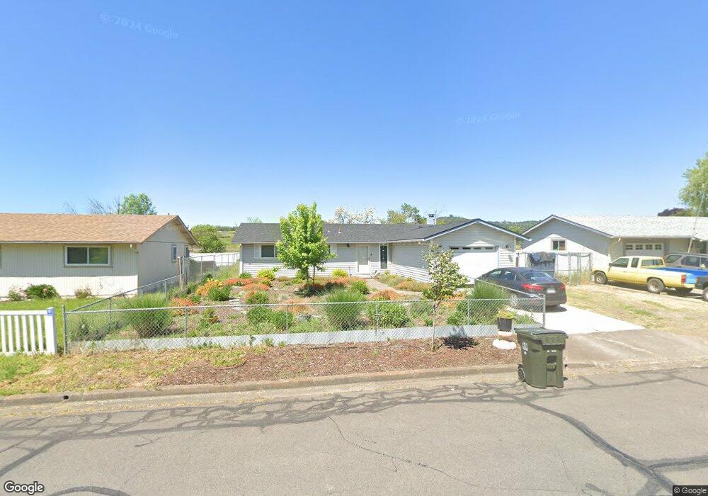
167 N Deanjou Ave Eagle Point, OR 97524
Estimated Value: $305,000 - $328,000
3
Beds
2
Baths
1,136
Sq Ft
$281/Sq Ft
Est. Value
About This Home
This home is located at 167 N Deanjou Ave, Eagle Point, OR 97524 and is currently estimated at $319,386, approximately $281 per square foot. 167 N Deanjou Ave is a home located in Jackson County with nearby schools including Eagle Rock Elementary School, Eagle Point Middle School, and White Mountain Middle School.
Ownership History
Date
Name
Owned For
Owner Type
Purchase Details
Closed on
Jul 6, 2022
Sold by
Rizzo Bernard and Rizzo Melinda
Bought by
Rizzo Family Trust and Rizzo
Current Estimated Value
Purchase Details
Closed on
Dec 14, 2021
Sold by
Westfall Michael and The Estate Of Michael A Westfa
Bought by
Rizzo Bernard and Rizzo Melinda
Home Financials for this Owner
Home Financials are based on the most recent Mortgage that was taken out on this home.
Original Mortgage
$228,000
Interest Rate
3.09%
Mortgage Type
New Conventional
Purchase Details
Closed on
May 13, 2005
Sold by
Fanning Larry J and Fanning Donna J
Bought by
Westfall Michael A and Westfall Cheryl A
Home Financials for this Owner
Home Financials are based on the most recent Mortgage that was taken out on this home.
Original Mortgage
$159,900
Interest Rate
1%
Mortgage Type
Negative Amortization
Create a Home Valuation Report for This Property
The Home Valuation Report is an in-depth analysis detailing your home's value as well as a comparison with similar homes in the area
Home Values in the Area
Average Home Value in this Area
Purchase History
| Date | Buyer | Sale Price | Title Company |
|---|---|---|---|
| Rizzo Family Trust | -- | Rizzo Bernard | |
| Rizzo Bernard | $285,000 | First American | |
| Westfall Michael A | $199,900 | First American Title |
Source: Public Records
Mortgage History
| Date | Status | Borrower | Loan Amount |
|---|---|---|---|
| Previous Owner | Rizzo Bernard | $228,000 | |
| Previous Owner | Westfall Michael A | $159,900 |
Source: Public Records
Tax History Compared to Growth
Tax History
| Year | Tax Paid | Tax Assessment Tax Assessment Total Assessment is a certain percentage of the fair market value that is determined by local assessors to be the total taxable value of land and additions on the property. | Land | Improvement |
|---|---|---|---|---|
| 2025 | $1,973 | $144,150 | $78,480 | $65,670 |
| 2024 | $1,973 | $139,960 | $76,190 | $63,770 |
| 2023 | $1,906 | $135,890 | $73,980 | $61,910 |
| 2022 | $1,854 | $135,890 | $73,980 | $61,910 |
| 2021 | $1,799 | $131,940 | $71,830 | $60,110 |
| 2020 | $1,911 | $128,100 | $69,740 | $58,360 |
| 2019 | $1,882 | $120,750 | $65,740 | $55,010 |
| 2018 | $1,846 | $117,240 | $63,830 | $53,410 |
| 2017 | $1,801 | $117,240 | $63,830 | $53,410 |
| 2016 | $1,766 | $110,520 | $60,180 | $50,340 |
| 2015 | $1,708 | $110,520 | $60,180 | $50,340 |
| 2014 | $1,659 | $104,190 | $56,740 | $47,450 |
Source: Public Records
Map
Nearby Homes
- 179 N Deanjou Ave
- 569 N Heights Dr
- 468 Merlee Cir
- 247 Lorraine Ave
- 315 S Buchanan Ave
- 403 N Deanjou Ave
- 136 Dianne Way
- 650 Sarah Ln
- 130 Dianne Way
- 911 Stonewater Dr
- 221 Ortega St
- 407 N Deanjou Ave
- 826 Crystal Dr
- 416 S Royal Ave
- 1023 Highlands Dr
- 124 Paxon Ave
- 470 Old Highway 62 Unit 2
- 0 Sf Little Butte Unit 220204792
- 323 S Shasta Ave
- 507 Sienna Hills Dr
- 129 N Deanjou Ave
- 35 N Deanjou Ave
- 128 N Deanjou Ave
- 184 N Deanjou Ave
- 11354 Hwy 62
- 11354 Highway 62
- 205 N de Anjou Ave
- 205 N Deanjou Ave
- 23 S Deanjou Ave
- 652 Sherman Way
- 649 Laurel St
- 22 N Deanjou Ave
- 11 N Deanjou Ave
- 227 N Deanjou Ave
- 11436 Or-62
- 11436 Highway 62
- 628 Sherman Way
- 216 N Deanjou Ave
- 627 Laurel St
- 647 Sherman Way