Estimated Value: $347,961 - $391,000
3
Beds
2
Baths
2,300
Sq Ft
$163/Sq Ft
Est. Value
About This Home
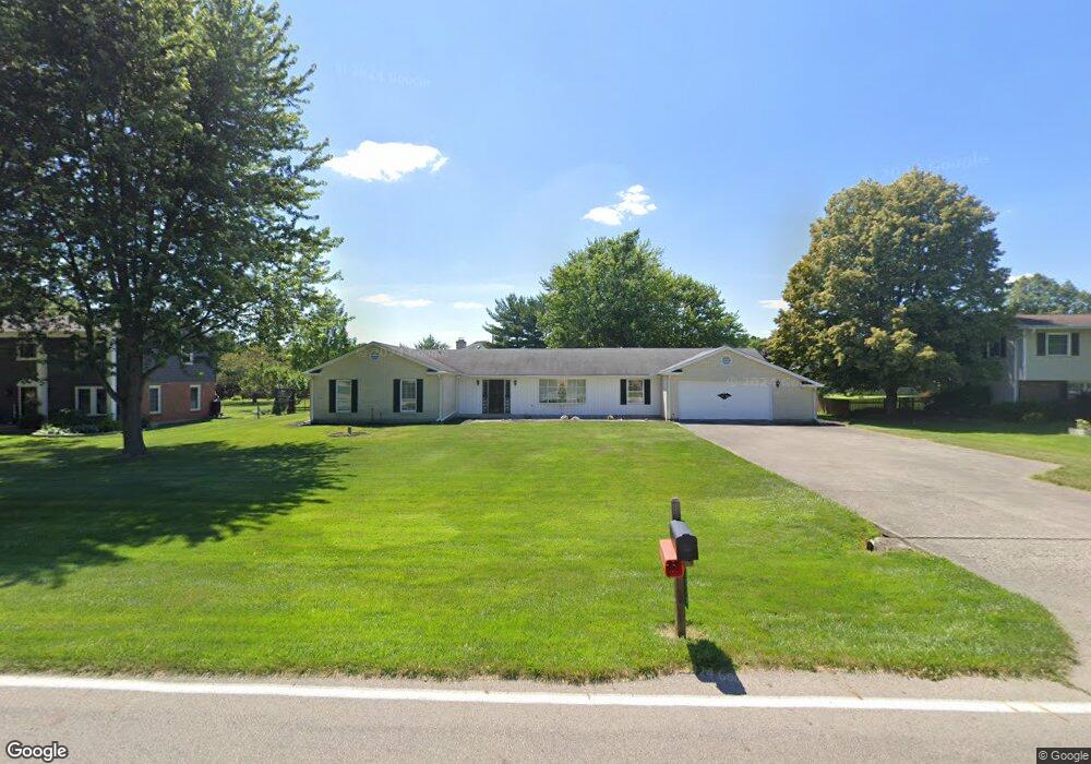
This home is located at 1670 Barnhart Rd, Troy, OH 45373 and is currently estimated at $375,740, approximately $163 per square foot. 1670 Barnhart Rd is a home located in Miami County with nearby schools including Concord Elementary School, Van Cleve Elementary School, and Troy Junior High School.
Ownership History
Date
Name
Owned For
Owner Type
Purchase Details
Closed on
Apr 9, 2018
Sold by
Davis Billie L and Davis Evangeline S
Bought by
Gomez Henry and Gomez Hector
Current Estimated Value
Purchase Details
Closed on
Sep 15, 2003
Sold by
Kear Herman F and Kear Clolata A
Bought by
Davis Billie Lee and Davis Evangeline S
Purchase Details
Closed on
Jul 12, 2002
Sold by
Kear Herman F and Kear Clolata A
Bought by
Kear Herman F and Kear Clolata A
Purchase Details
Closed on
Mar 25, 1993
Bought by
Kear Living Trust
Create a Home Valuation Report for This Property
The Home Valuation Report is an in-depth analysis detailing your home's value as well as a comparison with similar homes in the area
Home Values in the Area
Average Home Value in this Area
Purchase History
| Date | Buyer | Sale Price | Title Company |
|---|---|---|---|
| Gomez Henry | -- | None Available | |
| Davis Billie Lee | $160,000 | -- | |
| Kear Herman F | -- | -- | |
| Kear Living Trust | -- | -- |
Source: Public Records
Tax History Compared to Growth
Tax History
| Year | Tax Paid | Tax Assessment Tax Assessment Total Assessment is a certain percentage of the fair market value that is determined by local assessors to be the total taxable value of land and additions on the property. | Land | Improvement |
|---|---|---|---|---|
| 2024 | $3,315 | $85,270 | $21,180 | $64,090 |
| 2023 | $3,315 | $85,270 | $21,180 | $64,090 |
| 2022 | $2,777 | $85,270 | $21,180 | $64,090 |
| 2021 | $2,367 | $68,220 | $16,940 | $51,280 |
| 2020 | $2,370 | $68,220 | $16,940 | $51,280 |
| 2019 | $2,391 | $68,220 | $16,940 | $51,280 |
| 2018 | $2,266 | $61,570 | $15,680 | $45,890 |
| 2017 | $2,287 | $61,570 | $15,680 | $45,890 |
| 2016 | $2,255 | $61,570 | $15,680 | $45,890 |
| 2015 | $2,172 | $57,020 | $14,530 | $42,490 |
| 2014 | $2,172 | $57,020 | $14,530 | $42,490 |
| 2013 | $2,186 | $57,020 | $14,530 | $42,490 |
Source: Public Records
Map
Nearby Homes
- 1985 Fox Run
- 2537 Huntington Dr
- 1965 Quail Nest Ct
- 1350 Winchester Dr
- 2206 Northbridge Trail
- 1118 Winchester Dr
- 00 W
- 2295 Shenandoah Dr
- Holcombe Plan at Reserve at Cliff Oaks
- Chatham Plan at Reserve at Cliff Oaks
- Bridgeport Plan at Reserve at Cliff Oaks
- Newcastle Plan at Reserve at Cliff Oaks
- 2936 Hoying Dr
- 2944 Hoying Dr
- 2952 Hoying Dr
- 2960 Hoying Dr
- 2968 Hoying Dr
- 1209 Spruce St
- 1550 Creekwood Dr
- 650 Swailes Rd
- 1650 Barnhart Rd
- 1690 Barnhart Rd
- 2320 Worthington Dr
- 2324 Worthington Dr
- 2314 Worthington Dr
- 1634 Barnhart Rd
- 1675 Barnhart Rd
- 1695 Barnhart Rd
- 1655 Barnhart Rd
- 2330 Worthington Dr
- 2310 Worthington Dr
- 1726 Barnhart Rd
- 1495 Fox Run
- 1616 Barnhart Rd
- 2325 Worthington Dr
- 2300 Worthington Dr
- 2315 Worthington Dr
- 2334 Worthington Dr
- 1525 Fox Run
- 1615 Barnhart Rd