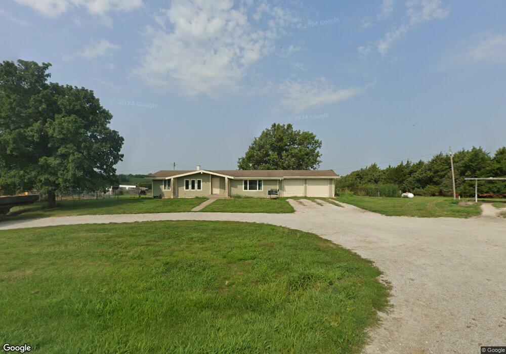
1671 Mulberry Rd Hiawatha, KS 66434
Estimated Value: $294,000 - $319,000
5
Beds
3
Baths
1,468
Sq Ft
$209/Sq Ft
Est. Value
About This Home
This home is located at 1671 Mulberry Rd, Hiawatha, KS 66434 and is currently estimated at $306,494, approximately $208 per square foot. 1671 Mulberry Rd is a home located in Brown County with nearby schools including Horton Elementary School, Everest Middle School, and Horton High School.
Ownership History
Date
Name
Owned For
Owner Type
Purchase Details
Closed on
Apr 1, 2013
Sold by
Compton Steven C and Compton Marilyn L
Bought by
Compton Daniel R
Current Estimated Value
Home Financials for this Owner
Home Financials are based on the most recent Mortgage that was taken out on this home.
Original Mortgage
$335,000
Interest Rate
3.59%
Mortgage Type
Future Advance Clause Open End Mortgage
Create a Home Valuation Report for This Property
The Home Valuation Report is an in-depth analysis detailing your home's value as well as a comparison with similar homes in the area
Home Values in the Area
Average Home Value in this Area
Purchase History
| Date | Buyer | Sale Price | Title Company |
|---|---|---|---|
| Compton Daniel R | -- | None Available |
Source: Public Records
Mortgage History
| Date | Status | Borrower | Loan Amount |
|---|---|---|---|
| Closed | Compton Daniel R | $335,000 |
Source: Public Records
Tax History Compared to Growth
Tax History
| Year | Tax Paid | Tax Assessment Tax Assessment Total Assessment is a certain percentage of the fair market value that is determined by local assessors to be the total taxable value of land and additions on the property. | Land | Improvement |
|---|---|---|---|---|
| 2025 | $3,282 | $35,337 | $956 | $34,381 |
| 2024 | $3,282 | $33,975 | $544 | $33,431 |
| 2023 | $3,298 | $33,117 | $446 | $32,671 |
| 2022 | $2,838 | $30,205 | $362 | $29,843 |
| 2021 | $2,397 | $28,163 | $327 | $27,836 |
| 2020 | $2,374 | $28,884 | $293 | $28,591 |
| 2019 | $2,384 | $28,820 | $258 | $28,562 |
| 2018 | $2,425 | $29,151 | $246 | $28,905 |
| 2017 | $2,425 | $27,662 | $243 | $27,419 |
| 2016 | $2,499 | $27,683 | $237 | $27,446 |
| 2015 | -- | $28,141 | $234 | $27,907 |
| 2014 | -- | $27,657 | $225 | $27,432 |
Source: Public Records
Map
Nearby Homes
- 1900 Yates Ave
- 1601 Central Ave
- 1521 1st Ave E
- 1539 1st Ave W
- 417 E 14th St
- 1533 Euclid Ave
- 115 E 15th St
- 200 E 14th St
- 0 150th St & Horned Owl Rd
- 741 Cedar St
- 1519 2nd Ave W
- 702 W 16th St
- 225 E 13th St
- 224 Main St
- 209 Main St
- 640 W 15th St
- 1208 Central Ave
- 414 Goldengate St
- 1036 Central Ave
- 934 3rd Ave W