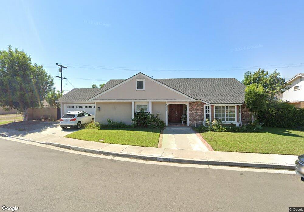
16715 Mount Michaelis Cir Fountain Valley, CA 92708
Estimated Value: $1,207,362 - $1,467,000
3
Beds
2
Baths
1,859
Sq Ft
$713/Sq Ft
Est. Value
About This Home
This home is located at 16715 Mount Michaelis Cir, Fountain Valley, CA 92708 and is currently estimated at $1,326,341, approximately $713 per square foot. 16715 Mount Michaelis Cir is a home located in Orange County with nearby schools including Mamie L. Northcutt Elementary School, Fitz Intermediate Language Academy, and Los Amigos High School.
Ownership History
Date
Name
Owned For
Owner Type
Purchase Details
Closed on
Jul 6, 2001
Sold by
The Salvation Army
Bought by
Romero Robert M and Romero Eva Rose
Current Estimated Value
Home Financials for this Owner
Home Financials are based on the most recent Mortgage that was taken out on this home.
Original Mortgage
$275,000
Outstanding Balance
$105,593
Interest Rate
7.09%
Estimated Equity
$1,220,748
Create a Home Valuation Report for This Property
The Home Valuation Report is an in-depth analysis detailing your home's value as well as a comparison with similar homes in the area
Home Values in the Area
Average Home Value in this Area
Purchase History
| Date | Buyer | Sale Price | Title Company |
|---|---|---|---|
| Romero Robert M | $320,000 | -- |
Source: Public Records
Mortgage History
| Date | Status | Borrower | Loan Amount |
|---|---|---|---|
| Open | Romero Robert M | $275,000 |
Source: Public Records
Tax History Compared to Growth
Tax History
| Year | Tax Paid | Tax Assessment Tax Assessment Total Assessment is a certain percentage of the fair market value that is determined by local assessors to be the total taxable value of land and additions on the property. | Land | Improvement |
|---|---|---|---|---|
| 2025 | $5,474 | $472,724 | $312,191 | $160,533 |
| 2024 | $5,474 | $463,455 | $306,069 | $157,386 |
| 2023 | $5,373 | $454,368 | $300,068 | $154,300 |
| 2022 | $5,258 | $445,459 | $294,184 | $151,275 |
| 2021 | $5,205 | $436,725 | $288,416 | $148,309 |
| 2020 | $5,134 | $432,247 | $285,458 | $146,789 |
| 2019 | $5,036 | $423,772 | $279,861 | $143,911 |
| 2018 | $4,935 | $415,463 | $274,373 | $141,090 |
| 2017 | $4,869 | $407,317 | $268,993 | $138,324 |
| 2016 | $4,657 | $399,331 | $263,719 | $135,612 |
| 2015 | $4,592 | $393,333 | $259,758 | $133,575 |
| 2014 | $4,479 | $385,629 | $254,670 | $130,959 |
Source: Public Records
Map
Nearby Homes
- 11892 Geode Ave
- 12061 Brighton River Unit 37
- 12143 Sylvan River Unit 147
- 3510 & 3512 W Pine St
- 12062 W Edinger Ave Unit 19
- 11620 Warner Ave Unit 624
- 17168 Newhope St Unit 222
- 17200 Newhope St Unit 109
- 17200 Newhope St Unit 217
- 17200 Newhope St Unit 10
- 17200 Newhope St Unit 1
- 17200 Newhope St Unit 312
- 11356 Stonecress Ave
- 11325 Dewdrop Ave
- 11611 Rosemary Ave
- 16050 Shasta St
- 12300 W Lilac Ave Unit 714
- 220 Palos Verdes Dr
- 2926 W La Verne Ave
- 11106 Coral Aloe Ave
- 16697 Mount Michaelis Cir
- 16690 Lassen St
- 16704 Lassen St
- 16724 Mount Michaelis Cir
- 16676 Lassen St
- 16716 Lassen St
- 16731 Mount Michaelis Cir
- 16706 Mount Michaelis Cir
- 16683 Mount Michaelis Cir
- 16736 Mount Michaelis Cir
- 16664 Lassen St
- 16690 Mount Michaelis Cir
- 16726 Lassen St
- 16540 Harbor Blvd
- 11890 Lotus Ave
- 11885 Wisteria Ave
- 16669 Mount Michaelis Cir
- 16652 Lassen St
- 11894 Wisteria Ave
- 11927 Goodale Ave