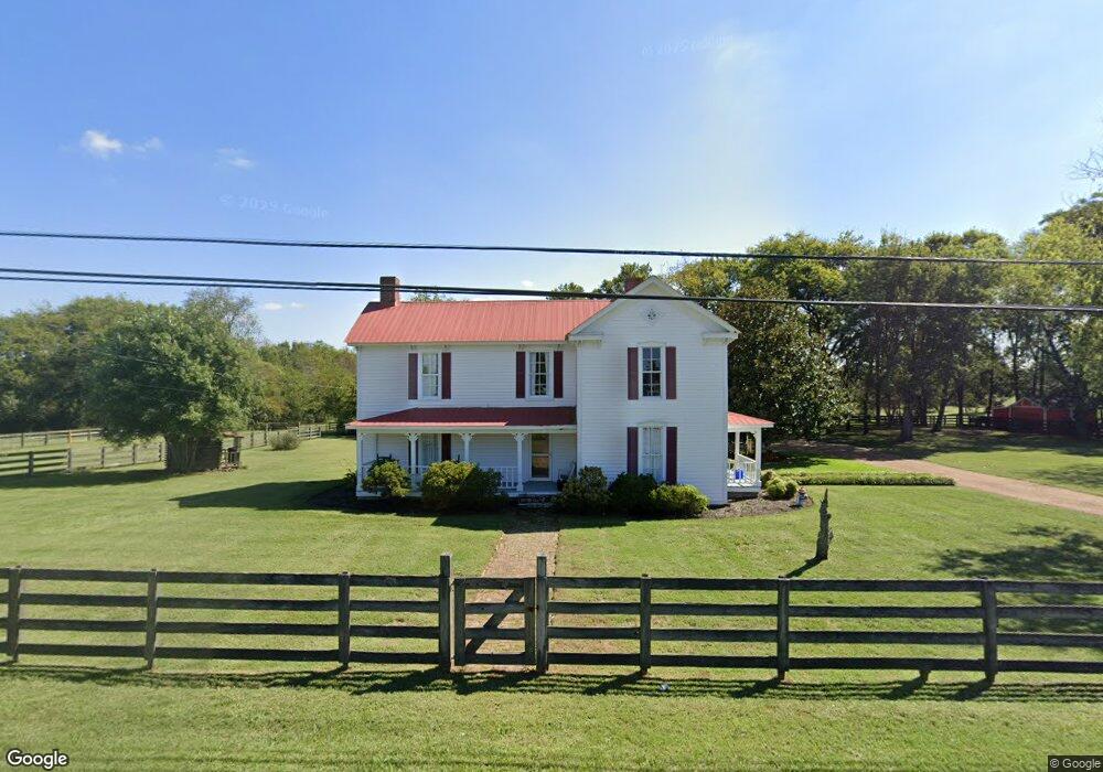
1672 Carters Creek Pike Columbia, TN 38401
Estimated Value: $782,234
--
Bed
2
Baths
3,035
Sq Ft
$258/Sq Ft
Est. Value
About This Home
This home is located at 1672 Carters Creek Pike, Columbia, TN 38401 and is currently priced at $782,234, approximately $257 per square foot. 1672 Carters Creek Pike is a home located in Maury County with nearby schools including Spring Hill Elementary School, Spring Hill Middle School, and Spring Hill High School.
Ownership History
Date
Name
Owned For
Owner Type
Purchase Details
Closed on
Jul 11, 2006
Sold by
Childress Jason B and Childress Holly C
Bought by
Wilson Julie L
Current Estimated Value
Home Financials for this Owner
Home Financials are based on the most recent Mortgage that was taken out on this home.
Original Mortgage
$344,000
Outstanding Balance
$228,132
Interest Rate
8.88%
Mortgage Type
Purchase Money Mortgage
Purchase Details
Closed on
Nov 9, 2001
Sold by
Cook Larry N and Cook Barbara J
Bought by
Childress Jason B and Childress Holly C
Home Financials for this Owner
Home Financials are based on the most recent Mortgage that was taken out on this home.
Original Mortgage
$217,250
Interest Rate
6.67%
Purchase Details
Closed on
Nov 25, 1991
Bought by
Cook Larry N and Cook Barbara J
Create a Home Valuation Report for This Property
The Home Valuation Report is an in-depth analysis detailing your home's value as well as a comparison with similar homes in the area
Home Values in the Area
Average Home Value in this Area
Purchase History
| Date | Buyer | Sale Price | Title Company |
|---|---|---|---|
| Wilson Julie L | $430,000 | Venture Title & Escrow Inc | |
| Childress Jason B | $237,250 | Heritage Title & Escrow Co I | |
| Cook Larry N | $39,900 | -- |
Source: Public Records
Mortgage History
| Date | Status | Borrower | Loan Amount |
|---|---|---|---|
| Open | Wilson Julie L | $344,000 | |
| Closed | Wilson Julie L | $344,000 | |
| Closed | Wilson Julie L | $86,000 | |
| Previous Owner | Childress Jason B | $217,250 | |
| Previous Owner | Cook Larry N | $30,611 | |
| Previous Owner | Cook Larry N | $88,000 |
Source: Public Records
Tax History Compared to Growth
Tax History
| Year | Tax Paid | Tax Assessment Tax Assessment Total Assessment is a certain percentage of the fair market value that is determined by local assessors to be the total taxable value of land and additions on the property. | Land | Improvement |
|---|---|---|---|---|
| 2022 | $1,985 | $103,925 | $29,875 | $74,050 |
Source: Public Records
Map
Nearby Homes
- 5679 Carters Creek Pike
- 2105 Sue Ln
- CALHOUN Plan at Harvest Point
- BRYAN A Plan at Harvest Point
- EMBRY Plan at Harvest Point
- DOUGLAS A Plan at Harvest Point
- FAYETTE A Plan at Harvest Point
- DIJON B Plan at Harvest Point
- IRWIN A Plan at Harvest Point
- STONEBROOK II Plan at Harvest Point
- Bristol MF Plan at Harvest Point
- TISDALE Plan at Harvest Point
- ANSLEY Plan at Harvest Point
- Clifton MF Plan at Harvest Point
- MILFORD Plan at Harvest Point
- BELFORT Plan at Harvest Point
- HOLDEN Plan at Harvest Point
- DENHAM Plan at Harvest Point
- 410 Wild Iris Way
- 406 Wild Iris Way
- 746 Autumn Ridge Ln
- 1709 Burkewood Dr
- 1713 Burkewood Dr
- 1705 Burkewood Dr
- 1660 Carters Creek Pike
- 1723 Burkewood Dr
- 1717 Burkewood Dr
- 1720 Burkewood Dr
- 1724 Burkewood Dr
- 1667 Carters Creek Pike
- 1708 Burkewood Dr
- 1712 Burkewood Dr
- 1698 Carters Creek Pike
- 1675 Carters Creek Pike
- 1704 Burkewood Dr
- 1679 Carters Creek Pike
- 1671 Carters Creek Pike
- 1687 Carters Creek Pike
- 1661 Carters Creek Pike
- 1716 Burkewood Dr