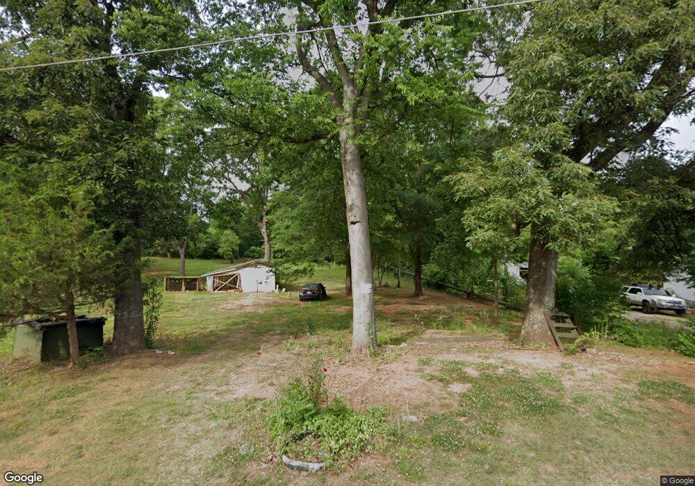
1672 Power Line Ave Newton, NC 28658
Estimated Value: $58,202 - $544,000
--
Bed
--
Bath
723
Sq Ft
$277/Sq Ft
Est. Value
About This Home
This home is located at 1672 Power Line Ave, Newton, NC 28658 and is currently estimated at $200,301, approximately $277 per square foot. 1672 Power Line Ave is a home with nearby schools including North Newton Elementary School, Newton-Conover Middle School, and Newton-Conover High School.
Ownership History
Date
Name
Owned For
Owner Type
Purchase Details
Closed on
Dec 6, 2019
Sold by
Bandy Timothy Dale and Bandy Whitney
Bought by
Guzman Bedolla Sergio
Current Estimated Value
Purchase Details
Closed on
May 20, 2019
Sold by
Mullinax Robert A
Bought by
Bandy Timothy Dale and Bandy James Dwight
Purchase Details
Closed on
Sep 22, 2008
Sold by
Angel Blanche C
Bought by
Cook David
Create a Home Valuation Report for This Property
The Home Valuation Report is an in-depth analysis detailing your home's value as well as a comparison with similar homes in the area
Home Values in the Area
Average Home Value in this Area
Purchase History
| Date | Buyer | Sale Price | Title Company |
|---|---|---|---|
| Guzman Bedolla Sergio | $15,000 | None Available | |
| Bandy Timothy Dale | -- | None Available | |
| Cook David | -- | None Available |
Source: Public Records
Tax History Compared to Growth
Tax History
| Year | Tax Paid | Tax Assessment Tax Assessment Total Assessment is a certain percentage of the fair market value that is determined by local assessors to be the total taxable value of land and additions on the property. | Land | Improvement |
|---|---|---|---|---|
| 2025 | $83 | $9,800 | $9,800 | $0 |
| 2024 | $83 | $9,800 | $9,800 | $0 |
| 2023 | $83 | $9,800 | $9,800 | $0 |
| 2022 | $109 | $9,800 | $9,800 | $0 |
| 2021 | $196 | $17,600 | $9,800 | $7,800 |
| 2020 | $196 | $17,600 | $9,800 | $7,800 |
| 2019 | $196 | $17,600 | $0 | $0 |
| 2018 | $191 | $17,100 | $9,800 | $7,300 |
| 2017 | $0 | $0 | $0 | $0 |
| 2016 | $191 | $0 | $0 | $0 |
| 2015 | $244 | $17,100 | $9,800 | $7,300 |
| 2014 | $244 | $24,200 | $9,800 | $14,400 |
Source: Public Records
Map
Nearby Homes
- The Piedmont Plan at Rowe Crossing
- The Braselton II Plan at Rowe Crossing
- The Caldwell Plan at Rowe Crossing
- The Benson II Plan at Rowe Crossing
- The Coleman Plan at Rowe Crossing
- The Reynolds Plan at Rowe Crossing
- The Harrington Plan at Rowe Crossing
- 2075 N Whisnant Ave
- 805 Mount Olive Church Rd
- 1128 McRee Heights Cir
- 932 Eastern Ridge Dr
- 1208 N Davis Ave
- 118 W 15th St
- 0000 Burris Rd
- 210 W 15th St
- 710 Mount Olive Church Rd
- 712 Mount Olive Church Rd
- 1687 Golden Cedar Ln
- 1208 N Ashe Ave
- 902 N Ashe Ave
- 1700 Power Line Ave
- 1620 Power Line Ave
- 1606 Power Line Ave
- 1602 Power Line Ave
- 1709 Rowe Ave
- 1708 Rowe Ave
- 606 E 19th St
- 1500 Power Line Ave
- 436 E 19th St
- 506 E 19th St
- 432 E 19th St
- 428 E 19th St
- 503 E 19th St
- 505 E 19th St
- 501 E 19th St
- 424 E 19th St
- 624 E 19th St
- 1908 N Whisnant Ave
- 1907 N Whisnant Ave
- 0 Burris Rd